Subject: United States
Period: 1861-62 (published)
Publication: Black's General Atlas
Color: Hand Color
Size:
21.5 x 16.3 inches
54.6 x 41.4 cm
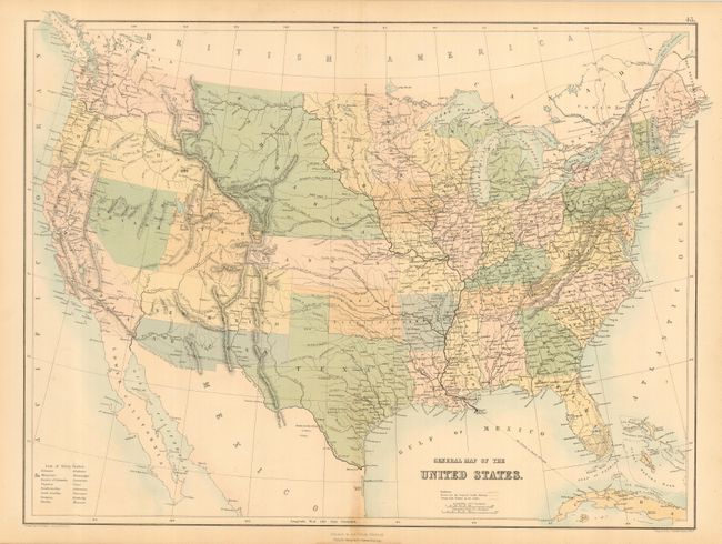
A lithographed map that was published at a time when many territorial borders were in very interesting configurations. Utah is a large territory that includes much of Colorado, but does not name Colona. New Mexico extends between Kansas and California, and includes part of present-day Colorado. Arizona Territory is below New Mexico, here as the Confederate Territory of Arizona. Oregon and Washington Territory extend to the Continental Divide. Nebraska extends from Kansas to the Canadian border and includes today's Montana, Wyoming and much of the Dakotas. Oklahoma is Indian Territory. Dakota is a small area that lays between Nebraska and Minnesota, bounded between the Missouri River at the west and the Sioux and Red Rivers on the east. A most interesting map that is filled with many details including forts, railroads and wagon roads. Good watershed, and limited topographical detail. Extensive railroad network shown throughout the East, with proposed railroads in the West. At lower left is a list of the Slave States.
References:
Condition: A
Hint of centerfold toning at bottom.