Subject: United States City Plans
Period: 1856-67 (dated)
Publication:
Color: Hand Color
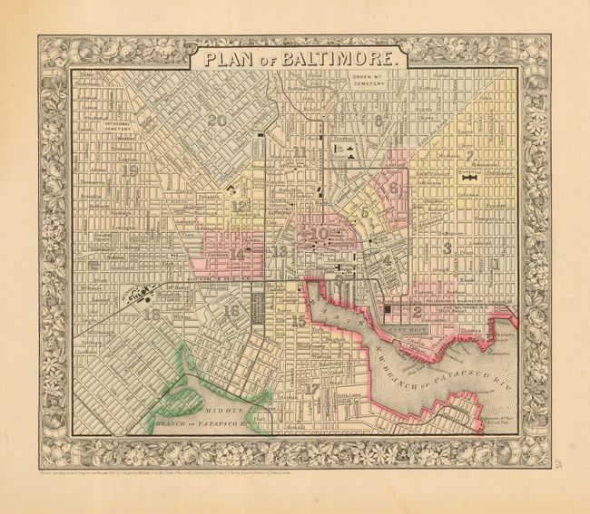
1) "Plan of Baltimore," Mitchell, 1860, Philadelphia, 11 x 9". This is a handsome city plan extending from Green Mt. Cemetery on Oliver, south to the Patapscor River and Randal. Filled with historical landmarks and places of interest.
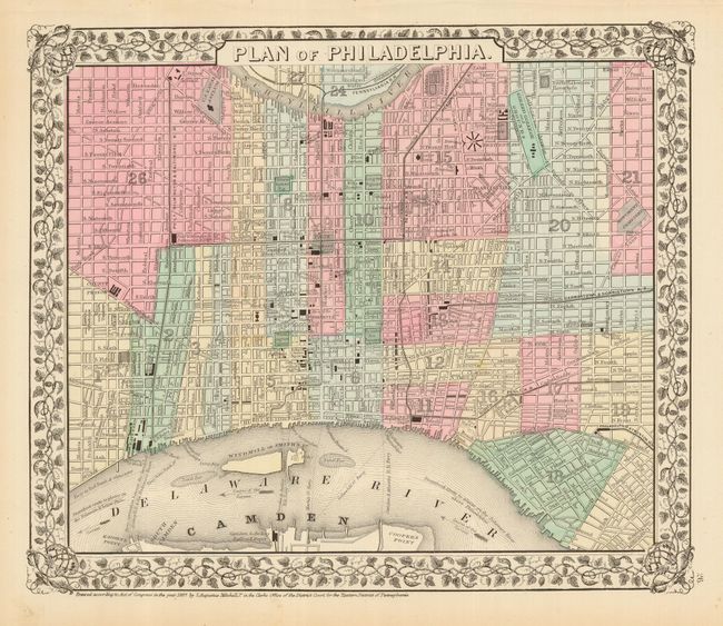
2) "Plan of Philadelphia," Mitchell, 1867, Philadelphia, 13 x 9". A finely engraved map that extends to Cooper's Point in the south and is bordered by the Schuylkill River on the north. Many points of interest and landmarks are shown, including railroad depots, squares, the U.S. Mint, the Girard Bank, Arch St. Theater, U.S. Naval Asylum and the Fairmont Water Works.
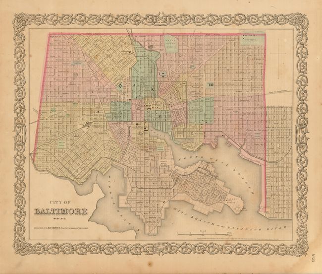
3) "City of Baltimore Maryland," Colton, 1856, New York, 15.5 x 12.8". Great city plan colored by ward with detail of streets, railroads, parks, etc.
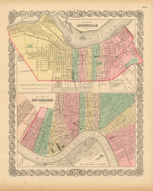
4) "The City of Louisville Kentucky" [and] "The City of New Orleans," Colton, 1856, New York, 12.6 x 15.6". Another attractive nineteenth century plan with two city plans within a common border. Colored by ward with the locations of streets, rail lines and the locations of major buildings. All feature decorative borders and original hand coloring.
References:
Condition:
#1, 2 and 4 are very good with the typical marginal toning or foxing. The Colton Baltimore is only good with a little scattered foxing or toning on the map.