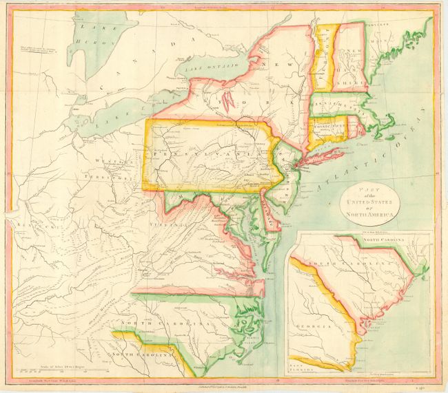
Subject: United States - Eastern
Period: 1798 (dated)
Publication: Travels Through the States of North America
Color: Hand Color
Size:
18.5 x 16 inches
47 x 40.6 cm
Early map of the young United States filled with great information on the early roads and settlements. The map covers from the Province of Main through North Carolina with a large inset covering South Carolina and Georgia. West of the states are Western Territory and Kentucky. The villages of "Christian Indians" are located.
A member of the Irish gentry, Isaac Weld traveled to North America as a young man in search of adventure. He visited the settled regions of the eastern seaboard and then ventured into the hinterland with the assistance of Indian guides. Weld's account of his travels is one of the earliest illustrated amateur travel accounts to be devoted to North America. It was very popular and went through several editions in English and translations into French, German, Italian and Dutch.
References: McCorkle #798.5.
Condition: B
Issued folding, now pressed. Narrow margins with binding tear just entering border at right. Later color.