Catalog Archive
Auction 115, Lot 104

"Carte des Etats-Unis d'Amerique, du Canada, du Nouveau Brunswick et d'une partie de la Nouvelle Bretagne", Lapie, Alexander Emile & Pierre

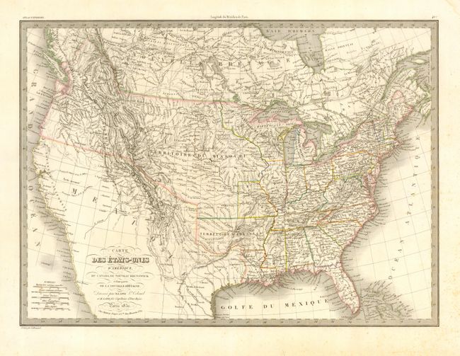
Subject: United States & Canada

Period: 1832 (dated)

Publication: Atlas Universel

Color: Hand Color

Size:
21 x 15 inches
53.3 x 38.1 cm
Download High Resolution Image
(or just click on image to launch the Zoom viewer)

Wonderful map that is filled with detail, hundreds of place names, plus Indian tribes, forts and other political and geographical information. Texas is an Independent Republic, Mexico controls the Southwest, Missouri Territory occupies all of the Midwest, Oregon Territory is labeled District de la Columbia, Arkansas Territory extends to the panhandle of Texas, and Texas is named and is part of Mexico. Two large lakes in today's Utah drain via rivers to the Pacific, as defined by dotted lines. The Colorado River ends in the desert east of San Diego. Lapie's embossed stamp imprint.

References:

Condition: A

Crisp, early impression with original outline coloring and wide margins. A little light scattered marginal foxing and damp stain, printer's crease in lower margin.

Estimate: $300 - $400

Unsold

Closed on 6/21/2006

Archived