Filtered by Category:United States(Show All Categories)
Showing results for:Auction 109
Catalog Archive
164 lots
Page 1 of 4
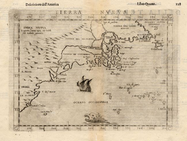
Auction 109, Lot 103
Subject: Colonial North America
Ruscelli, Girolamo
Tierra Nueva, 1598-99
Size: 9.7 x 7 inches (24.6 x 17.8 cm)
Estimate: $800 - $900
Sold for: $850
Closed on 12/1/2004
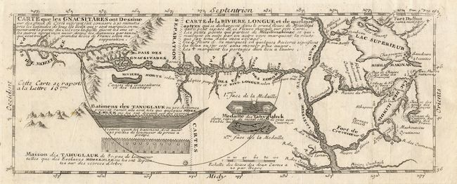
Auction 109, Lot 104
Subject: Colonial Midwest
Lahontan, Louis Armand
Carte que les Gnacsitares ont Dessine sur ... Carte de la Riviere Longue et de quelques Autres qui se Dechargent dans le Grand Fleuve Missisipi …, 1728
Size: 11.7 x 4.4 inches (29.7 x 11.2 cm)
Estimate: $600 - $800
Sold for: $550
Closed on 12/1/2004
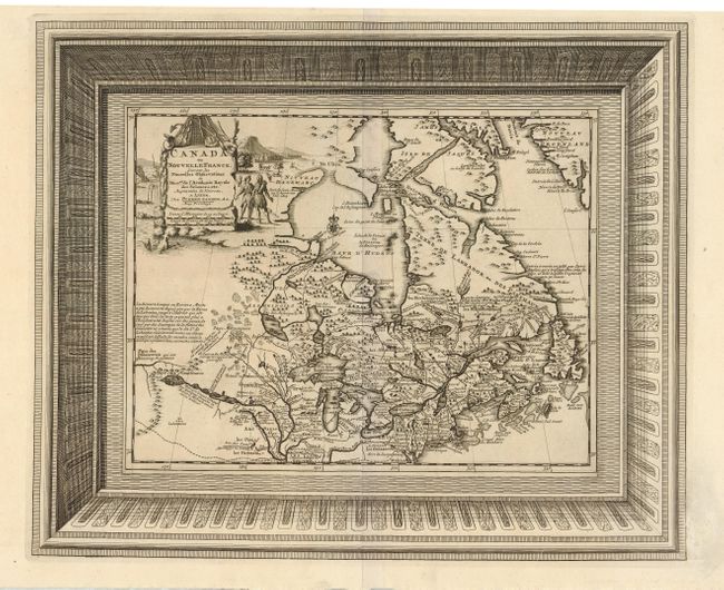
Auction 109, Lot 105
Subject: Colonial Canada and Great Lakes
Aa, Pieter van der
Canada ou Nouvelle France Suivant les Nouvelles Observations de Messrs. de l'Academie Royale des Sciences etc., 1729
Size: 16 x 13 inches (40.6 x 33 cm)
Estimate: $600 - $700
Sold for: $450
Closed on 12/1/2004
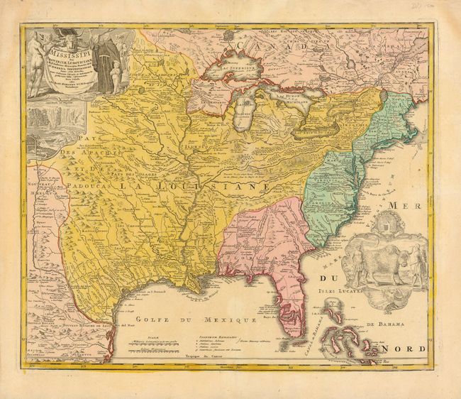
Auction 109, Lot 106
Subject: Colonial North America
Homann, Johann Baptist
Amplissimae Regionis Mississipi Seu Provinciae Ludovicianae…, 1730
Size: 23 x 19.2 inches (58.4 x 48.8 cm)
Estimate: $2,200 - $2,400
Sold for: $1,800
Closed on 12/1/2004
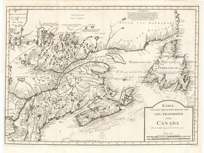
Auction 109, Lot 107
Subject: Colonial North America
Bellin, Jacques Nicolas
Karte von dem Ostlichen Stucke von Neu Frankreich oder Canada, 1744
Size: 21.5 x 15.5 inches (54.6 x 39.4 cm)
Estimate: $350 - $400
Sold for: $250
Closed on 12/1/2004
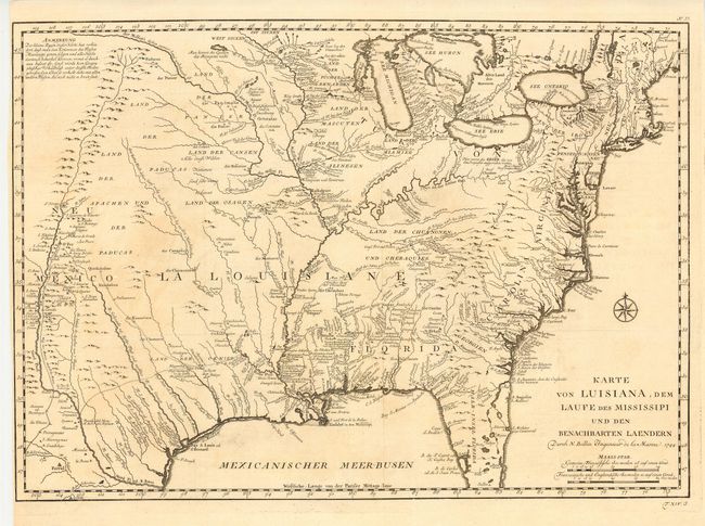
Auction 109, Lot 108
Subject: Colonial Louisiana
Bellin, Jacques Nicolas
Karte von Luisiana, dem Laufe des Mississipi und den Benachbarten Laendern…, 1744
Size: 22 x 15.5 inches (55.9 x 39.4 cm)
Estimate: $1,100 - $1,200
Sold for: $750
Closed on 12/1/2004
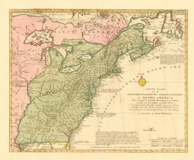
Auction 109, Lot 109
Subject: Colonial North America
Tirion, Isaac
Nieuwe Kaart van de Grootbrittannische Volkplantingen in Noord America…, 1755
Size: 17.6 x 14.2 inches (44.7 x 36.1 cm)
Estimate: $850 - $950
Sold for: $850
Closed on 12/1/2004
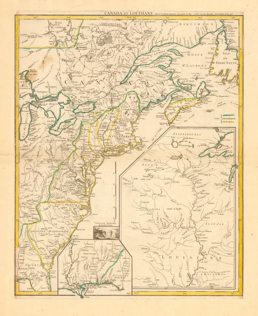
Auction 109, Lot 110
Subject: Colonial Canada & United States
Le Rouge, George Louis
Canada et Louisiane…, 1755
Size: 19.7 x 24 inches (50 x 61 cm)
Estimate: $1,900 - $2,200
Unsold
Closed on 12/1/2004
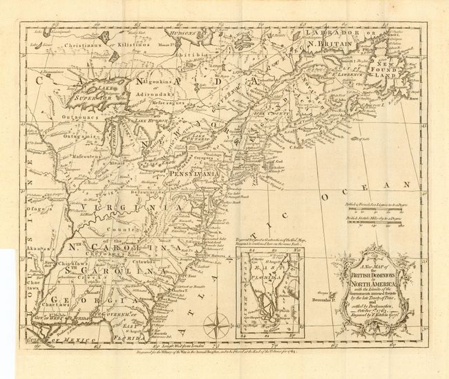
Auction 109, Lot 111
Subject: Colonial United States and Canada
Kitchin, Thomas
A New Map of the British Dominions in North America; with the Limits of the Governments Annexed thereto by the Late Treaty of Peace, and Settled by Proclamation, October 7th, 1763, 1763
Size: 12 x 9.5 inches (30.5 x 24.1 cm)
Estimate: $200 - $300
Sold for: $600
Closed on 12/1/2004
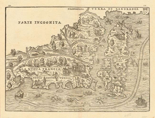
Auction 109, Lot 112
Subject: Colonial New England and Canada
Gastaldi/Ramusio
La Nuova Francia, 1606
Size: 14.5 x 10.5 inches (36.8 x 26.7 cm)
Estimate: $2,400 - $3,000
Sold for: $2,100
Closed on 12/1/2004
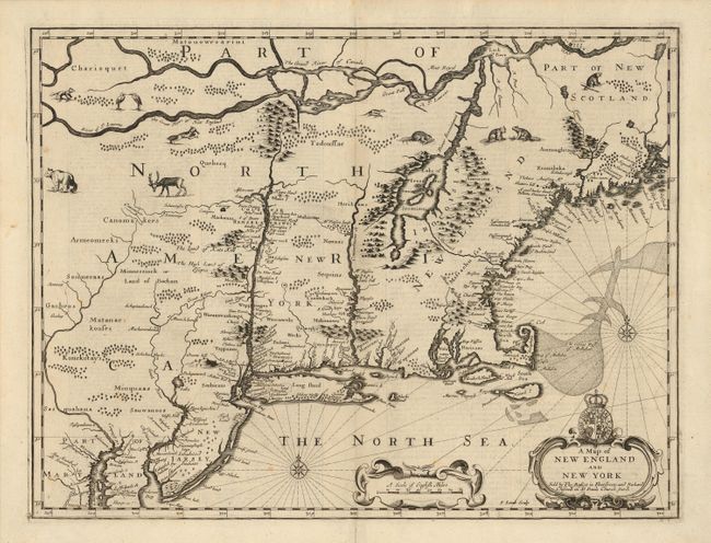
Auction 109, Lot 114
Subject: Colonial New England
Speed/Lamb
A Map of New England and New York, 1676
Size: 19.5 x 15 inches (49.5 x 38.1 cm)
Estimate: $6,000 - $7,000
Sold for: $5,000
Closed on 12/1/2004
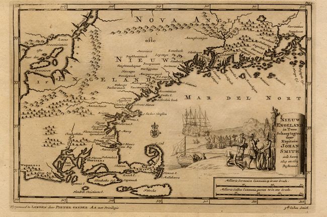
Auction 109, Lot 116
Subject: Colonial New England
Aa, Pieter van der
Nieuw Engeland in Twee Scheepstogten door Kapitein Johan Smith in de Jaren 1614 en 1615, 1707
Size: 9 x 6 inches (22.9 x 15.2 cm)
Estimate: $700 - $800
Sold for: $650
Closed on 12/1/2004
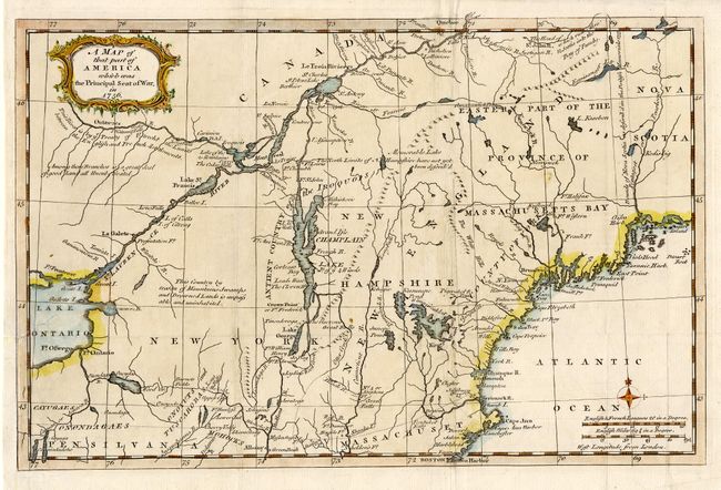
Auction 109, Lot 117
Subject: Colonial New England
Anon.
A Map of that part of America which was the Principal Seat of War, in 1756, 1757
Size: 13 x 8.7 inches (33 x 22.1 cm)
Estimate: $350 - $400
Sold for: $250
Closed on 12/1/2004
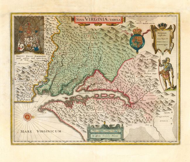
Auction 109, Lot 118
Subject: Colonial Virginia
Hondius/Blaeu
Nova Virginiae Tabula, 1662
Size: 18.8 x 14.7 inches (47.8 x 37.3 cm)
Estimate: $2,750 - $3,250
Sold for: $2,200
Closed on 12/1/2004
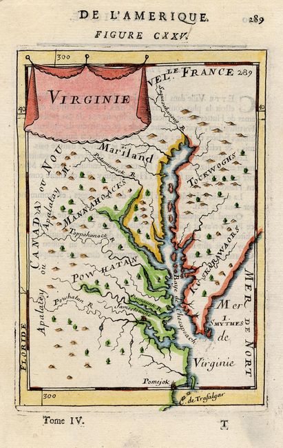
Auction 109, Lot 119
Subject: Colonial Virginia
Mallet, Alain Manesson
Virginie, 1683
Size: 4 x 6 inches (10.2 x 15.2 cm)
Estimate: $250 - $325
Sold for: $425
Closed on 12/1/2004
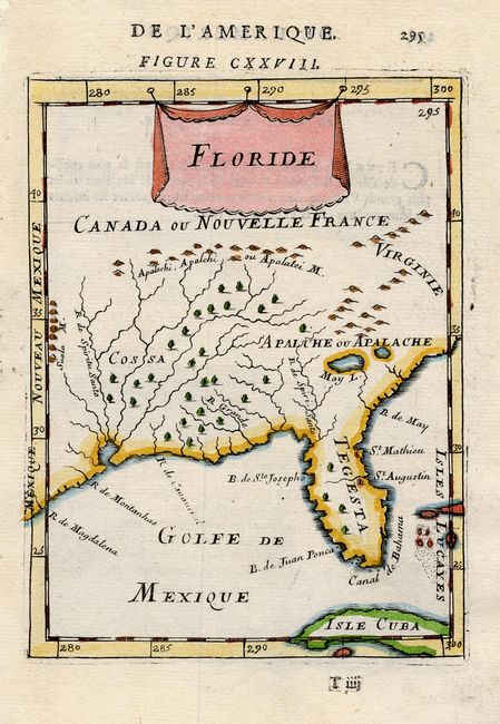
Auction 109, Lot 122
Subject: Colonial South
Mallet, Alain Manesson
Floride, 1683
Size: 4.5 x 6 inches (11.4 x 15.2 cm)
Estimate: $250 - $350
Sold for: $170
Closed on 12/1/2004
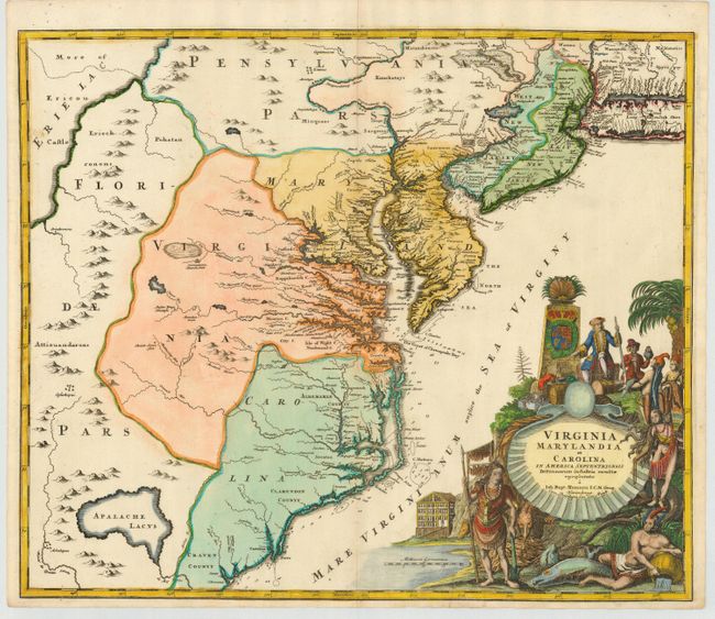
Auction 109, Lot 123
Subject: Colonial Southeast
Homann, Johann Baptist
Virginia Marylandia et Carolina in America Septentrionali Britannorum industria excultae, 1765
Size: 22.5 x 19 inches (57.2 x 48.3 cm)
Estimate: $1,800 - $2,200
Sold for: $1,300
Closed on 12/1/2004
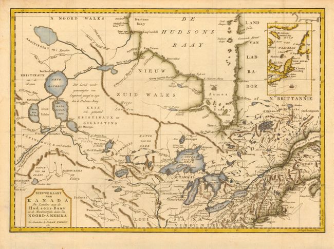
Auction 109, Lot 125
Subject: Colonial Great Lakes
Tirion, Isaac
Nieuwe Kaart van Kanada, de Landen aan de Hudsons-Baay en de Noordwestelyke deelen van Noord-Amerika, 1769
Size: 17.2 x 12.2 inches (43.7 x 31 cm)
Estimate: $400 - $450
Sold for: $300
Closed on 12/1/2004
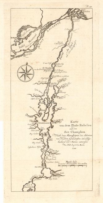
Auction 109, Lot 142
Subject: Canada and New York
Bellin, Jacques Nicolas
Karte von dem Flusse Richelieu und dem See Champlain…, 1744
Size: 5.2 x 11.8 inches (13.2 x 30 cm)
Estimate: $90 - $120
Sold for: $130
Closed on 12/1/2004
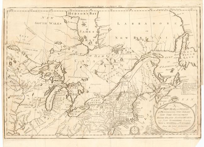
Auction 109, Lot 143
Subject: Canada & United States
Gordon, William
New Map of the States of Pensylvania New Jersey New York Connecticut Rhode Island Massachusets and New Hampshire Including Nova Scotia and Canada, 1789
Size: 16 x 10.6 inches (40.6 x 26.9 cm)
Estimate: $200 - $300
Sold for: $250
Closed on 12/1/2004
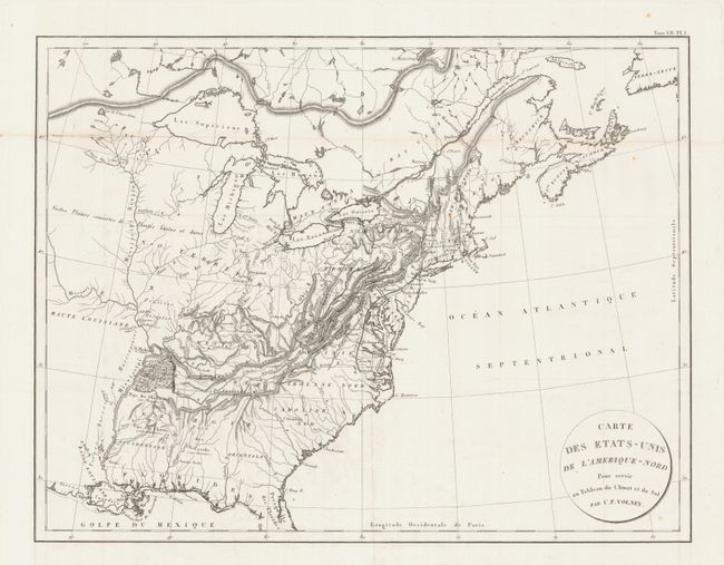
Auction 109, Lot 144
Subject: United States & Canada
Volney, C. F.
Carte des Etats-Unis de l'Amerique-Nord, 1809
Size: 21.5 x 16.2 inches (54.6 x 41.1 cm)
Estimate: $200 - $250
Sold for: $220
Closed on 12/1/2004
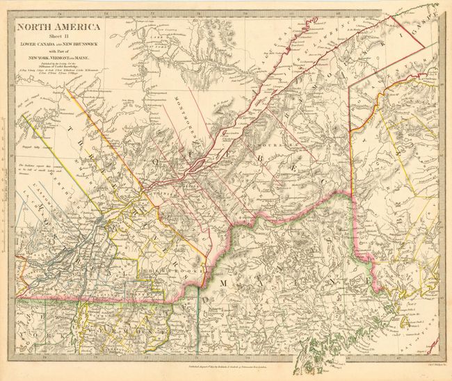
Auction 109, Lot 145
Subject: New England & Canada
SDUK Society for the Diffusion of Useful Knowledge
North America Sheet II Lower-Canada and New Brunswick with Part of New-York, Vermont and Maine, 1832
Size: 15.2 x 13.7 inches (38.6 x 34.8 cm)
Estimate: $80 - $100
Sold for: $50
Closed on 12/1/2004
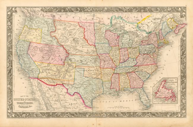
Auction 109, Lot 146
Subject: United States
Mitchell, Samuel Augustus
Map of the United States, and Territories. Together with Canada &c., 1860-61
Size: 21.5 x 13 inches (54.6 x 33 cm)
Estimate: $200 - $250
Sold for: $700
Closed on 12/1/2004
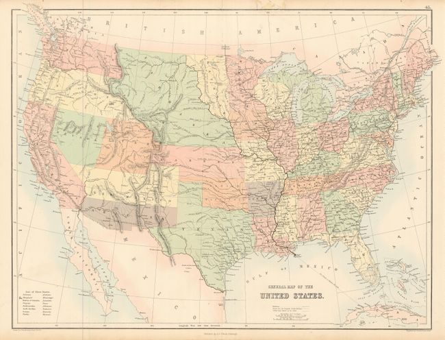
Auction 109, Lot 147
Subject: United States
Black, Adam & Charles
General Map of the United States, 1859-61
Size: 21.5 x 16.2 inches (54.6 x 41.1 cm)
Estimate: $150 - $200
Sold for: $325
Closed on 12/1/2004
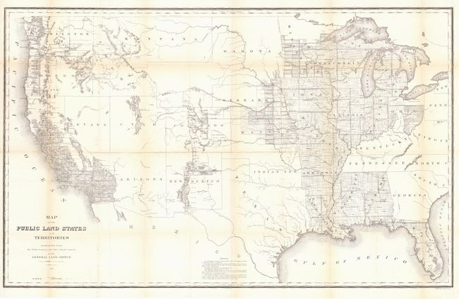
Auction 109, Lot 148
Subject: United States
General Land Office
Map of the Public Land States and Territories constructed from The Public Surveys and other official sources in the General Land Office, 1864
Size: 45 x 28 inches (114.3 x 71.1 cm)
Estimate: $200 - $250
Sold for: $150
Closed on 12/1/2004
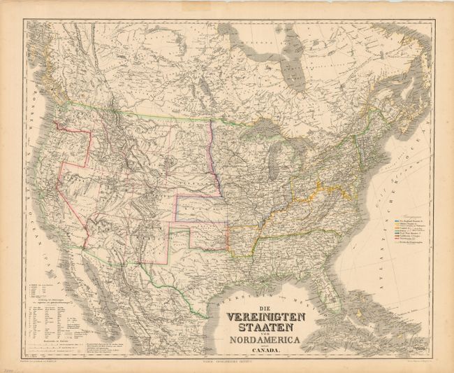
Auction 109, Lot 149
Subject: United States
Kiepert, Heinrich C.
Die Vereinigten Staaten von Nord America nebst Canada, 1868
Size: 25.2 x 20.7 inches (64 x 52.6 cm)
Estimate: $200 - $250
Unsold
Closed on 12/1/2004
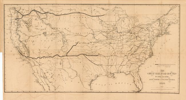
Auction 109, Lot 150
Subject: United States
Gorlinski, Joseph
The Great Railroad Routes to the Pacific, and Their Connections, 1869
Size: 27.7 x 14 inches (70.4 x 35.6 cm)
Estimate: $160 - $200
Sold for: $160
Closed on 12/1/2004
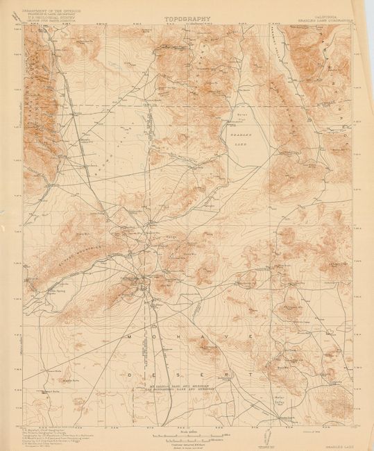
Auction 109, Lot 151
Subject: United States
U.S. Geological Survey (USGS)
[Lot of 25 - Topographic Maps], 1915-6
Size: 13.6 x 17.5 inches (34.5 x 44.5 cm)
Estimate: $240 - $300
Unsold
Closed on 12/1/2004
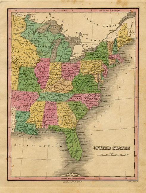
Auction 109, Lot 152
Subject: United States - Eastern
Finley, Anthony
United States, 1824
Size: 8.7 x 11.2 inches (22.1 x 28.4 cm)
Estimate: $120 - $150
Sold for: $90
Closed on 12/1/2004
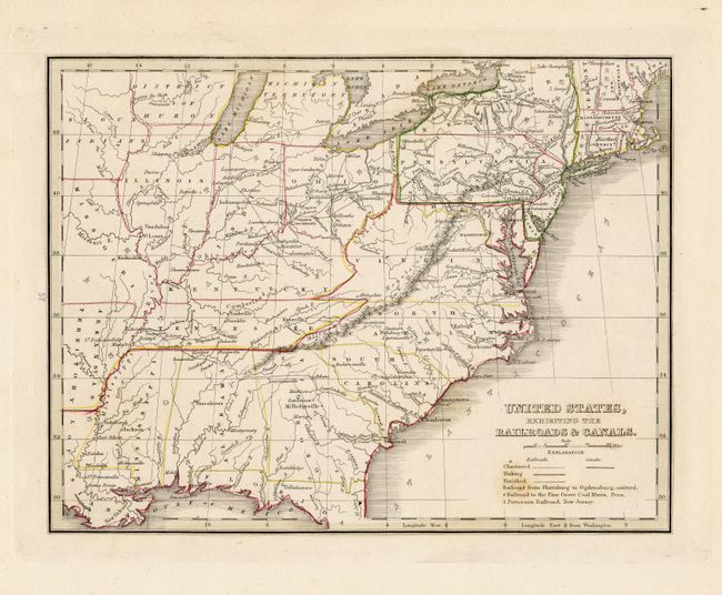
Auction 109, Lot 153
Subject: United States - Eastern
Bradford, Thomas Gamaliel
United States, Exhibiting the Railroads & Canals, 1835
Size: 9.8 x 7.5 inches (24.9 x 19.1 cm)
Estimate: $100 - $150
Sold for: $75
Closed on 12/1/2004
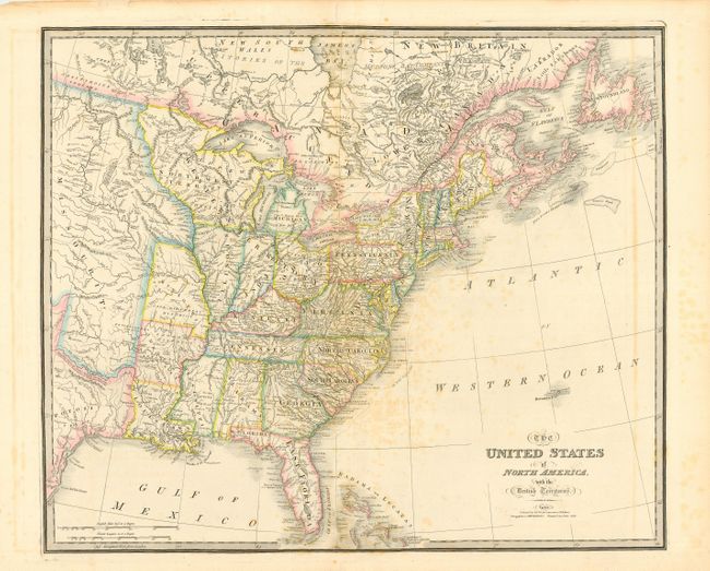
Auction 109, Lot 154
Subject: United States - Eastern
Wyld, James
The United States of North America with the British Territories, 1838
Size: 25 x 21 inches (63.5 x 53.3 cm)
Estimate: $600 - $700
Sold for: $450
Closed on 12/1/2004
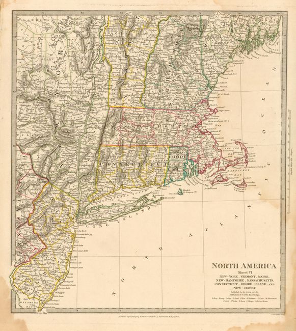
Auction 109, Lot 155
Subject: Northeastern United States
SDUK Society for the Diffusion of Useful Knowledge
North America Sheet VI New-York, Vermont, Maine, New-Hampshire, Massachusetts, Connecticut, Rhode Island, and New Jersey, 1832
Size: 12.5 x 13.7 inches (31.8 x 34.8 cm)
Estimate: $50 - $60
Sold for: $0
Closed on 12/1/2004
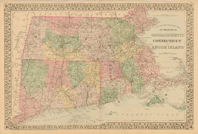
Auction 109, Lot 156
Subject: Northeastern United States
Mitchell, Samuel Augustus
County and Township Map of the States of Massachusetts Connecticut and Rhode Island, 1880
Size: 21.5 x 14.5 inches (54.6 x 36.8 cm)
Estimate: $80 - $100
Sold for: $75
Closed on 12/1/2004
Auction 109, Lot 157
Subject: United States - Mid-Atlantic
U.S. War Dept.
[Lot of 2] Potomac Aqueduct [with] Oregon Inlet N. Carolina, 1832-1862
Size: See Description
Estimate: $60 - $80
Sold for: $45
Closed on 12/1/2004
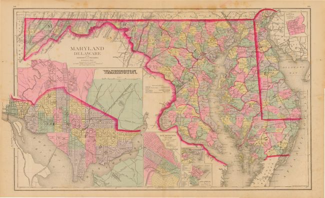
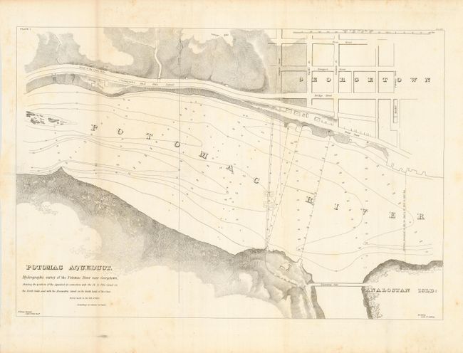
Auction 109, Lot 158
Subject: United States - Mid-Atlantic
Gray, Ormando Willis & Son
Maryland, Delaware and the District of Columbia, 1881
Size: 26 x 15.7 inches (66 x 39.9 cm)
Estimate: $90 - $120
Sold for: $85
Closed on 12/1/2004
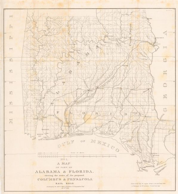
Auction 109, Lot 159
Subject: Southern United States
U.S. Corps of Engineers
No. 1 A Map of Part of Alabama & Florida shewing the route of the proposed Columbus & Pensacola Rail Road, 1836
Size: 20.7 x 22 inches (52.6 x 55.9 cm)
Estimate: $150 - $250
Sold for: $75
Closed on 12/1/2004
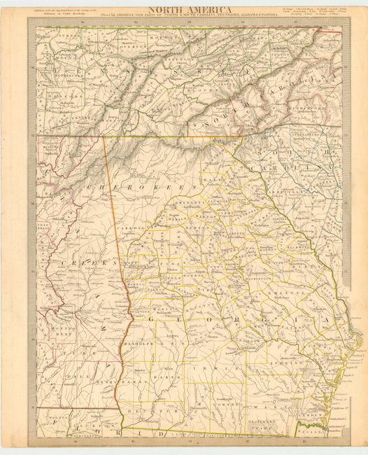
Auction 109, Lot 160
Subject: United States - Southern
SDUK Society for the Diffusion of Useful Knowledge
North America Sheet XII Georgia with Parts of North & South Carolina, Tennessee, Alabama & Florida, 1840
Size: 12.5 x 15.7 inches (31.8 x 39.9 cm)
Estimate: $100 - $120
Sold for: $150
Closed on 12/1/2004
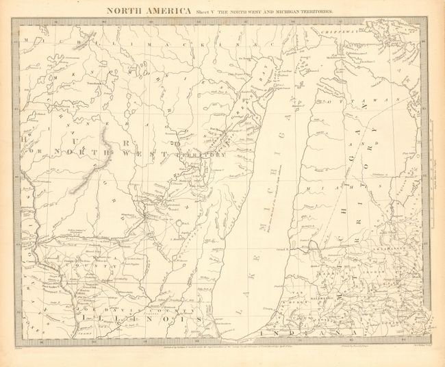
Auction 109, Lot 161
Subject: United States - Central
SDUK Society for the Diffusion of Useful Knowledge
North America Sheet V The North West and Michigan Territories, 1833
Size: 15 x 11.8 inches (38.1 x 30 cm)
Estimate: $150 - $200
Sold for: $160
Closed on 12/1/2004
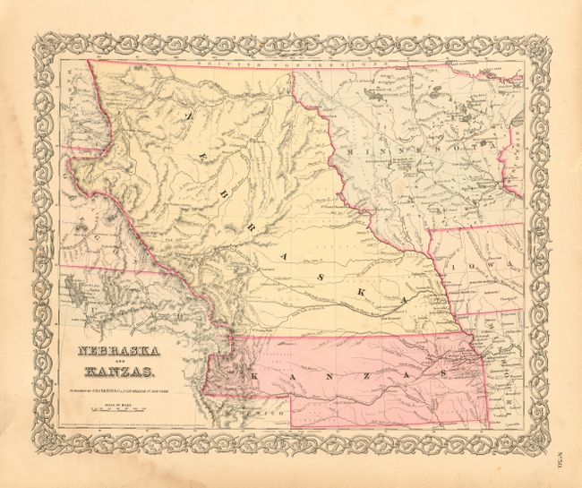
Auction 109, Lot 162
Subject: United States - Central
Colton, Joseph Hutchins
Nebraska and Kanzas, 1855
Size: 16 x 13 inches (40.6 x 33 cm)
Estimate: $275 - $325
Sold for: $240
Closed on 12/1/2004
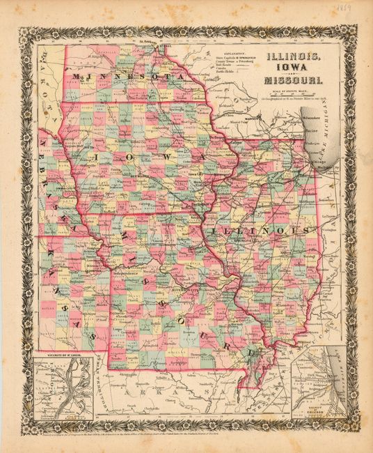
Auction 109, Lot 163
Subject: United States - Central
Colton, Joseph Hutchins
Illinois, Iowa and Missouri, 1858
Size: 10.7 x 12.7 inches (27.2 x 32.3 cm)
Estimate: $110 - $150
Sold for: $75
Closed on 12/1/2004
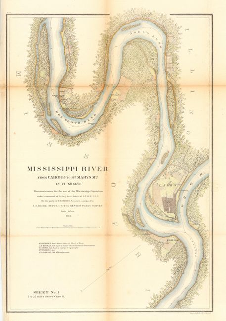
Auction 109, Lot 164
Subject: United States - Central
U.S. Coast Survey
[Lot of 8] Mississippi River From Cairo Ill. To St. Marys Mo. In VI Sheets [with] Mississippi River Grand Gulf, Turner's Pt. New Carthage… Sheets No. 1 & No. 2…, 1864
Size: See Description
Estimate: $250 - $350
Sold for: $170
Closed on 12/1/2004
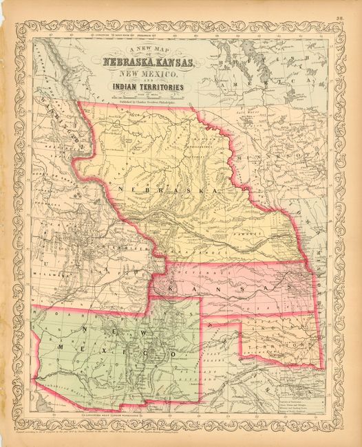
Auction 109, Lot 165
Subject: United States - Central & Southwest
Desilver, Charles
A New Map of Nebraska, Kansas, New Mexico, and Indian Territories, 1859
Size: 13 x 16 inches (33 x 40.6 cm)
Estimate: $220 - $260
Sold for: $425
Closed on 12/1/2004
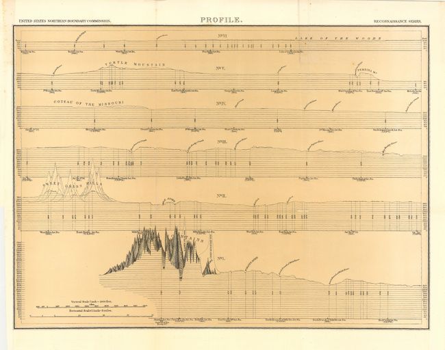
Auction 109, Lot 166
Subject: Central and Western United States
U.S. Government
Reconnaissance Maps (Six Sheets and Profile) Showing the general features of the topography adjacent to the 49th Parallel from the Lake of the Woods to the Rocky Mountains, 1878
Size: 21 x 15.3 inches (53.3 x 38.9 cm)
Estimate: $350 - $450
Unsold
Closed on 12/1/2004
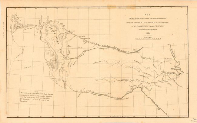
Auction 109, Lot 167
Subject: United States - Western
Franklin, William Buell [Lt.]
Map of the Route Pursued by the Late Expedition under the Command of Col. S.W. Kearney, U.S. 1st Dragoons, 1845
Size: 12.8 x 8 inches (32.5 x 20.3 cm)
Estimate: $200 - $250
Sold for: $140
Closed on 12/1/2004
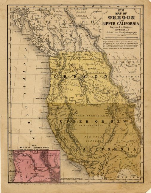
Auction 109, Lot 168
Subject: United States - Western
Thomas, Cowperthwait & Co.
No. 15 Map of Oregon and Upper California, 1846
Size: 8 x 10.5 inches (20.3 x 26.7 cm)
Estimate: $150 - $200
Sold for: $85
Closed on 12/1/2004
Auction 109, Lot 169
Subject: Western United States
U.S. Railroad Surveys
[Lot of 3 - Pacific Railroad], 1853
Size: See Description
Estimate: $220 - $275
Sold for: $160
Closed on 12/1/2004
Auction 109, Lot 170
Subject: United States - Western
Smith, Roswell C.
Map No. 10 United States, 1855
Size: 8.6 x 10.5 inches (21.8 x 26.7 cm)
Estimate: $100 - $120
Sold for: $160
Closed on 12/1/2004
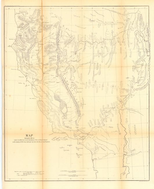
Auction 109, Lot 171
Subject: United States - Western
U.S. Army
Map Showing the Different Routes Travelled over by the Detachments of the Overland Command in the Spring of 1855 from Salt Lake City, Utah to the Bay of San Francisco, 1855
Size: 18.7 x 22.2 inches (47.5 x 56.4 cm)
Estimate: $250 - $350
Unsold
Closed on 12/1/2004
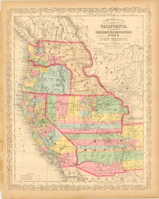
Auction 109, Lot 172
Subject: United States - Western
Desilver, Charles
A New Map of the State of California, the Territories of Oregon, Washington, Utah & New Mexico, 1859
Size: 13 x 16.2 inches (33 x 41.1 cm)
Estimate: $500 - $600
Sold for: $425
Closed on 12/1/2004
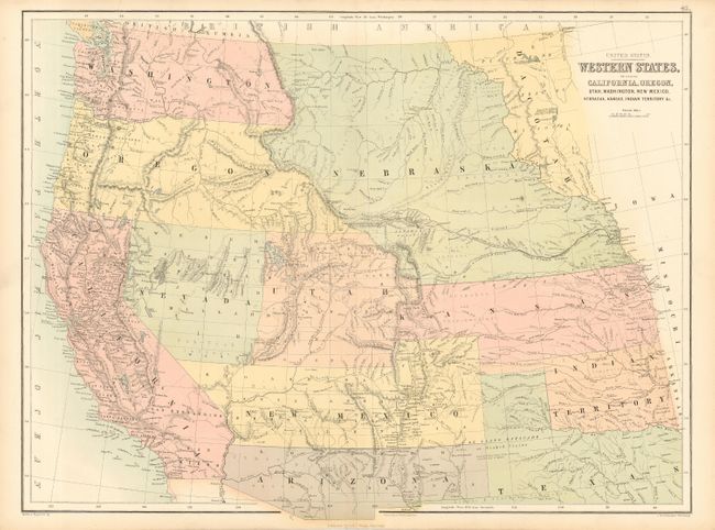
Auction 109, Lot 173
Subject: United States - Western
Black, Adam & Charles
United States Western States, including California, Oregon, Utah, Washington, New Mexico, Nebraska, Kansas, Indian Territory &c., 1859-61
Size: 22 x 16.7 inches (55.9 x 42.4 cm)
Estimate: $250 - $300
Sold for: $275
Closed on 12/1/2004
164 lots
Page 1 of 4