Catalog Archive
Auction 109, Lot 111

"A New Map of the British Dominions in North America; with the Limits of the Governments Annexed thereto by the Late Treaty of Peace, and Settled by Proclamation, October 7th, 1763", Kitchin, Thomas

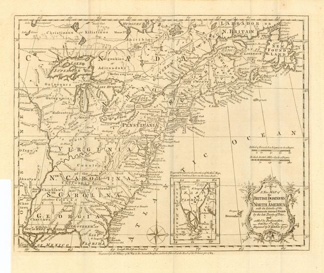
Subject: Colonial United States and Canada

Period: 1763 (dated)

Publication: History of War…

Color: Black & White

Size:
12 x 9.5 inches
30.5 x 24.1 cm
Download High Resolution Image
(or just click on image to launch the Zoom viewer)

A very historical map illustrating the British colonies after the Treaty of Paris that marked the end of the French and Indian War in America. The treaty ended French colonial ambitions in North America with minor exceptions. Spain ceded east and west Florida to Great Britain and France relinquished to Spain title to the Louisiana Territory and established the Mississippi River as the British - Spanish Boundary. The map reflects the claims of the southern colonies that their charters extended to the Mississippi River. Also of interest are the names and locations of many Indian tribes and nations located away from the more populated areas of English settlements. With an inset of East Florida. A very nice example of this map.

References: McCorkle 763.5; Sellers & Van Ee 103; Jolly ANNREG-3.

Condition: A

Nice impression on thick hand laid paper with full margins. Folding, as issued.

Estimate: $200 - $300

Sold for: $600

Closed on 12/1/2004

Archived