Subject: United States - Central & Southwest
Period: 1859 (dated)
Publication: New Universal Atlas
Color: Hand Color
Size:
13 x 16 inches
33 x 40.6 cm
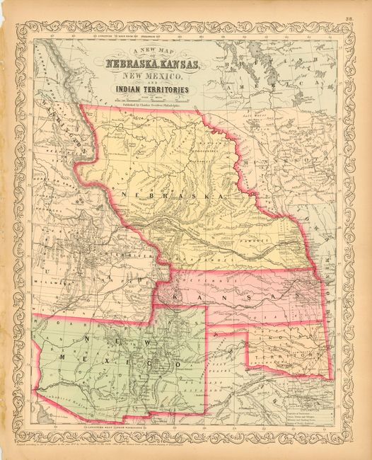
Fine map of the states and territories from this important series of maps originating with Samuel Augustus Mitchell. The map is filled with early county configurations, exploration routes, and various trails including the Santa Fe Trail. Nebraska extends between Canada and Kansas, with Washington to the west and Minnesota in the east. Oklahoma is Indian Territory. New Mexico Territory extends from California to Texas and features the northern county of Taos that extends into the future Colorado. Part of Utah Territory is shown and extends to Middle Park and Long's Peak in present-day Colorado with its eastern border formed by Nebraska and Kansas. Filled with interesting features and notations including "Great Indian Treaty Ground", "Uninhabited Region", etc. Desilver's unique scroll border with his imprint at Philadelphia.
References:
Condition: A
Crisp impression and fine original hand coloring. A little marginal toning, map image very good.