Subject: Colonial Canada and Great Lakes
Period: 1729 (published)
Publication: La Galerie Agreable du Monde
Color: Black & White
Size:
16 x 13 inches
40.6 x 33 cm
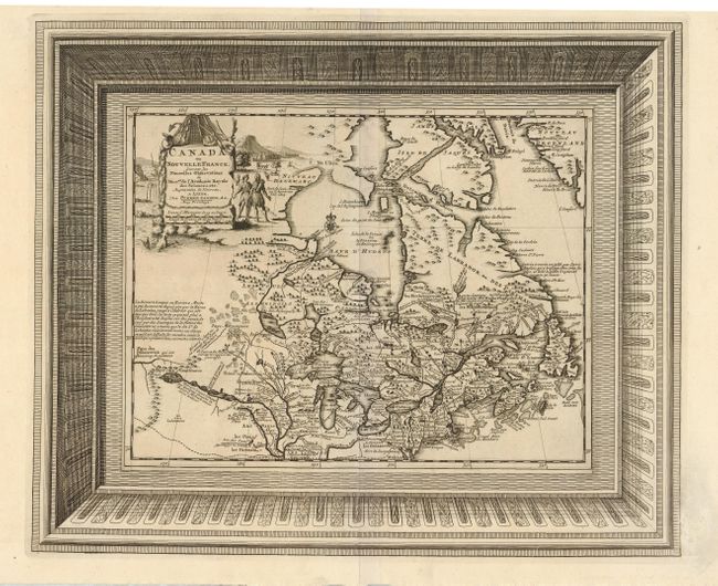
Beautifully engraved map of northeastern North American and the Great Lakes region based on Delisle's important map of 1703. The Great Lakes are reasonably well delineated, but Hudson Bay and the upper Mississippi River basin are distorted. Lahontan's mythical Riviere Longue is shown linking a large western lake with the Mississippi River. It is thought that the lake's origin is derived from Indian stories concerning the Great Salt Lake. The map is filled with place names, Indian tribes and interesting notations. The large title cartouche is surrounded by scenes of natives and indigenous animals. This is the much more decorative, and uncommon, second state with the map enclosed in a superb picture frame-style border with incredible 3-dimensional quality.
References: Kershaw #328.
Condition: A
Fine impression. Faint ex-library stamp in blank margin, not affecting map.