Subject: United States - Central
Period: 1864 (dated)
Publication:
Color: Hand Color
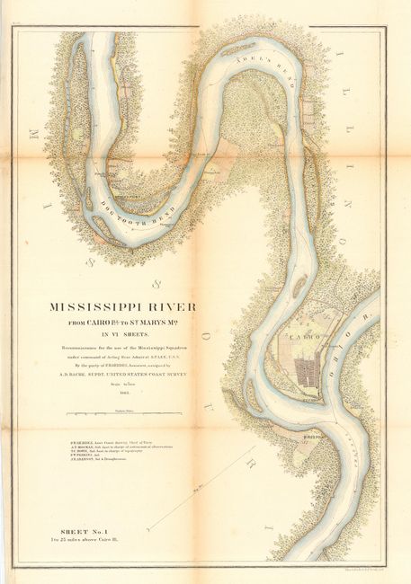
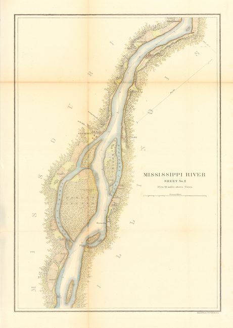
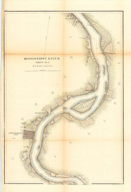
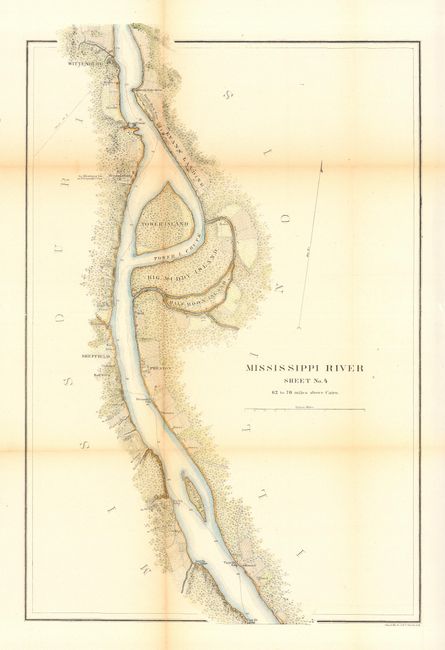
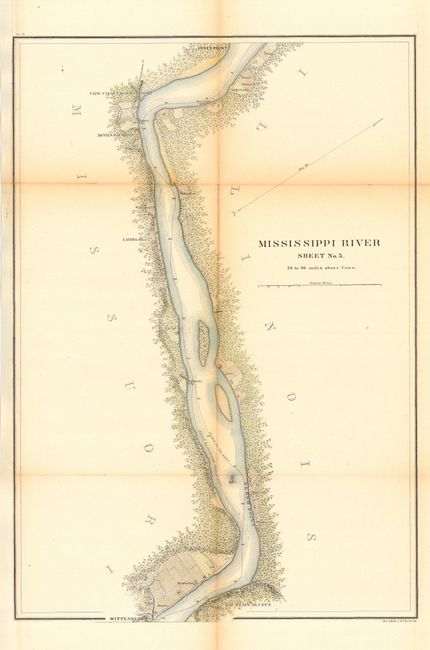
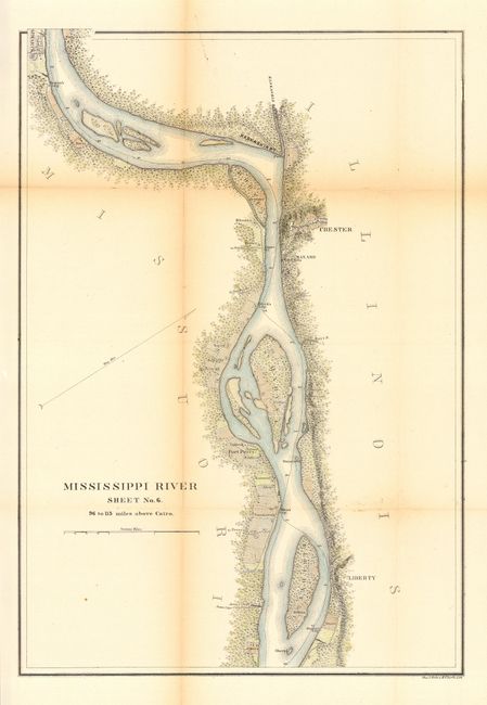
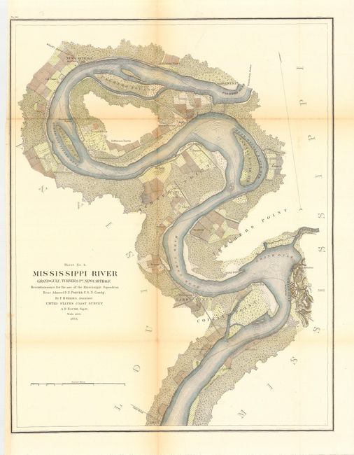
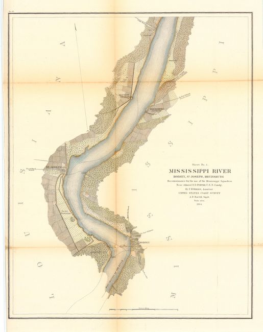
Firstsix sheets are (15.5 x22.5") and the last two are (16.7 x 21"). Group of Coast Survey Charts of the Mississippi River. All eight charts were produced from a reconnaissance survey for use by the Mississippi Squadron during the Civil War. The first group (6 charts titled "Mississippi River Sheet No. 1" through "…No. 6"), examines the river from Cairo up stream for about 116 miles. The second group (2 charts titled "Sheet No. 1 Mississippi River Rodney, St. Joseph, Bruinsburg" and "Sheet No. 2 Mississippi River Grand Gulf, Turner's Pt., New Carthage"), examines the River from Rodney northward for about 45 miles to the vicinity of Palmyra Bend at Sergeants Point. All show great detail inland from both banks for about one mile, naming plantations and other interesting features along the way.
References:
Condition: B
All issued folding, now each is backed with archival tissue. Most with binding trim extended to better accommodate framing.