Subject: United States - Western
Period: 1846 (dated)
Publication: Mitchell's School and Family Geography
Color: Hand Color
Size:
8 x 10.5 inches
20.3 x 26.7 cm
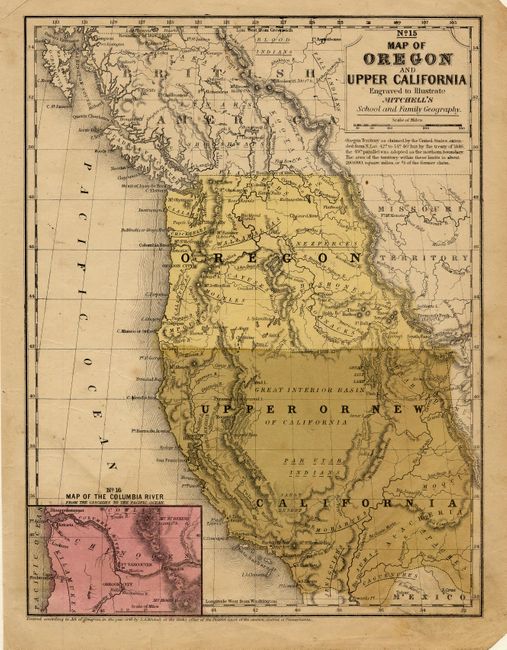
This is a scarce school atlas map of Oregon Territory and the area that will become California, Nevada, and parts of Arizona and Utah in a few years; part of Mexico is labeled Upper California. Includes inset "No. 16 Map of the Columbia River from the Cascades to the Pacific Ocean." Names major rivers, mountains, Indian regions, forts, towns and pueblos. A very nice map produced during the J.C. Fremont explorations and utilizing some of his discoveries. The boundary of Upper California extends to the 42nd parallel as determined by the Treaty of 1819.
References: Wheat (Gold) #28.
Condition: B
Nice impression on sound paper. The full wash green over Upper California is a little oxidized. A little surface soiling, especially at lower right.