Subject: Colonial Eastern Canada
Period: 1758 (published)
Publication: London Magazine
Color: Black & White
Size:
7.1 x 4.6 inches
18 x 11.7 cm
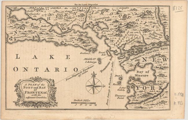
A. A Plan of the Fort and Bay of Frontenac, with the Adjacent Countries. Strongly engraved map published during the French & Indian War. Centered on Lake Ontario it shows Fort Frontenac on the western shore of New York and Ontario above. Locates the settlements of Kent and Ganaraske, the Toniata Village of Iroquois, the Catarackui River, Deer Island, the Bay of Niaoure and more. Published in the November 1758 issue.
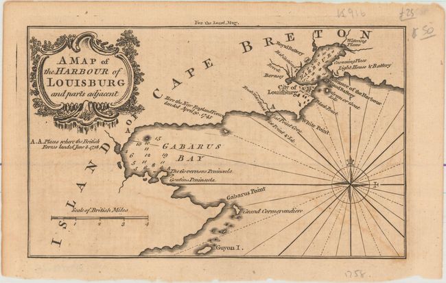
B. A Map of the Harbour of Louisburg and Parts Adjacent. The port city of Louisbourg on Cape Breton Island was founded by the French in 1713. This map depicts the city and harbor of Louisbourg, as well as the adjacent Gabarus Bay, and identifies the location where the British landed on June 8, 1758 during the Seven Years' War. After the British captured Louisbourg, they destroyed all of the fortifications. Published in the August 1758 issue.
References: Jolly #LOND-142 & 152.
Condition: B+
Light toning with some offsetting from an opposing page.