Filtered by Category:Canada(Show All Categories)
Showing results for:Auction 119
Catalog Archive
29 lots
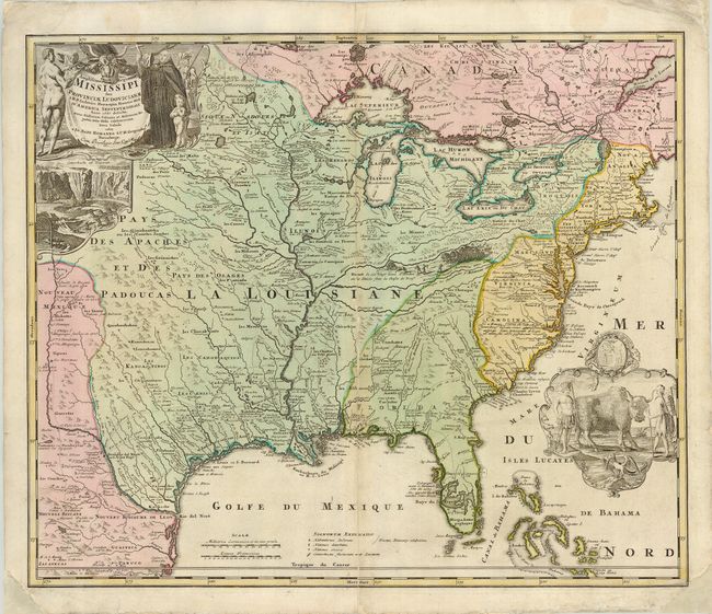
Auction 119, Lot 117
Subject: Colonial North America
Homann, Johann Baptist
Amplissimae Regionis Mississipi seu Provinciae Ludovicianae…, 1730
Size: 22.8 x 19 inches (57.9 x 48.3 cm)
Estimate: $1,600 - $1,800
Sold for: $1,400
Closed on 5/9/2007
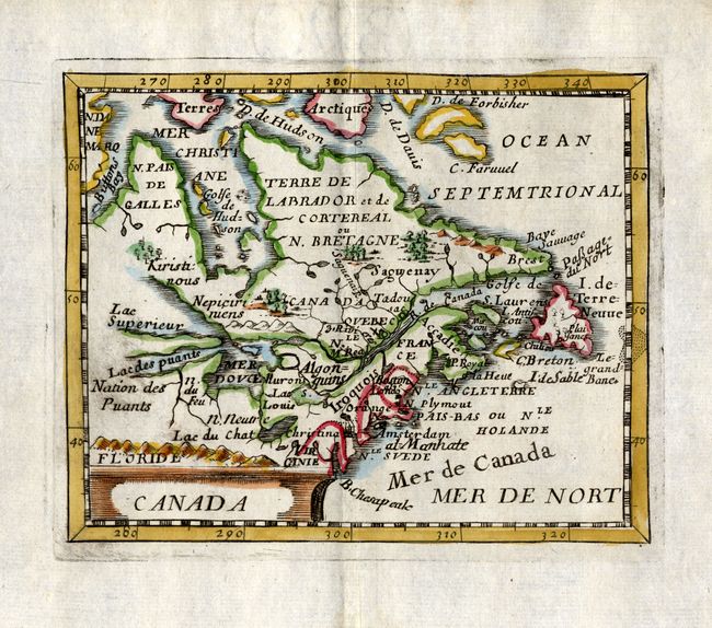
Auction 119, Lot 125
Subject: Canada
Duval, Pierre
Canada, 1682
Size: 4.8 x 3.8 inches (12.2 x 9.7 cm)
Estimate: $550 - $600
Unsold
Closed on 5/9/2007
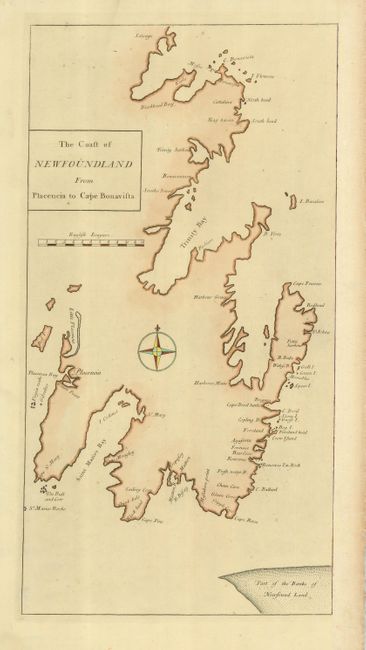
Auction 119, Lot 126
Subject: Canada, Newfoundland
Cutler, Nathaniel
The Coast of Newfoundland from Placencia to Cape Bonavista, 1728
Size: 9.5 x 18 inches (24.1 x 45.7 cm)
Estimate: $200 - $240
Sold for: $150
Closed on 5/9/2007
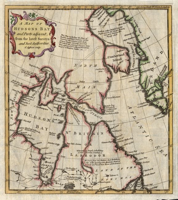
Auction 119, Lot 127
Subject: Canada - Arctic
Jefferys, Thomas
A Map of Hudsons Bay and Parts adjacent, from the latest Surveys and best Authorities, 1750
Size: 8.5 x 9.5 inches (21.6 x 24.1 cm)
Estimate: $100 - $180
Sold for: $75
Closed on 5/9/2007
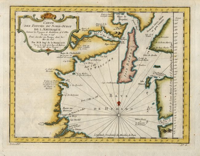
Auction 119, Lot 128
Subject: Canada - Hudson Bay
[blank]
[Lot of 2] Carte des Parties du Nord-Ouest de l'Amerique Suivant les Voyages e Middleton et d'Ellis en 1742 et 1746… [and] New and Accurate Chart of Hudson's Bay, in North America, 1753-1782
Size: See Description
Estimate: $100 - $200
Unsold
Closed on 5/9/2007
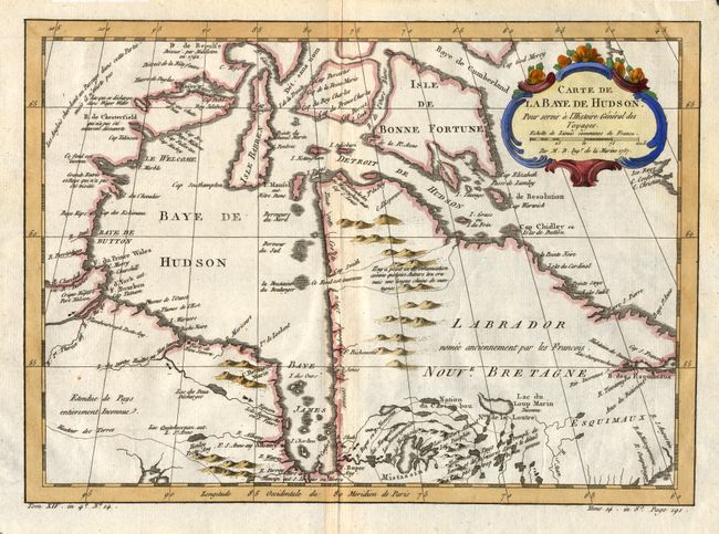
Auction 119, Lot 129
Subject: Canada - Arctic
Bellin, Jacques Nicolas
Carte de la Baye de Hudson Pour servir a l'Histoire Generale des Voyages, 1757
Size: 11.8 x 8.5 inches (30 x 21.6 cm)
Estimate: $120 - $200
Sold for: $90
Closed on 5/9/2007
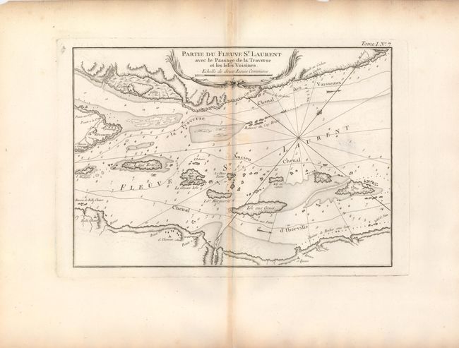
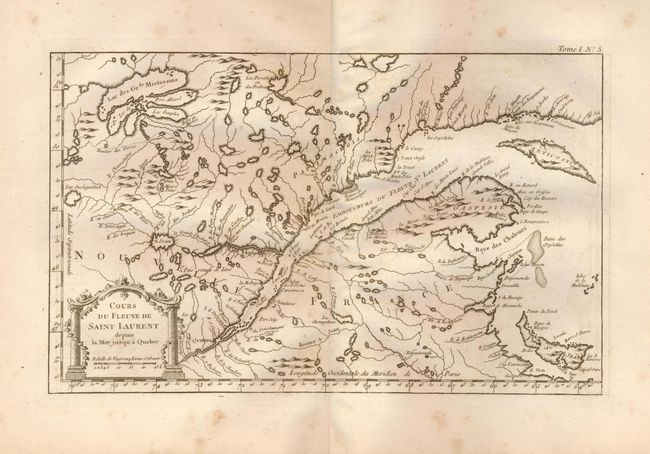
Auction 119, Lot 130
Subject: Canada
Bellin, Jacques Nicolas
Partie du Fleuve St. Laurent avec le Passage de la Traverse et les Isles Voisines, 1764
Size: 11.8 x 8.2 inches (30 x 20.8 cm)
Estimate: $120 - $140
Unsold
Closed on 5/9/2007
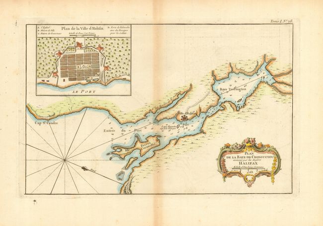
Auction 119, Lot 131
Subject: Canada
Bellin, Jacques Nicolas
Plan de la Baye de Chibouctou nommee par les Anglois Halifax. No. 28, 1764
Size: 13.8 x 8.7 inches (35.1 x 22.1 cm)
Estimate: $350 - $450
Sold for: $250
Closed on 5/9/2007
Auction 119, Lot 132
Subject: Canada - St. Lawrence River
Bellin, Jacques Nicolas
[Lot of 4 - St. Lawrence River], 1764
Size: See Description
Estimate: $200 - $400
Sold for: $130
Closed on 5/9/2007
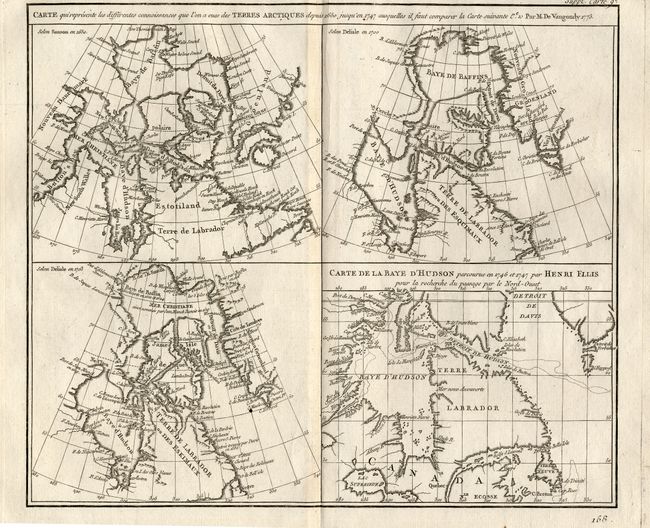
Auction 119, Lot 133
Subject: Canada - Arctic
Robert de Vaugondy, Didier
Carte qui represente les differentes connoissances que l'on a eues des Terres Arctiques depuis 1650, jusqu ' en 1747…, 1772
Size: 10 x 15.5 inches (25.4 x 39.4 cm)
Estimate: $140 - $180
Sold for: $100
Closed on 5/9/2007
Auction 119, Lot 134
Subject: Canada and Greenland
Bonne/Lattre
Partie de l'Amerique Septentrionale qui comprend le Canada, la Louisiane, le Labrador, le Groenland, la Nouvelle Angleterre, la Floride &c., 1776
Size: 17 x 11.8 inches (43.2 x 30 cm)
Estimate: $150 - $200
Sold for: $100
Closed on 5/9/2007
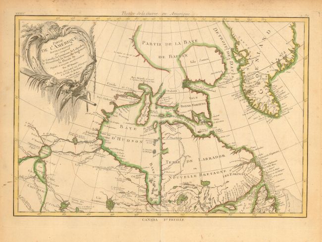
Auction 119, Lot 135
Subject: Canada & Arctic
Vandermaelen, Philippe Marie Guillaume
[Lot of 6 - Hudson Bay and Vicinity], 1825-7
Size: 22 x 18.5 inches (55.9 x 47 cm)
Estimate: $400 - $700
Sold for: $300
Closed on 5/9/2007
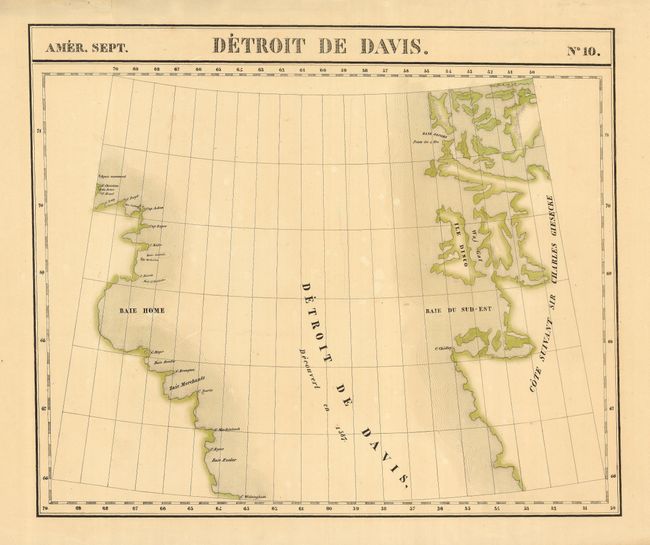
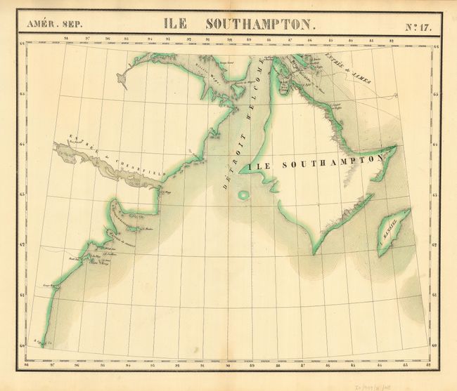
Auction 119, Lot 136
Subject: Arctic Canada and Greenland
Vandermaelen, Philippe Marie Guillaume
[Lot of 2] Amer. Sep. Detroit de Davis. No. 10. [and] Amer. Sep. Partie du Groenland. No. 19., 1827
Size: 22.6 x 18.7 inches (57.4 x 47.5 cm)
Estimate: $200 - $300
Sold for: $150
Closed on 5/9/2007
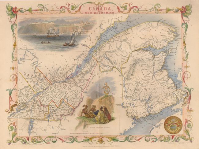
Auction 119, Lot 137
Subject: Canada
Tallis, John
East Canada and New Brunswick, 1850
Size: 13.5 x 10.5 inches (34.3 x 26.7 cm)
Estimate: $100 - $140
Sold for: $120
Closed on 5/9/2007
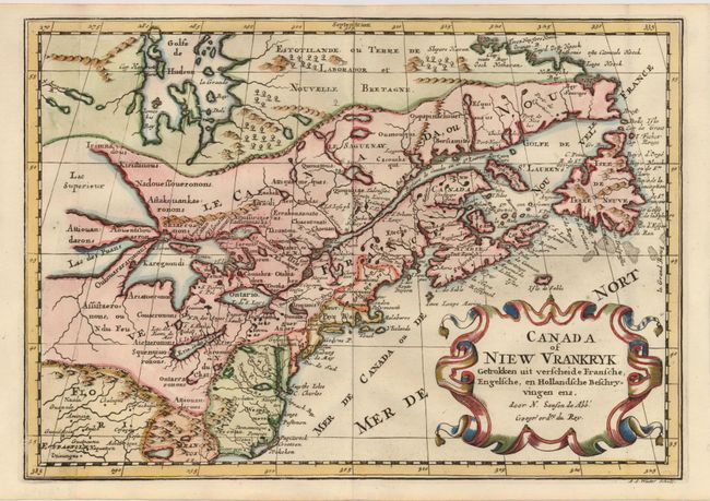
Auction 119, Lot 138
Subject: Colonial United States and Canada
Sanson, Nicolas
Canada of Niew Vrankryk Getrokken uit verscheide Fransche, Engelsche, en Hollandsche Beschryvingen enz, 1705
Size: 11.7 x 8.2 inches (29.7 x 20.8 cm)
Estimate: $750 - $950
Sold for: $650
Closed on 5/9/2007
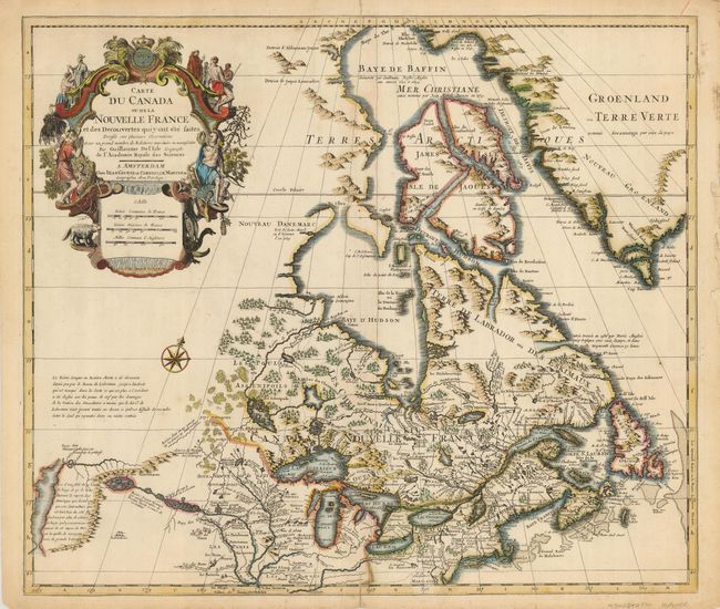
Auction 119, Lot 139
Subject: Colonial United States and Canada
Delisle/Covens & Mortier
Carte du Canada ou de la Nouvelle France…, 1730
Size: 22.5 x 19.3 inches (57.2 x 49 cm)
Estimate: $1,100 - $1,400
Sold for: $700
Closed on 5/9/2007
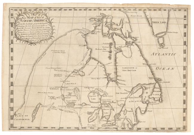
Auction 119, Lot 140
Subject: Colonial United States and Canada
La France, Joseph
A new Map of Part of North America From the Latitude of 40 to 68 Degrees. Including the late discoveries made on Board the Furnace Bomb Ketch in 1742…, 1744
Size: 18.5 x 13 inches (47 x 33 cm)
Estimate: $4,500 - $6,000
Sold for: $3,250
Closed on 5/9/2007
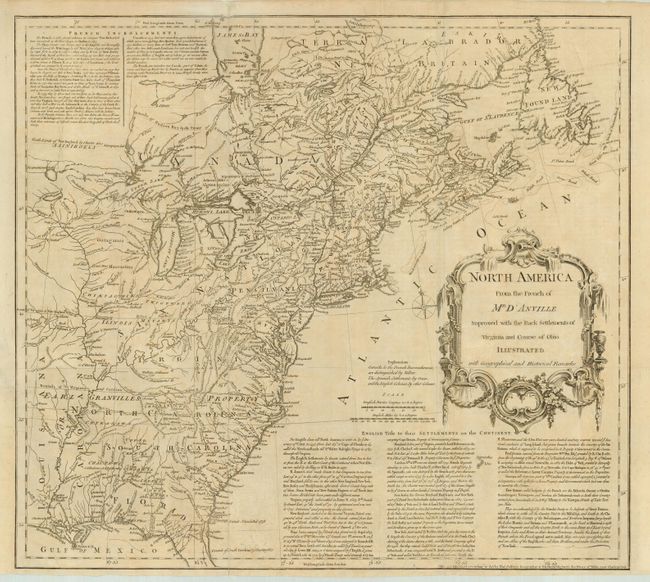
Auction 119, Lot 141
Subject: Colonial United States and Canada
Jefferys, Thomas
North America From the French of Mr. D'Anville Improved with the Back Settlements of Virginia and Course of Ohio Illustrated with Geographical and Historical Remarks, 1755
Size: 20 x 18 inches (50.8 x 45.7 cm)
Estimate: $1,300 - $1,600
Sold for: $1,200
Closed on 5/9/2007
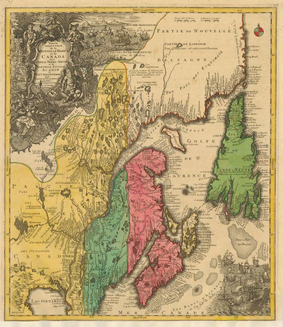
Auction 119, Lot 142
Subject: Colonial United States and Canada
Seutter/Lotter
Partie Orientale de la Nouvelle France ou du Canada avec l'Isle de Terre-Neuve et de Nouvelle Ecosse, Acadie et Nouv. Angleterre…, 1756
Size: 19.3 x 22.3 inches (49 x 56.6 cm)
Estimate: $1,000 - $1,300
Unsold
Closed on 5/9/2007
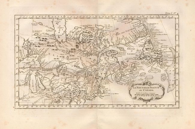
Auction 119, Lot 143
Subject: Colonial United States and Canada
Bellin, Jacques Nicolas
La Nouvelle France ou Canada, 1764
Size: 13.8 x 7.8 inches (35.1 x 19.8 cm)
Estimate: $240 - $300
Sold for: $150
Closed on 5/9/2007
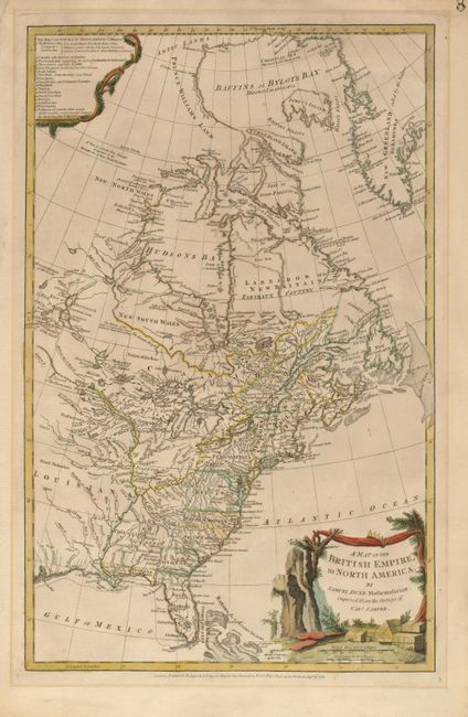
Auction 119, Lot 144
Subject: Colonial United States and Canada
Dunn, Samuel
A Map of the British Empire, in North America, 1776
Size: 11.8 x 18.8 inches (30 x 47.8 cm)
Estimate: $1,400 - $1,700
Sold for: $1,600
Closed on 5/9/2007
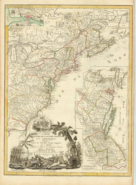
Auction 119, Lot 145
Subject: Colonial United States and Canada
Denis, Louis
Carte du Theatre de la Guerre Presente en Amerique Dressee d'apres les Nouvelles Cartes Anglaises, 1782
Size: 19.5 x 26.3 inches (49.5 x 66.8 cm)
Estimate: $3,000 - $4,000
Sold for: $5,500
Closed on 5/9/2007
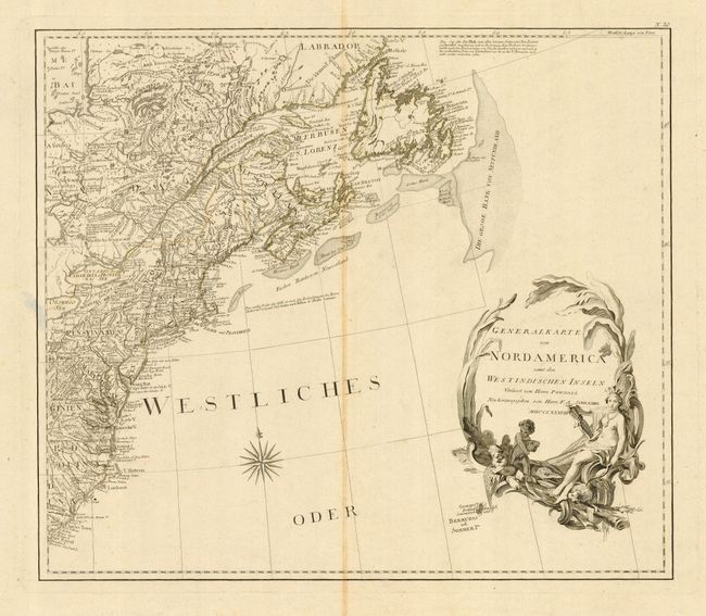
Auction 119, Lot 146
Subject: Canada & United States
Schraembl, Franz Anton
[2 Sheets] General Karte von Nordamerica samt den Westindischen Inseln Verfasst von Herrn Pownall, 1788
Size: 23 x 20 inches (58.4 x 50.8 cm)
Estimate: $800 - $950
Sold for: $600
Closed on 5/9/2007
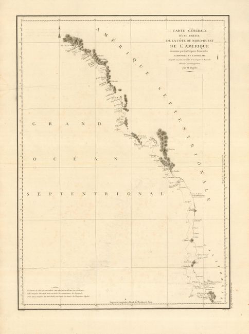
Auction 119, Lot 147
Subject: Western Canada & United States
La Perouse, Comte Jean F. Galoup, de
Carte Generale d'une Partie de la Cote du Nord-Ouest de l'Amerique reconnue par les Fregates Francaises la Boussole et l'Astrolabe, 1797
Size: 19.3 x 27 inches (49 x 68.6 cm)
Estimate: $150 - $250
Sold for: $90
Closed on 5/9/2007
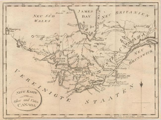
Auction 119, Lot 148
Subject: Canada & United States & Great Lakes
Stockdale, John
Neue Karte von Ober und Unter Canada, 1801
Size: 8.8 x 6.5 inches (22.4 x 16.5 cm)
Estimate: $120 - $160
Sold for: $60
Closed on 5/9/2007
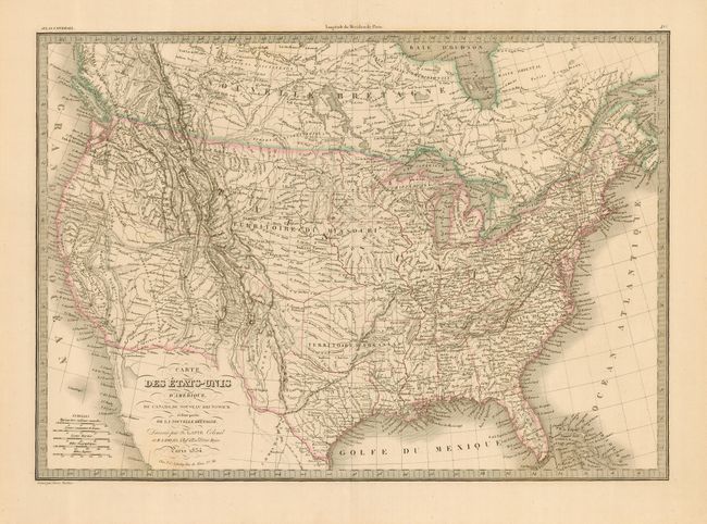
Auction 119, Lot 149
Subject: Canada & United States
Brue, Adrien Hubert
Nouvelle Carte des Etats-Unis, du Haut et Bas-Canada, de la Nouvle. Ecosse, du Nouvau. Brunswick, de Terre-Neuve &c., 1832
Size: 36.8 x 24.8 inches (93.5 x 63 cm)
Estimate: $700 - $800
Unsold
Closed on 5/9/2007
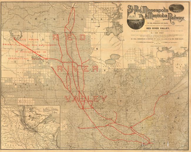
Auction 119, Lot 150
Subject: Central United States - Manitoba
Railroad Companies, (Various)
St. Paul, Minneapolis & Manitoba Railway, 1884
Size: 30.3 x 24 inches (77 x 61 cm)
Estimate: $150 - $200
Sold for: $400
Closed on 5/9/2007
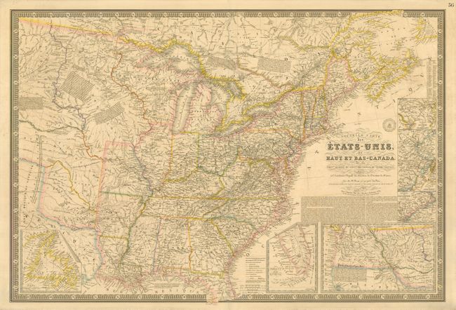
Auction 119, Lot 154
Subject: United States
Lapie, Alexander Emile & Pierre
Carte des Etats-Unis d'Amerique, du Canada, du Nouveau Brunswick et d'une partie de la Nouvelle Bretagne, 1854
Size: 21.5 x 15.3 inches (54.6 x 38.9 cm)
Estimate: $200 - $250
Unsold
Closed on 5/9/2007
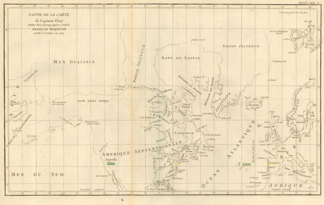
Auction 119, Lot 456
Subject: Canada & Alaska
Robert de Vaugondy, Didier
Partie de la Carte du Capitaine Cluny Auteur d'un ouvrage anglois intitule American Traveller, 1772
Size: 19 x 11.5 inches (48.3 x 29.2 cm)
Estimate: $180 - $230
Unsold
Closed on 5/9/2007
29 lots