Subject: Canada & United States
Period: 1788 (dated)
Publication:
Color: Black & White
Size:
23 x 20 inches
58.4 x 50.8 cm
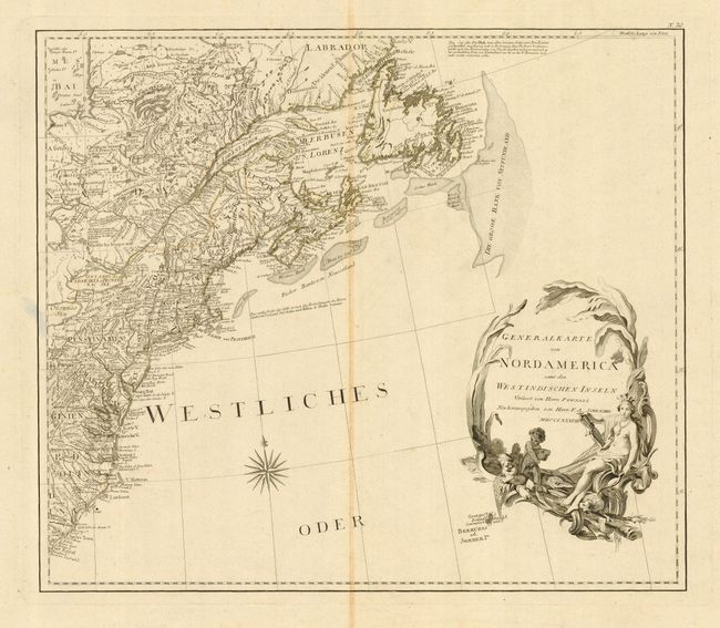
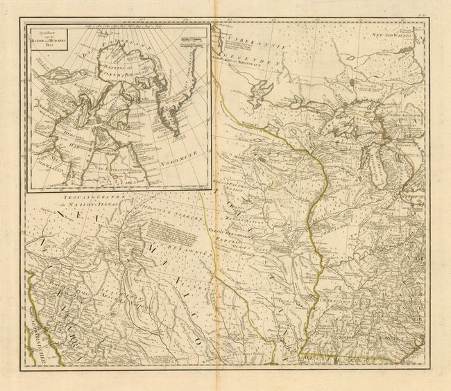
These two sheets (of four) make up the top part of a scarce Austrian map of Colonial North America. They are based on the important Bowen & Gibson map of North America and the West Indies (Sayer & Bennett 1783 edition) updated to include the surveys of Governor Thomas Pownall. The maps are beautifully engraved with excellent detail of roads, trails, settlements, Indian nations and notations of various explorations. Sheet 20 includes the superb title cartouche that features a maiden representing America. Sheet 21 includes a large inset of Baffin & Hudson Bay with a depiction of the Northwest Passage according to Admiral de Font. Engraved on two separate, large folio sheets (each map approximately 23 x 20") with individual borders and very wide margins.
References:
Condition: B
There is a bit of centerfold toning, else very good.