Subject: Canada
Period: 1850 (circa)
Publication:
Color: Hand Color
Size:
13.5 x 10.5 inches
34.3 x 26.7 cm
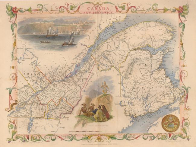
Lovely nineteenth century map of the St. Lawrence River and New Brunswick. Locates Montreal and Quebec. With a great vignette of Quebec as seen from the river. A second vignette shows a group of North American Indians in fancy dress with weapons. The view of Quebec contains numerous sailing ships and boats in the foreground with the cliffs and settlement high above the cliffs. Further embellished with the seal of Great Britain and a decorative border. Lovely color in the border, water and views distinguish this exquisite map. Vignettes drawn by H. Warren and engraved by J.B. Allen. J. Rapkin created and engraved the map.
References: Rumsey #2531.
Condition: A
Very nice color and impression printed on heavy paper with wider than normal margins. Along centerfold is a little mis-folding and a hint of toning.