Subject: Colonial United States and Canada
Period: 1782 (dated)
Publication:
Color: Hand Color
Size:
19.5 x 26.3 inches
49.5 x 66.8 cm
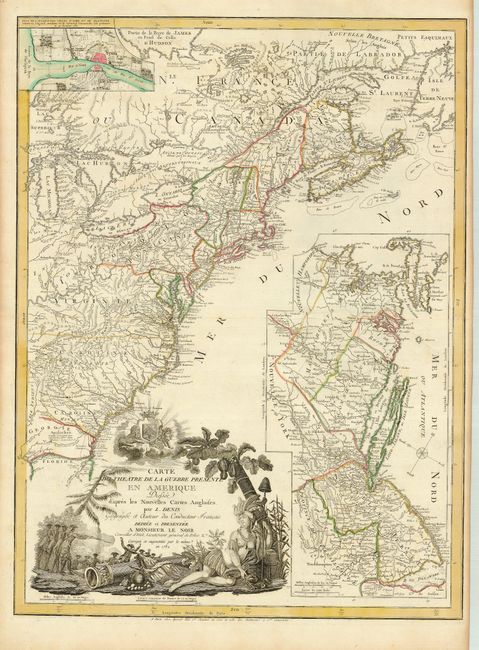
This is a very scarce American Revolutionary War map. It covers the region from Newfoundland to northern Florida, but only as far west as Lake Michigan. There is a large inset of part of New England and New York, eastern Pennsylvania and all of New Jersey that features the region most affected by the Revolution in 1779 (when the map was first published). The map is filled with topographical information, boundaries, cities, towns, forts, Indian territory and villages, battlefields, trails and roads. The large title cartouche includes a battle scene, the personification of America as an Indian queen, and a scene of the British redcoats surrendering to the American militia. This edition has been updated with an inset plan of Yorktown, the site of Gen. Cornwallis's surrender in October 1781. The map was separately published by Basset.
References: cf McCorkle #779.6; Nebenzahl (Biblio) #192; cf Sellers & van Ee #737.
Condition: A
Nice impression and original outline color with toning in blank margins.