Subject: Canada - St. Lawrence River
Period: 1764 (published)
Publication: Le Petit Atlas Maritime
Color: Black & White
Set of four double-page Bellin maps that detail the St. Lawrence River. Each has one or more decorative features including cartouches, rhumb lines, compass roses, and fleur-de-lys. The lot includes:
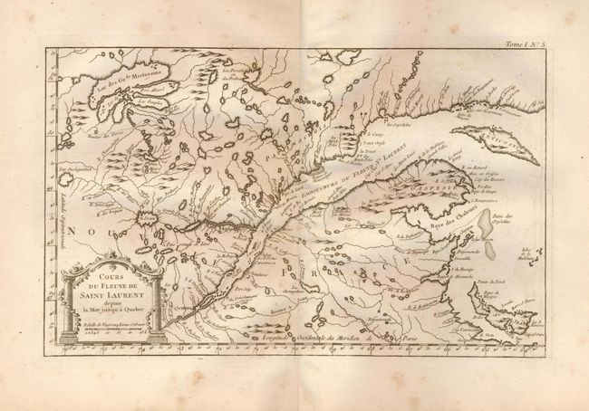
1) Cours du Fleuve de Saint Laurent depuis la Mer jusqu'a Quebec. Extends from Quebec to the mouth of the St. Lawrence and Anticosti Island. (13.8 x 8.5")
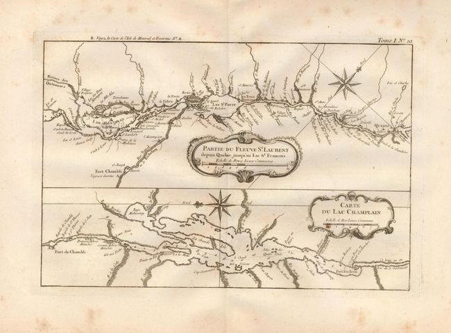
2) Partie du Fleuve St. Laurent depuis Quebec jusqu'au Lac St. Laurent [above] Carte du Lac Champlain. The upper map extends from Quebec west to beyond Montreal. Filled with place names along the river. The lower map details Lake Champlain. Locates Fort de Chambli and more. (12.3 x 8.3")
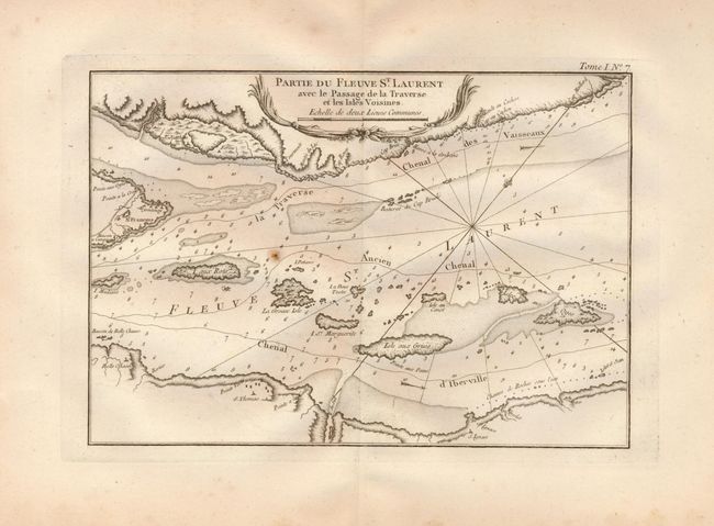
3) Partie du Fleuve St. Laurent avec le Passage de la Traverse et les Isles Voisines. Shows a detailed section of the river just below Quebec. Extends from the eastern tip and St. Francois down river to include the islands of Madame, Rots, Grosse, Marguertie, Grues, and Oyes. This treacherous part of the river features much navigational information including hazards and rocks, soundings, and two suggested tracks. (12 x 8.3")
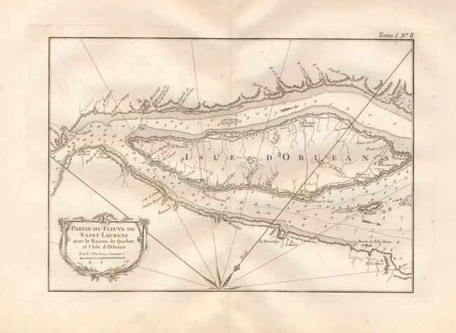
4) Partie du Fleuve de Saint Laurent avec le Bassin de Quebec et l'Isle d'Orleans. A detailed chart of the island. Locates Quebec as a fortified city at the extreme left with several place names along the river and on the island. Shows hazards to navigation and soundings in the river. (11 x 8.3")
References: Kershaw #660, 663, 661, and 662;
Condition: B
All on thick hand-laid paper with fine impression and full, wide margins. The first three have a few light spots, the latter is very good and clean.