Catalog Archive
Auction 119, Lot 141

"North America From the French of Mr. D'Anville Improved with the Back Settlements of Virginia and Course of Ohio Illustrated with Geographical and Historical Remarks", Jefferys, Thomas

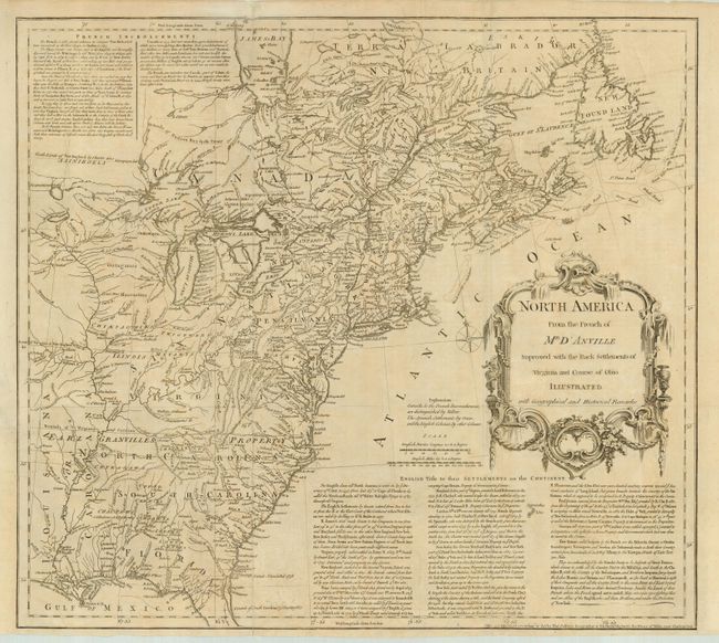
Subject: Colonial United States and Canada

Period: 1755 (dated)

Publication:

Color: Black & White

Size:
20 x 18 inches
50.8 x 45.7 cm
Download High Resolution Image
(or just click on image to launch the Zoom viewer)

First state of this important map details the British colonies on the eve of the French and Indian War. The map is extremely detailed particularly in the Back Settlements with the locations of forts, Indian villages, tribal territory, and mines. Earl Granvilles Property is shown extending to the Mississippi River. Various treaty boundaries and charters are shown. Below the large, decorative title cartouche is a lengthy explanation describing the "English Title to their Settlements on the Continent" and at upper left is a notation concerning the "French Incroachments" [sic]. Jefferys' imprint (near Charing Cross) at bottom.

References: McCorkle #755.2; Stevens & Tree #51; Sellers and Van Ee #29.

Condition: B

Lightly toned with some tissue reinforcement of folds and minor border tears on verso.

Estimate: $1,300 - $1,600

Sold for: $1,200

Closed on 5/9/2007

Archived