Showing Unsold Lots(remove filter)
Filtered by Category:Asia, Middle East, Holy Land(Show All Categories)
Current Auction
36 lots
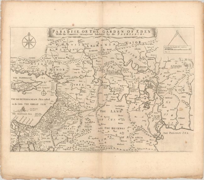
Lot 561
Subject: Middle East & Cyprus
Moxon, Joseph
Paradise or the Garden of Eden with the Countries Circumjacent Inhabited by the Patriarchs, 1691
Size: 18 x 12.2 inches (45.7 x 31 cm)
Estimate: $275 - $350
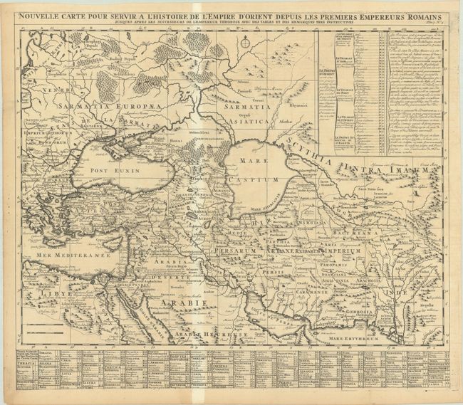
Lot 562
Subject: Middle East
Chatelain, Henry Abraham
Nouvelle Carte pour Servir a l'Histoire de l'Empire d'Orient Depuis les Premiers Empereurs Romains Jusques Apres les Successeurs de l'Empereur Theodose..., 1720
Size: 22.8 x 19.8 inches (57.9 x 50.3 cm)
Estimate: $160 - $190
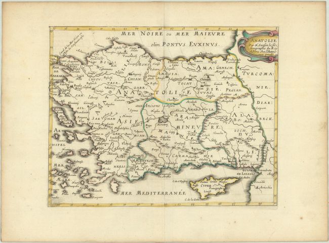
Lot 564
Subject: Turkey & Cyprus
Sanson, Nicolas
Anatolie, 1652
Size: 9.4 x 7.3 inches (23.9 x 18.5 cm)
Estimate: $110 - $140
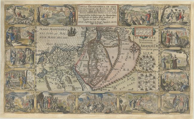
Lot 566
Subject: Holy Land
Plancius/Cloppenburg
Tabula Geographica, in qua Iisraelitarum, ab Aegypto ad Kenahanaeam usque Profectiones Omnes... / Geographische Beschryvinge der Heirtochten ende Rustplaetsen der Kinderen Israels, Treckende uyt Egypten in Land van Belosten, 1625
Size: 19.5 x 11.5 inches (49.5 x 29.2 cm)
Estimate: $700 - $850
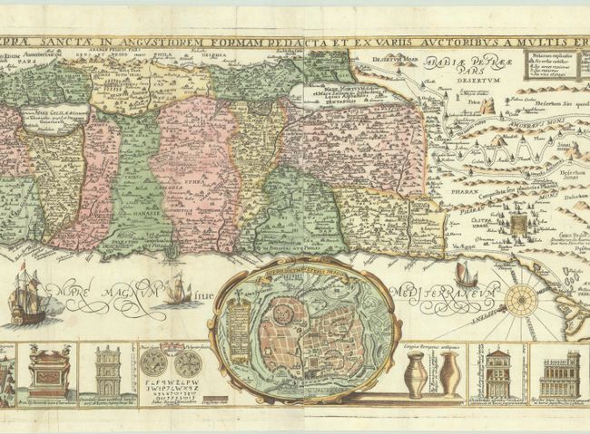
Lot 568
Subject: Holy Land
Tirinus, Jacobus
Chorographia Terrae Sanctae in Angustiorem Formam Redacta et ex Variis Auctoribus a Multis Erroribus Expurgata, 1632
Size: 31.6 x 12.4 inches (80.3 x 31.5 cm)
Estimate: $750 - $900
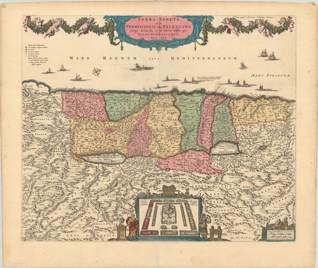
Lot 570
Subject: Holy Land
Visscher/Schenk
Terra Sancta, sive Promissionis, olim Palestina Recens Delineata, et in Lucem Edita, 1659
Size: 22.1 x 18.3 inches (56.1 x 46.5 cm)
Estimate: $400 - $475
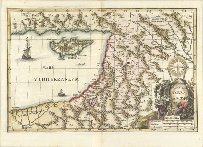
Lot 571
Subject: Holy Land & Cyprus
Scherer, Heinrich
Palaestina Terra Sancta, 1699
Size: 14 x 9.2 inches (35.6 x 23.4 cm)
Estimate: $275 - $350
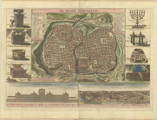
Lot 572
Subject: Jerusalem, Holy Land
Danckerts, Cornelius
De Stadt Ierusalem, 1718
Size: 19.6 x 13.6 inches (49.8 x 34.5 cm)
Estimate: $240 - $300
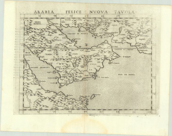
Lot 573
Subject: Arabia
Ptolemy/Ruscelli
Arabia Felice Nuova Tavola, 1564
Size: 9.8 x 7.1 inches (24.9 x 18 cm)
Estimate: $300 - $375
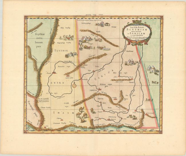
Lot 576
Subject: Central Asia
Ptolemy/Mercator
Tab. VIII. Asiae, Scythiam Extra Imaum, ac Sericam Comprehendens..., 1720
Size: 15.8 x 13.4 inches (40.1 x 34 cm)
Estimate: $140 - $170
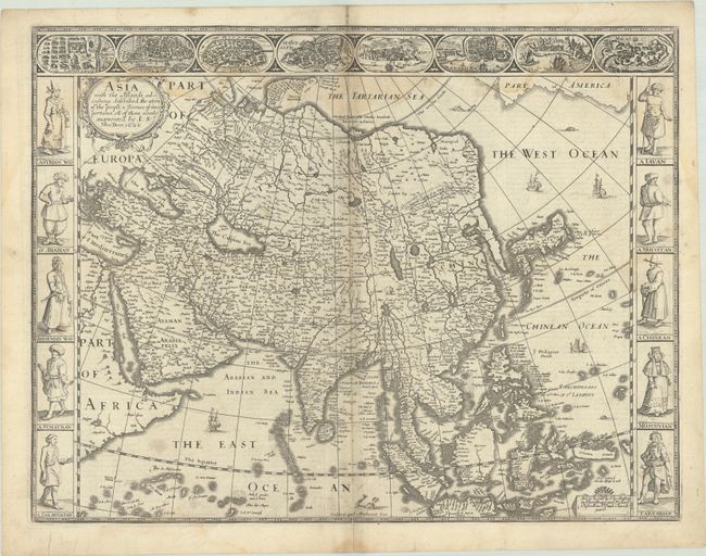
Lot 577
Subject: Asia
Speed, John
Asia with the Islands Adioyning Described, the Atire of the People, & Townes of Importance, All of Them Newly Augmented, 1626
Size: 20.4 x 15.6 inches (51.8 x 39.6 cm)
Estimate: $1,600 - $1,900
The First English Printed Map of Asia
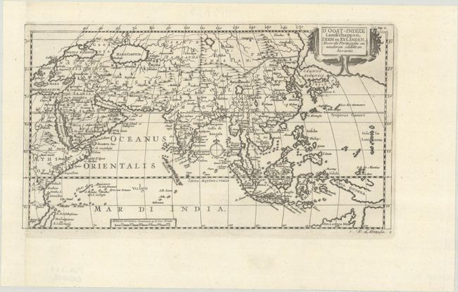
Lot 581
Subject: Asia
Aa, Pieter van der
D'Oost-Indize Landschappen, Zeen en Eylanden, door de Portugysen en Anderen Ondekt en Bevaren, 1707
Size: 10.6 x 5.9 inches (26.9 x 15 cm)
Estimate: $110 - $140
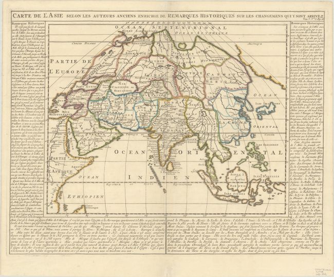
Lot 582
Subject: Asia
Chatelain, Henry Abraham
Carte de l'Asie Selon les Auteurs Anciens Enrichie de Remarques Historiques sur les Changemens qui y sont Arrivez, 1720
Size: 15 x 12 inches (38.1 x 30.5 cm)
Estimate: $140 - $170
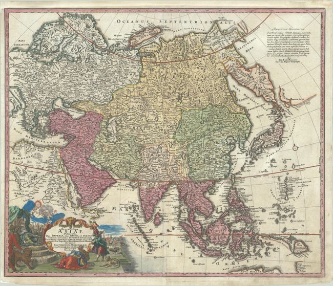
Lot 583
Subject: Asia
Homann, Johann Christoph
Recentissima Asiae Delineatio, qua Imperia ejus, Regna, et Status, Unacum Novissimis Russorum..., 1730
Size: 22.8 x 19.1 inches (57.9 x 48.5 cm)
Estimate: $375 - $450
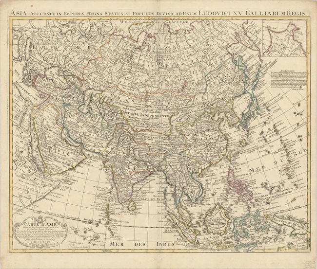
Lot 584
Subject: Asia
Delisle/Covens & Mortier
Carte d'Asie Dressee sur les Memoires Envoyez par le Czar a l'Academie Royale des Science..., 1750
Size: 24.3 x 19.1 inches (61.7 x 48.5 cm)
Estimate: $300 - $375
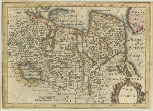
Lot 587
Subject: Northern Asia
Cloppenburg, Johannes
Tartaria, 1676
Size: 10.1 x 7.4 inches (25.7 x 18.8 cm)
Estimate: $150 - $180
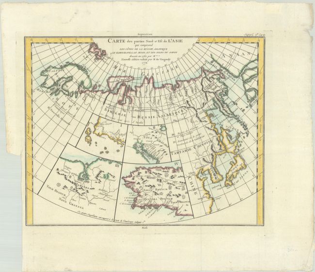
Lot 588
Subject: Northern Asia & Western North America
Robert de Vaugondy/Diderot
Carte des Parties Nord et Est de l'Asie qui Comprend les Cotes de la Russie Asiatique le Kamschatka, le Jesso, et les Isles du Japon, 1772
Size: 14.9 x 11.8 inches (37.8 x 30 cm)
Estimate: $120 - $150
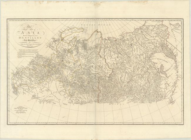
Lot 589
Subject: Northern Asia
Harrison/D' Anville
The Third Part of Asia Drawn & Engraved from D'Anvilles Two Sheet Map, 1791
Size: 27.7 x 16.8 inches (70.4 x 42.7 cm)
Estimate: $240 - $300
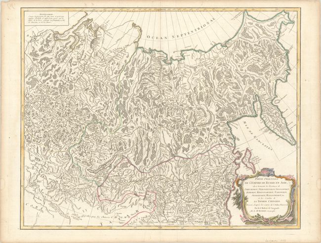
Lot 590
Subject: Russia in Asia
Robert de Vaugondy, Gilles
Partie Orientale de l'Empire de Russie en Asie, ou se Trouvent les Provinces de Jakuckskoy, Nerckzinskoy, Selinginskoy, Ilimskoy, Krasnojarskoy, Narimskoy, Jenisseiskoy, Mangajeiskoy, &c..., 1755
Size: 23.3 x 18.4 inches (59.2 x 46.7 cm)
Estimate: $110 - $140
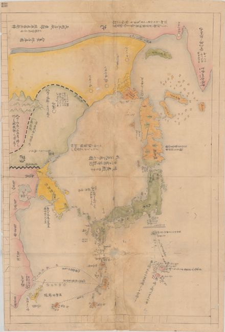
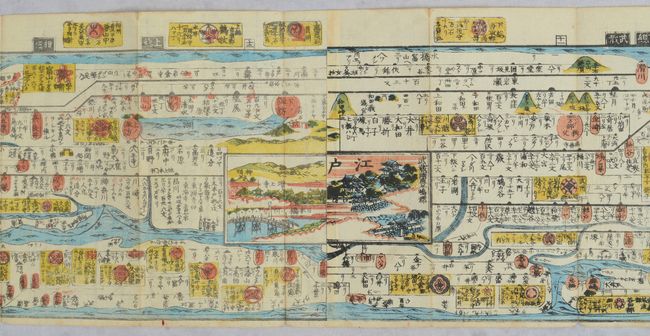
Lot 592
Subject: Eastern Asia, Japan
[Japanese Manuscript Map of the Three Kingdoms] Sangoku Tsuran Yochi Rotei Zenzu, 1792
Size: 19.9 x 28.8 inches (50.5 x 73.2 cm)
Estimate: $2,400 - $3,000
Manuscript Example of Controversial and Banned Map
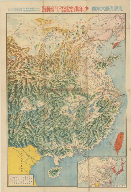
Lot 593
Subject: China
[Japanese Manga Map - Travel Map of China] Shina Kengaku Dai Chizu, 1938
Size: 23.5 x 33.8 inches (59.7 x 85.9 cm)
Estimate: $350 - $425
Published During Second Sino-Japanese War
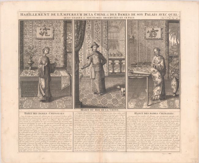
Lot 596
Subject: China, Natives
Chatelain, Henry Abraham
[Lot of 2] Habillement de l'Empereur de la Chine & des Dames de son Palais avec Quelques Usages & Coutumes Observees en ce Pais [and] Description d'un des Plus Fameux Temples des Chinois, 1719
Size: 17.1 x 14.8 inches (43.4 x 37.6 cm)
Estimate: $120 - $150
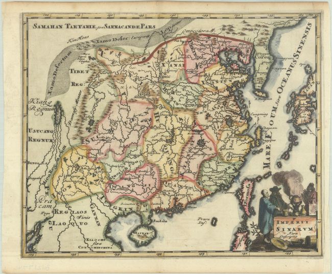
Lot 597
Subject: China, Korea & Japan
Cluver, Philipp
Imperii Sinarum Nova Descriptio, 1729
Size: 10 x 8.1 inches (25.4 x 20.6 cm)
Estimate: $160 - $190
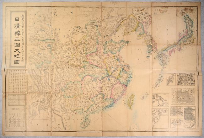
Lot 598
Subject: China, Korea & Japan
[On 8 Sheets - Japanese Map of the Sino-Japanese War] Nisshin Kan Sangoku Dai Chizu, 1894
Size: 56.2 x 36.5 inches (142.7 x 92.7 cm)
Estimate: $1,000 - $1,300
Lot 599
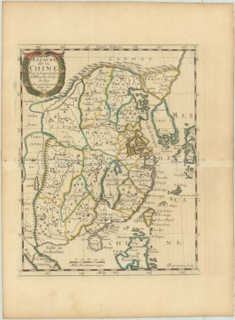
Subject: China & Korea
Sanson, Nicolas
Royaume de la Chine, 1652
Size: 7.6 x 9.7 inches (19.3 x 24.6 cm)
Estimate: $275 - $350
Lot 601
Subject: Japan
[Japanese Strip Map of Japan] Kaisei Zōho Dochu Kotei Meisai, 1850
Size: 252.5 x 6.5 inches (641.4 x 16.5 cm)
Estimate: $750 - $900
Astounding 21-Foot-Long Woodblock Strip Map of Japan
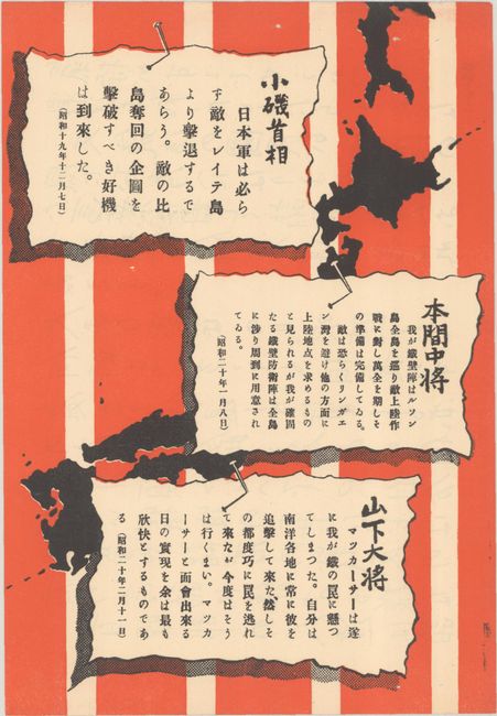
Lot 602
Subject: Japan, World War II
U.S. Army
[U.S. Army Propaganda Leaflet in Japanese - Japanese Statements] , 1945
Size: 5.4 x 7.9 inches (13.7 x 20.1 cm)
Estimate: $140 - $170
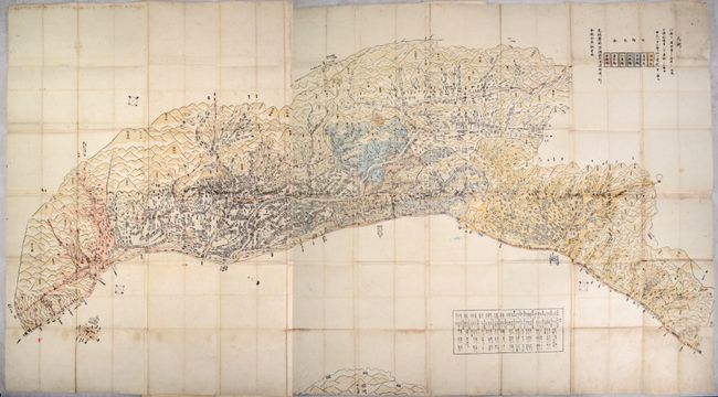
Lot 603
Subject: Echigo Province, Japan
Anon.
[Japanese Woodblock Map of Echigo from Edo Period], 1860
Size: 81.8 x 42.8 inches (207.8 x 108.7 cm)
Estimate: $400 - $475
Lot 604
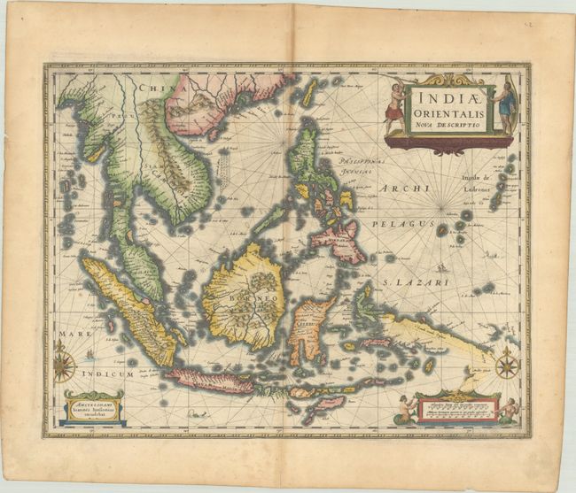
Subject: Southeast Asia
Jansson, Jan
Indiae Orientalis Nova Descriptio, 1638
Size: 19.9 x 15.4 inches (50.5 x 39.1 cm)
Estimate: $1,200 - $1,500
Includes Discoveries Made by the Dutch "Duyfken" Exploration
Lot 605
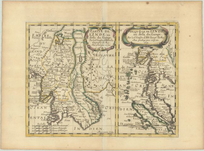
Subject: Southeast Asia
Sanson, Nicolas
Partie de l'Inde au dela du Gange [on sheet with] Presqu-Isle de l'Inde au dela du Gange, 1652
Size: 10 x 7.5 inches (25.4 x 19.1 cm)
Estimate: $140 - $170
Lot 606
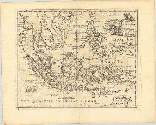
Subject: Southeast Asia
Bowen, Emanuel
A New and Accurate Map of the East India Islands. Laid Down According to the Latest Discoveries, and Agreeable to the Most Approved Maps & Charts..., 1747
Size: 16.7 x 13.6 inches (42.4 x 34.5 cm)
Estimate: $350 - $425
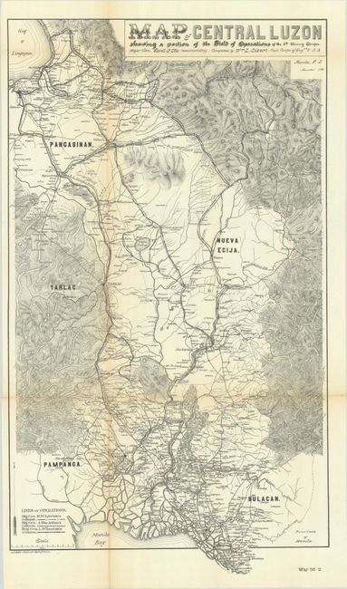
Lot 610
Subject: Luzon, Philippines
U.S. Corps of Engineers
[Lot of 2] Map of Central Luzon Showing a Portion of the Field of Operations of the 8th Army Corps... [and] Southern Luzon Showing Portion of the Theatre of Operations..., 1899
Size: See Description
Estimate: $180 - $220
Scarce Maps Documenting Operations in the Philippine-American War
Lot 616
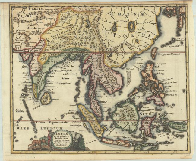
Subject: Southern & Southeast Asia
Cluver, Philipp
Indiae Orientalis et Insularum Adiacentium Antiqua et Nova Descriptio, 1697
Size: 10.3 x 8.6 inches (26.2 x 21.8 cm)
Estimate: $240 - $300
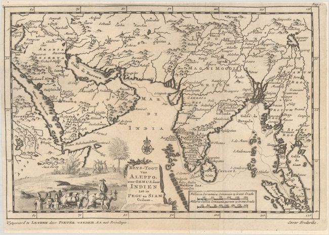
Lot 617
Subject: Southern & Southeast Asia
Aa, Pieter van der
Reys-Togt van Aleppo, over Ormus, door Indien tot in Pegu en Siam Gedaan, 1707
Size: 8.8 x 6 inches (22.4 x 15.2 cm)
Estimate: $200 - $230
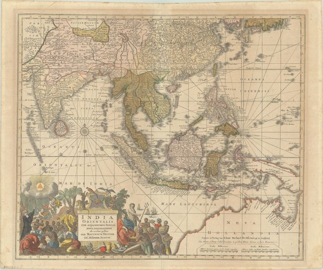
Lot 618
Subject: Southern & Southeast Asia
Seutter, Matthias
India Orientalis, cum Adjacentibus Insulis Nova Delineatione ob Oculos Posita, 1770
Size: 22.4 x 19.1 inches (56.9 x 48.5 cm)
Estimate: $750 - $900
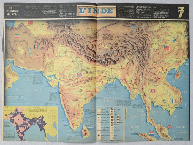
Lot 619
Subject: Southern & Southeast Asia, World War II
[Map in Magazine] L'Inde [in] 7 Jours - 8 Mars 1942, 1942
Size: 22.1 x 16.4 inches (56.1 x 41.7 cm)
Estimate: $160 - $190
36 lots