Current Auction
Lot 591
Current Auction

"Palaestina Terra Sancta", Scherer, Heinrich

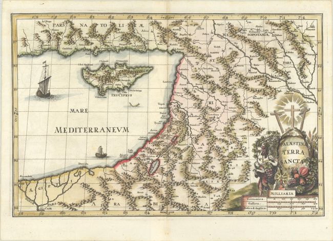
Subject: Holy Land & Cyprus

Period: 1699 (dated)

Publication: Atlas Novus

Color: Hand Color

Size:
14 x 9.2 inches
35.6 x 23.4 cm
Download High Resolution Image
(or just click on image to launch the Zoom viewer)

This boldly engraved map of the Holy Land extends to include Cyprus. The map is filled with rivers, forests, and mountainous topography, with relatively few place names. The decorative cartouche is in the form of a rock with three crosses atop, and also features two men carrying a giant bunch of grapes. Dated 1699 but published in 1703.

References: Laor #706; Shirley (BL Atlases) T.SHER-1a #102.

Condition: A

A sharp impression on a bright sheet with a hint of offsetting.

Estimate: $275 - $350

Current High Bid:
$0

Reserve: Reserve Not Met
Next Bid: $140

Bid Increments
$100 - $249$10
$250 - $499$25
$500 - $999$50
$1,000 - $2,499$100
Terms & Conditions