Subject: Istanbul, Turkey
Period: 1720 (circa)
Publication:
Color: Hand Color
Size:
22.7 x 19.2 inches
57.7 x 48.8 cm
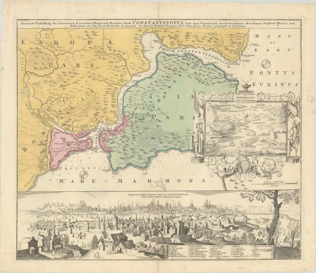
This is one of the most decorative maps of the strategic region between the Mediterranean and Black seas. A large inset features a bird's-eye view of the Dardanelles with several ships engaged in battle in the Sea of Marmara with Constantinople in the background. This decorative inset is framed with coats-of-arms, flags, shields, and figures representing "civilized" Europe on the left and "barbaric" Asia on the right. The lower third of the sheet is a finely rendered bird's-eye panorama of Constantinople viewed from the north, probably from the heights of Pera. A legend names and locates 30 important buildings, such as the Seraglio, Hagia Sophia, several mosques, etc. The Galata Tower is shown, as is the entrance to the Golden Horn before any bridges were built.
References: Manasek #70.
Condition: A
A nice impression with full contemporary color on a bright, watermarked sheet. There are a couple of minor spots in the image and some soiling and creasing along the edges of the sheet.