Subject: Southern & Southeast Asia
Period: 1770 (circa)
Publication:
Color: Hand Color
Size:
22.4 x 19.1 inches
56.9 x 48.5 cm
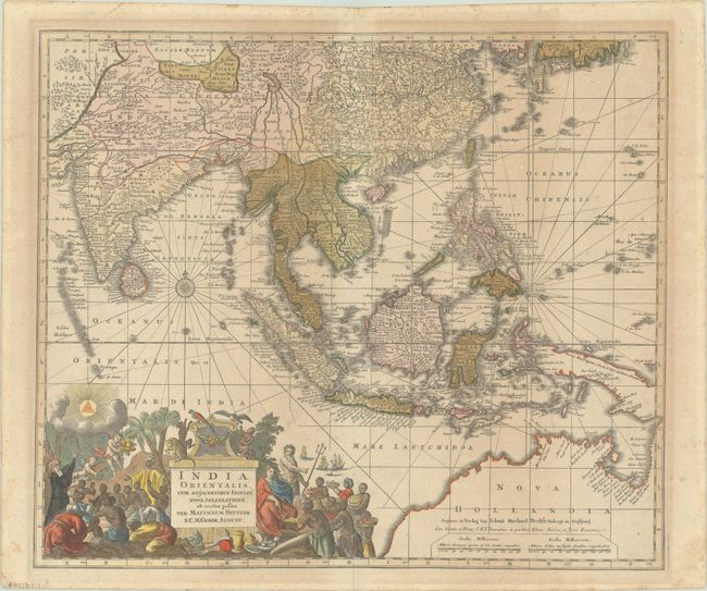
This superb map of Southern and Southeast Asia presents a detailed image of the sphere of operations and Asian trading empire of the Dutch East India Company. The map extends from India to the Philippines and the Ladrone Islands, and from southern Japan to the recent Dutch discoveries in Northern Australia. There is a partial outline of Papua New Guinea, which is shown connected to Nova Hollandia within the border of the map. There is considerable cartographic data in the East Indies, although the islands are still taking shape. The mythical Chiamay Lacus is still shown in western China with fiver rivers flowing south. The fabulous title cartouche is surrounded by various people and animals of the region and a bounty of trade goods.
After Seutter's death in 1762, the Probst family purchased two-thirds of his stock. This example was re-issued by Probst, with his imprint above the distance scales.
References:
Condition: B+
Contemporary color in the map with later color in the cartouche on a lightly toned sheet with a short centerfold separation at top and light foxing along the edges of the sheet.