Subject: Northern Asia
Period: 1676 (published)
Publication: Introductionis in Universam Geographiam
Color: Hand Color
Size:
10.1 x 7.4 inches
25.7 x 18.8 cm
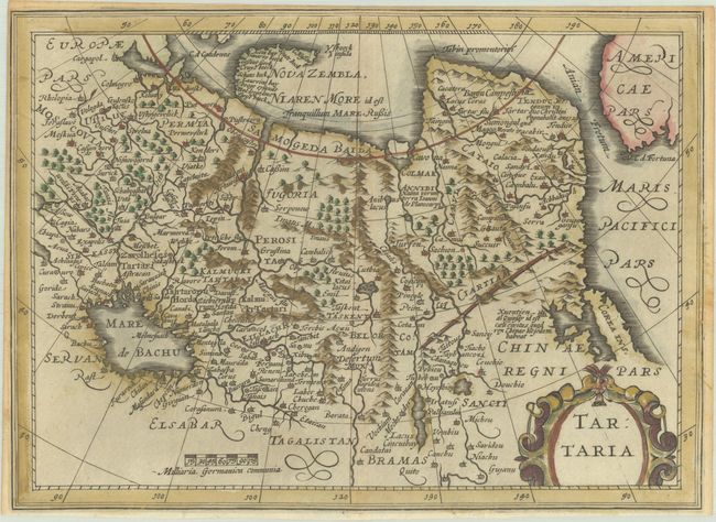
This is a reduced version of Hondius' folio map of northern Asia, first published in the slightly larger pocket atlas published by Cloppenburg. This map covers all of northern Asia from Moscow to the Anian Fretum and a bit of what is today Alaska (labeled Americae Pars). Korea is shown as an island and the Great Wall separates Tartary from China. Novaya Zemlya is only partially delineated and does not connect to the mainland. This map was originally engraved for for Cloppenburgh's small Atlas, first published in 1630, and later used by Jansson's heirs for an edition of Philipp Cluver's popular series of geographical textbooks.
Cluver's Introductio in Universam Geographicam was a popular atlas, appearing in over 45 editions during a 100-year period. The first edition was published without maps in the 1620s, and the first edition to include maps was published circa 1641. The various editions were published in different cities throughout Europe, including Amsterdam, Nuremberg, and London, often with new sets of maps engraved. This map is from an Amsterdam edition published by Jansson's heirs, which included some maps from Jansson's Atlas Minor.
References: Shirley (BL Atlases) T.CLUV-6a #33; Van der Krogt (Vol. III) #8050:353.1.
Condition: B+
A crisp impression on a lightly toned sheet with narrow margins, as issued.