Subject: China
Period: 1835 (circa)
Publication: Tōdo rekidai shūgun enkaku chizu
Color: Hand Color
Size:
14.8 x 13 inches
37.6 x 33 cm
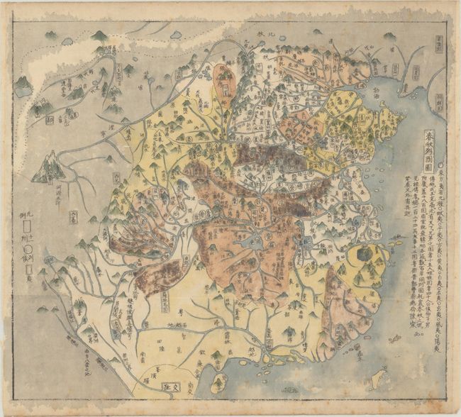
This manuscript map was copied from Sekisui Nagakubo's historical atlas of China (Tōdo rekidai shūgun enkaku chizu), which was first published in 1789, with later editions in 1830, 1835 and 1857, with new woodblocks cut for the last edition. Sekisui Nagakubo (1717-1801) is considered the father of modern Japanese geography. His atlas of China included 13 maps of China from various time periods.
This map depicts the political divisions of ancient China during the Spring and Autumn Period (c. 770–476 BC), during the first half of the Eastern Zhou. The text at right gives historical context of the various ruling states during the era.
References: cf. Rumsey #15632.007.
Condition: B+
Contemporary color with light, scattered foxing and several small worm tracks that have been archivally repaired on verso, with minute loss of image.