Showing Featured Lots(remove filter)
Showing results for:Auction 137
Catalog Archive
94 lots
Page 1 of 2
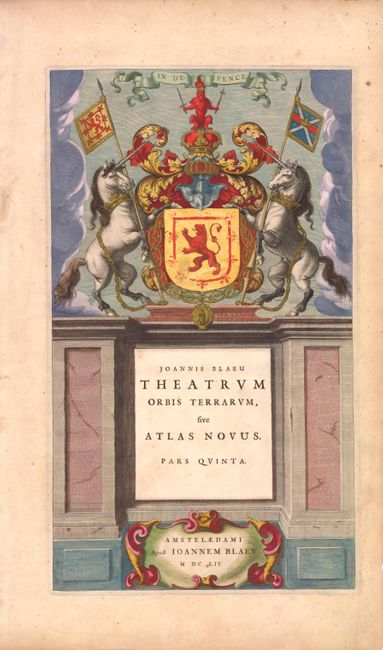
Auction 137, Lot 7
Subject: Title Pages
Blaeu, Johannes
Theatrum Orbis Terrarum, sive Atlas Novus. Pars Quinta, 1654
Size: 9.5 x 16.3 inches (24.1 x 41.4 cm)
Estimate: $350 - $425
Presentation Piece with Original Color and Gold Leaf
Sold for: $250
Closed on 9/14/2011
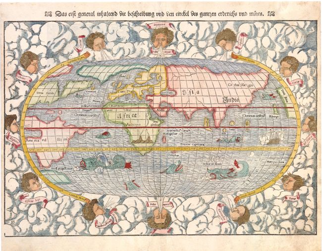
Auction 137, Lot 24
Subject: World
Munster, Sebastian
Das Erst General Inhaltend die Beschreibung und den Circkel des Gantzen Erdtrichs und More, 1550-78
Size: 15 x 10.8 inches (38.1 x 27.4 cm)
Estimate: $2,000 - $3,000
Sold for: $1,500
Closed on 9/14/2011
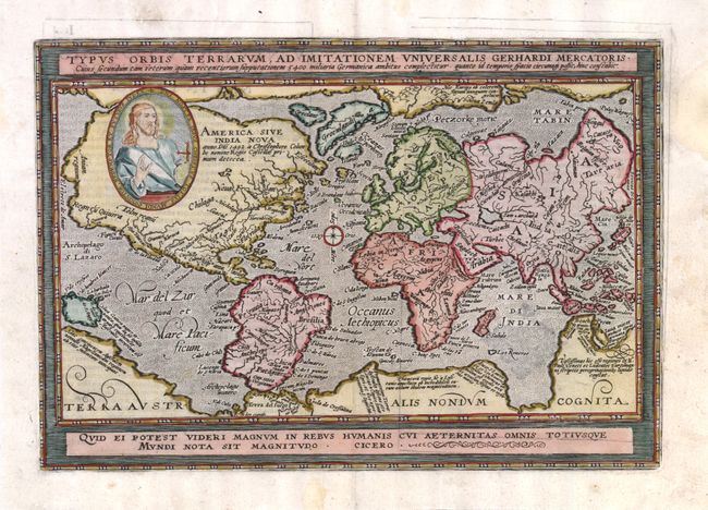
Auction 137, Lot 27
Subject: World
Quad, Matthias von Kinckelbach
Typus Orbis Terrarum, ad Imitationem Universalis Gerhardi Mercatoris…, 1597
Size: 12.3 x 8.5 inches (31.2 x 21.6 cm)
Estimate: $1,900 - $2,300
Unsold
Closed on 9/14/2011
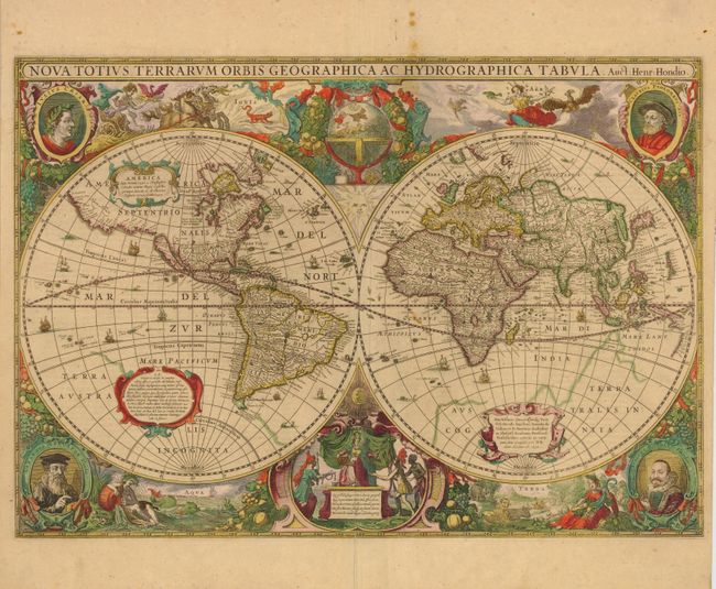
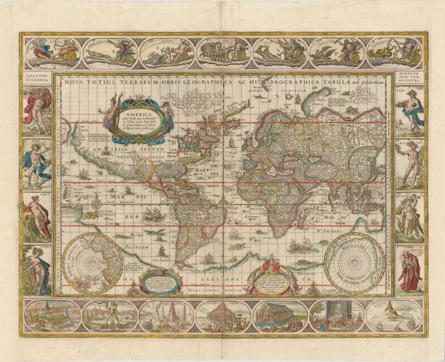
Auction 137, Lot 29
Subject: World
Hondius, Henricus
Nova Totius Terrarum Orbis Geographica ac Hydrographica Tabula, 1630
Size: 21 x 15 inches (53.3 x 38.1 cm)
Estimate: $12,000 - $15,000
Henricus Hondius' Baroque-Style World Map
Unsold
Closed on 9/14/2011
Auction 137, Lot 30
Subject: World
Blaeu, Willem
Nova Totius Terrarum Orbis Geographica ac Hydrographica Tabula, 1635
Size: 21.4 x 16 inches (54.4 x 40.6 cm)
Estimate: $20,000 - $24,000
Blaeu's Magnificent World Map
Unsold
Closed on 9/14/2011
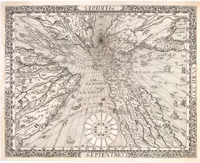
Auction 137, Lot 31
Subject: World
Ritter, Franz
[Untitled - World], 1640
Size: 14.5 x 11.3 inches (36.8 x 28.7 cm)
Estimate: $14,000 - $17,000
Ritter's Fascinating Sundial World Map
Sold for: $8,500
Closed on 9/14/2011
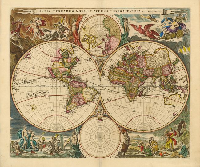
Auction 137, Lot 32
Subject: World
Visscher, Nicolas
Orbis Terrarum Nova et Accuratissima Tabula…, 1658
Size: 22 x 18.5 inches (55.9 x 47 cm)
Estimate: $6,000 - $8,000
Visscher's Superb Double-Hemisphere World Map
Sold for: $4,500
Closed on 9/14/2011
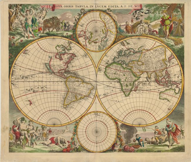
Auction 137, Lot 33
Subject: World
Wit, Frederick de
Nova Orbis Tabula, in Lucem Edita, 1670
Size: 21.8 x 18.5 inches (55.4 x 47 cm)
Estimate: $5,000 - $7,000
Sold for: $2,750
Closed on 9/14/2011
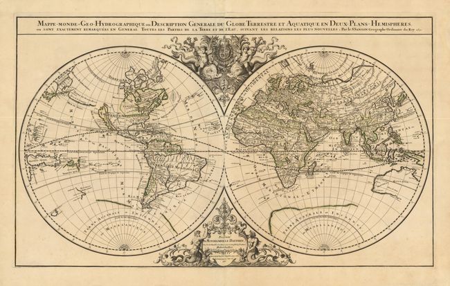
Auction 137, Lot 34
Subject: World
Jaillot, Alexis-Hubert
Mappe-Monde Geo-Hydrographique, ou Description Generale du Globe Terrestre et Aquatique en Deux Plans-Hemispheres…, 1691
Size: 35.3 x 21 inches (89.7 x 53.3 cm)
Estimate: $3,500 - $4,250
Unsold
Closed on 9/14/2011
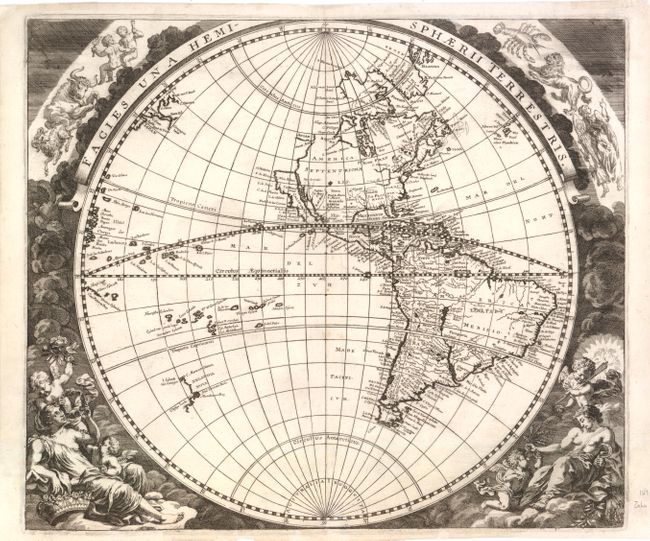
Auction 137, Lot 35
Subject: World
Zahn, Johannes
[Lot of 2] Facies Una Hemisphaerii Terrestris [and] Facies Altera Hemisphaerii Terrestris, 1696
Size: 16.5 x 14 inches (41.9 x 35.6 cm)
Estimate: $3,750 - $4,500
Unsold
Closed on 9/14/2011
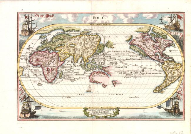
Auction 137, Lot 37
Subject: World
Scherer, Heinrich
Navigationes Praecipuae Europaeorum ad Exteras Nationes, 1700
Size: 13.5 x 8.8 inches (34.3 x 22.4 cm)
Estimate: $1,500 - $1,800
Sold for: $1,100
Closed on 9/14/2011
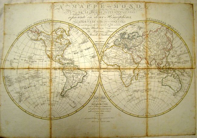
Auction 137, Lot 49
Subject: World & Continents
Herisson, Eustache
La Mappe-Monde [and] Carte Generale de L'Europe [and] Carte Generale de L'Asie [and] Carte Generale de L'Afrique [and] Carte Generale de L'Amerique, 1809-17
Size: 12 x 16 inches (30.5 x 40.6 cm)
Estimate: $1,400 - $1,800
Book of Maps of Captain Cook's Voyages
Unsold
Closed on 9/14/2011
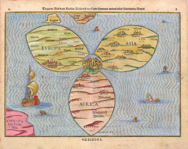
Auction 137, Lot 58
Subject: Ancient World
Bunting, Heinrich
Die Ganze Welt in ein Kleeblat / Welches ist der Stadt Hannover Meines Lieben Vaterlandes Wapen, 1581
Size: 14.3 x 10.5 inches (36.3 x 26.7 cm)
Estimate: $7,000 - $8,000
Bunting's Clover Leaf Map of the Old World
Unsold
Closed on 9/14/2011
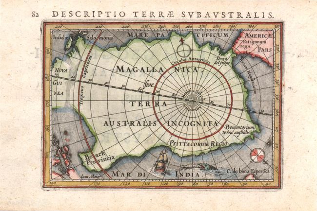
Auction 137, Lot 67
Subject: South Pole
Hondius/Bertius
Descriptio Terrae Subaustralis, 1616
Size: 5.3 x 4 inches (13.5 x 10.2 cm)
Estimate: $500 - $600
The first map to focus solely on the South Pole
Sold for: $375
Closed on 9/14/2011
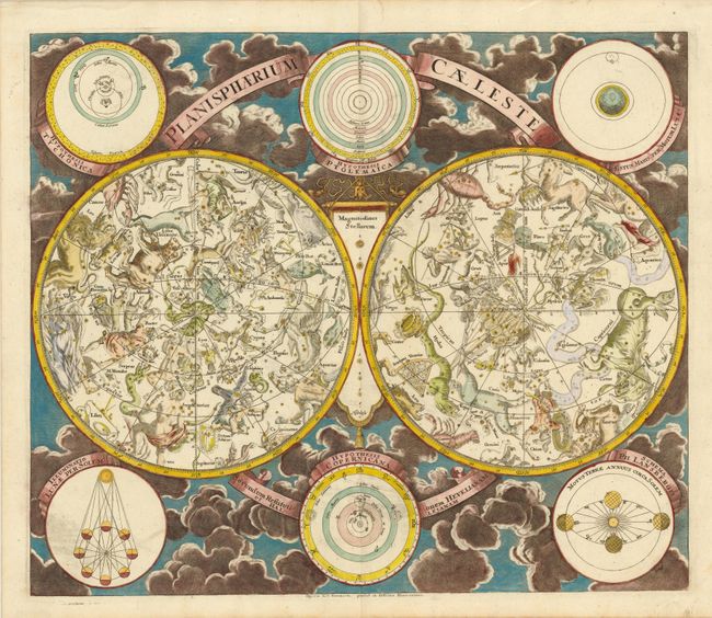
Auction 137, Lot 68
Subject: Celestial
Eimmart/Homann
Planisphaerium Caeleste Secundum Restitutionem Hevelianam et Hallejanam, 1720
Size: 22.5 x 19.3 inches (57.2 x 49 cm)
Estimate: $1,500 - $1,800
Twin Hemisphere Celestial Map
Sold for: $1,100
Closed on 9/14/2011
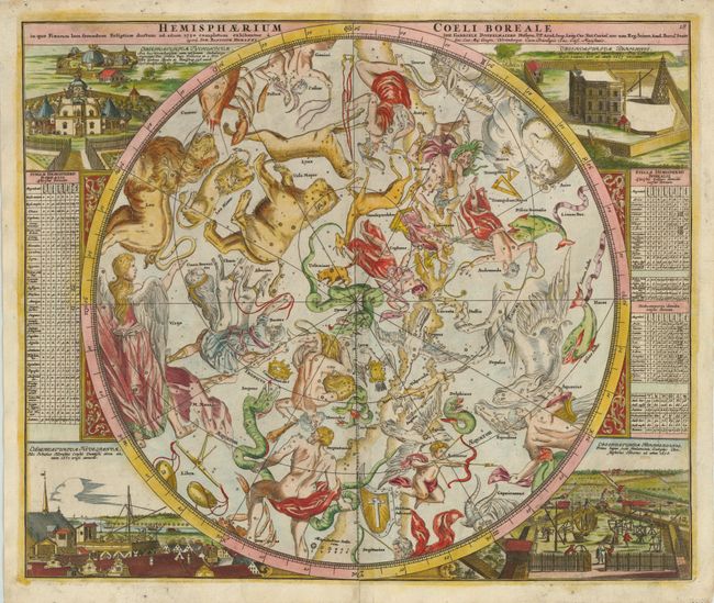
Auction 137, Lot 69
Subject: Celestial
Doppelmayr/Homann
Hemisphaerium Coeli Boreale in quo Fixarum Loca Secundum Eclipticae Ductum ad Anum 1730…, 1742
Size: 23 x 19.3 inches (58.4 x 49 cm)
Estimate: $1,500 - $1,800
Superb Celestial Chart
Unsold
Closed on 9/14/2011
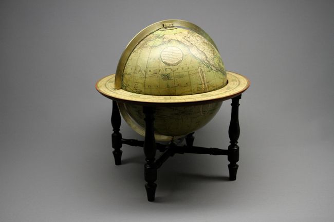
Auction 137, Lot 75
Subject: Globes
Cary, John
Cary’s New Terrestrial Globe Delineated from the Best Authorities…, 1800
Size: 17 x 18 inches (43.2 x 45.7 cm)
Estimate: $10,000 - $12,000
Magnificent 19th Century Cary Brothers Globe
Sold for: $7,500
Closed on 9/14/2011
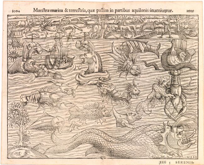
Auction 137, Lot 77
Subject: Cartographic Miscellany
Munster, Sebastian
[Monsters] Monstra marina & terrestria, quae passim in partibus aqualonis inueniuntur, 1550
Size: 13.5 x 10 inches (34.3 x 25.4 cm)
Estimate: $1,200 - $1,500
Sold for: $900
Closed on 9/14/2011
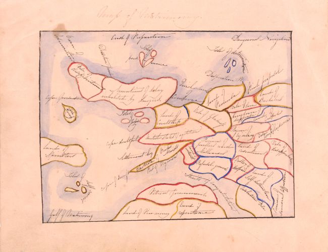
Auction 137, Lot 84
Subject: Cartographic Curiosity
Anon.
Map of Matrimony, 1880
Size: 7 x 5 inches (17.8 x 12.7 cm)
Estimate: $200 - $250
Unique Manuscript Map
Sold for: $150
Closed on 9/14/2011
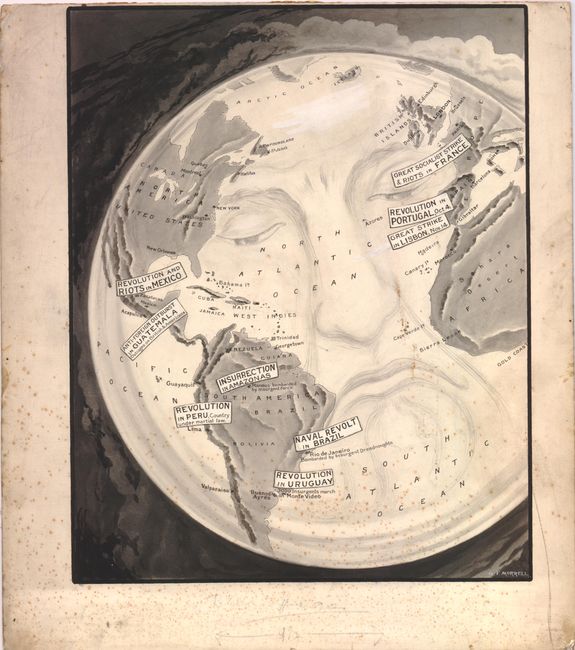
Auction 137, Lot 85
Subject: Cartographic Miscellany
Morrell, George
[World], 1910
Size: 12 x 15.3 inches (30.5 x 38.9 cm)
Estimate: $300 - $400
Unsold
Closed on 9/14/2011
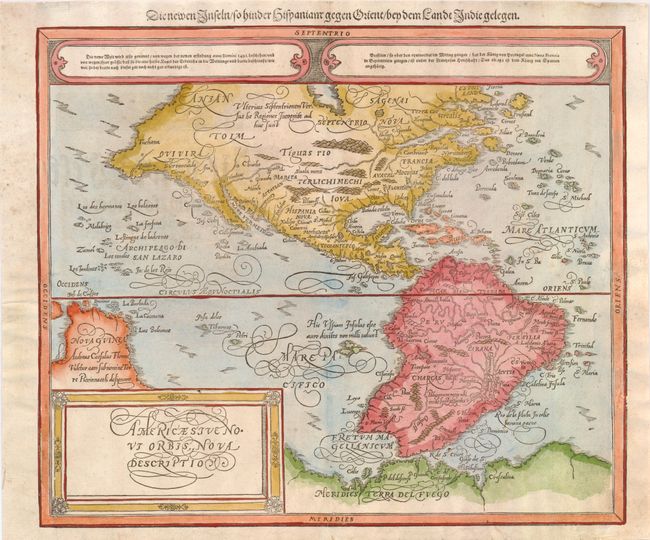
Auction 137, Lot 87
Subject: Western Hemisphere
Munster/Petri
Americae sive Novi Orbis, Nova Descriptio, 1588
Size: 14.3 x 12.3 inches (36.3 x 31.2 cm)
Estimate: $1,300 - $1,600
Sold for: $1,000
Closed on 9/14/2011
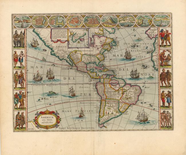
Auction 137, Lot 88
Subject: Western Hemisphere
Hondius, Henricus
America Noviter Delineata, 1631
Size: 19.5 x 15 inches (49.5 x 38.1 cm)
Estimate: $2,400 - $3,000
Sold for: $2,750
Closed on 9/14/2011
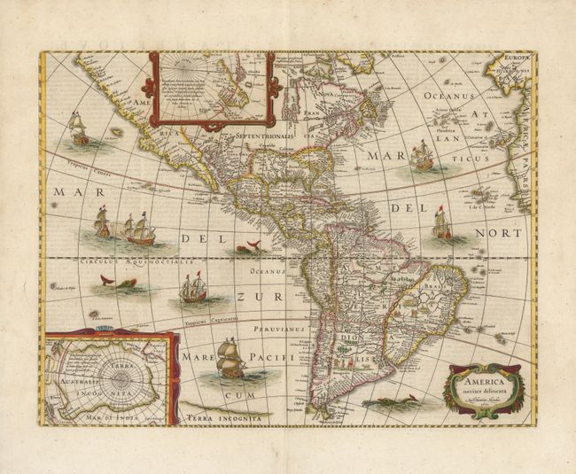
Auction 137, Lot 89
Subject: Western Hemisphere
Blaeu, Willem
Americae Nova Tabula, 1635
Size: 22 x 16 inches (55.9 x 40.6 cm)
Estimate: $6,000 - $7,500
Blaeu's Stunning Carte-a-Figures Map of the Americas
Sold for: $5,500
Closed on 9/14/2011
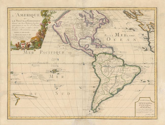
Auction 137, Lot 96
Subject: Western Hemisphere
Nolin, Jean Batiste
L'Amerique ou le Nouveau Continent Dressee sur les Memoires les Plus Nouveaux ... Dediee et Presentee a Monsiegneur Law …, 1720
Size: 23.5 x 17.5 inches (59.7 x 44.5 cm)
Estimate: $1,600 - $2,000
Scarce edition of Nolin's Map of the Americas
Sold for: $1,200
Closed on 9/14/2011
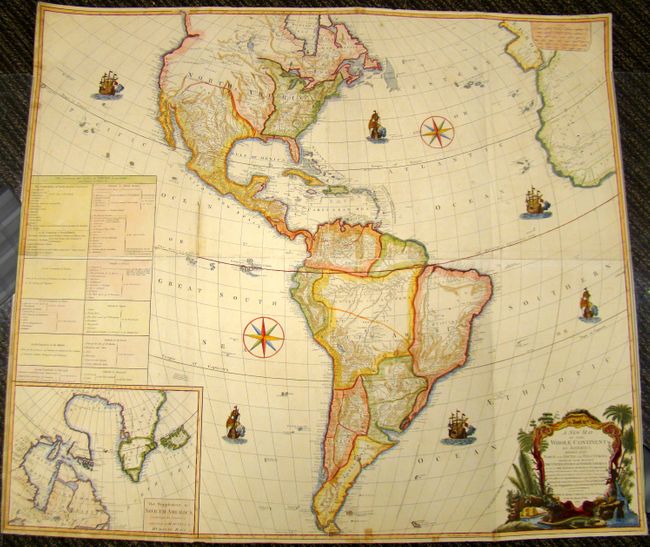
Auction 137, Lot 101
Subject: Western Hemisphere
Laurie & Whittle
A New Map of the Whole Continent of America. Divided into North and South and West Indies…, 1794
Size: 47 x 41 inches (119.4 x 104.1 cm)
Estimate: $1,500 - $2,000
Unsold
Closed on 9/14/2011
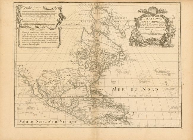
Auction 137, Lot 107
Subject: North America
Delisle, Guillaume
L'Amerique Septentrionale Dressee sur les Observations de Mrs. de l'Academie Royale des Sciences…, 1700
Size: 23.8 x 18 inches (60.5 x 45.7 cm)
Estimate: $2,000 - $2,500
Delisle's foundation map of North America
Unsold
Closed on 9/14/2011
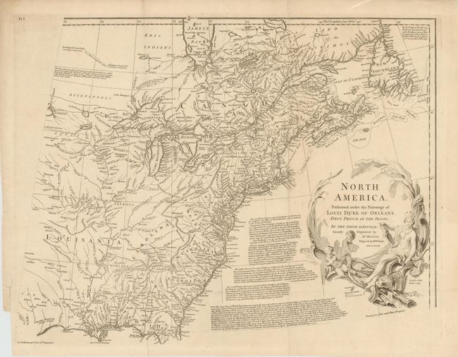
Auction 137, Lot 111
Subject: North America
Bolton, Solomon
[4 Sheets] North America. Performed Under the Patronage of Louis Duke of Orleans, First Prince of the Blood; by the Sieur d'Anville. Greatly Improved by Mr. Bolton., 1752
Size: 34 x 32.5 inches (86.4 x 82.6 cm)
Estimate: $1,200 - $1,500
Sold for: $800
Closed on 9/14/2011
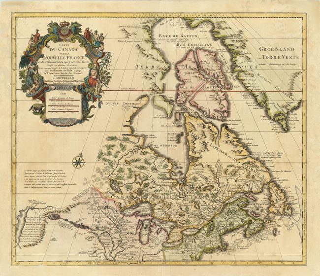
Auction 137, Lot 140
Subject: Colonial United States & Canada
Delisle/Covens & Mortier
Carte du Canada ou de la Nouvelle France et des Decouvertes qui y ont ete faites…, 1730
Size: 22.5 x 19.5 inches (57.2 x 49.5 cm)
Estimate: $1,300 - $1,600
One of the most influential maps of Canada, the Great Lakes and Upper Midwest
Unsold
Closed on 9/14/2011
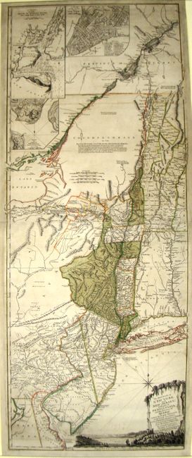
Auction 137, Lot 144
Subject: Colonial Northeast and Quebec
Holland/Pownal
The Provinces of New York, and New Jersey; with Part of Pensilvania, and the Province of Quebec. Drawn by Major Holland…, 1777
Size: 20 x 52.3 inches (50.8 x 132.8 cm)
Estimate: $4,000 - $5,000
Rare German Edition of an Important Revolutionary War Period Map
Sold for: $2,600
Closed on 9/14/2011
Auction 137, Lot 160
Subject: United States
Mitchell, Samuel Augustus
Map of the United States by J.H. Young, 1833
Size: 35 x 44 inches (88.9 x 111.8 cm)
Estimate: $1,400 - $1,800
Rare, Early Edition Mitchell Wall Map
Unsold
Closed on 9/14/2011
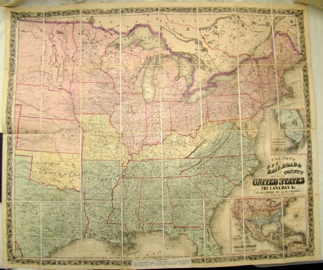
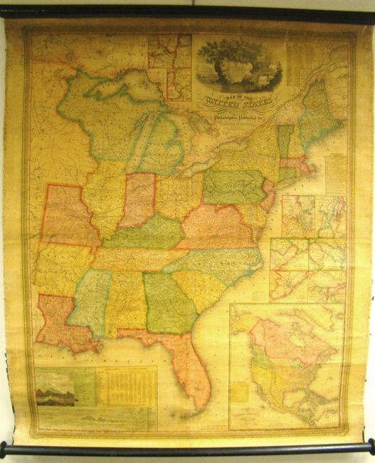
Auction 137, Lot 167
Subject: United States
Colton, Joseph Hutchins
Colton's New Railroad & County Map of the United States, 1862
Size: 39.5 x 33 inches (100.3 x 83.8 cm)
Estimate: $1,000 - $1,200
Rare Colton Civil War Map for a British Audience
Sold for: $1,200
Closed on 9/14/2011
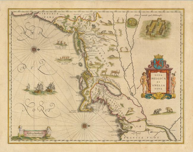
Auction 137, Lot 192
Subject: Colonial New England and Mid-Atlantic
Blaeu, Willem
Nova Belgica et Anglia Nova, 1638
Size: 20 x 15.3 inches (50.8 x 38.9 cm)
Estimate: $3,250 - $4,000
Important Map of Colonial New England and Mid Atlantic
Sold for: $3,250
Closed on 9/14/2011
Auction 137, Lot 193
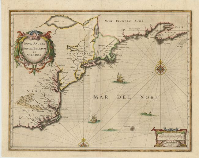
Subject: Colonial New England and Mid-Atlantic
Jansson, Jan
Nova Anglia Novum Belgium et Virginia, 1649
Size: 20 x 15.3 inches (50.8 x 38.9 cm)
Estimate: $1,900 - $2,200
Jansson's influential map of the East Coast
Sold for: $1,300
Closed on 9/14/2011
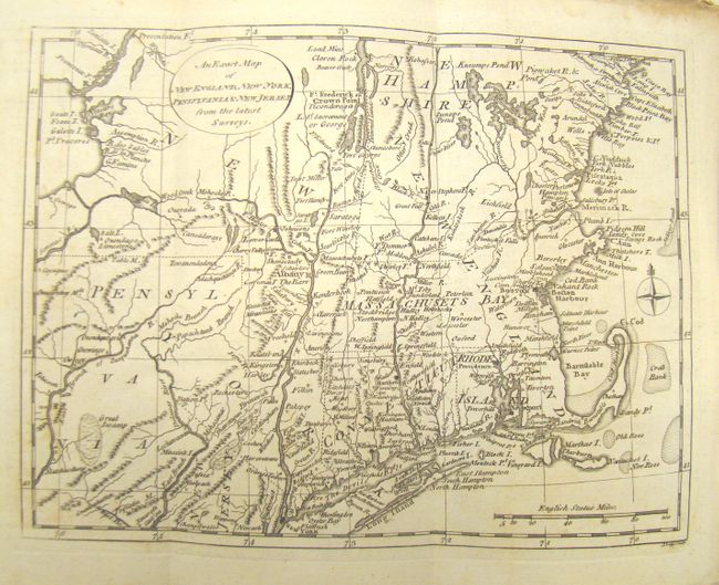
Auction 137, Lot 197
Subject: Colonial New England and Mid-Atlantic
Lodge, John
An Exact Map of New England, New York, Pennsylvania & New Jersey From the Latest Surveys, 1777
Size: 6.5 x 9.5 inches (16.5 x 24.1 cm)
Estimate: $475 - $600
Uncommon Revolutionary War Map
Sold for: $350
Closed on 9/14/2011
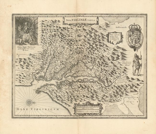
Auction 137, Lot 204
Subject: Colonial Mid-Atlantic
Hondius, Henricus
Nova Virginiae Tabula, 1630
Size: 19.5 x 15 inches (49.5 x 38.1 cm)
Estimate: $2,300 - $3,000
Unsold
Closed on 9/14/2011
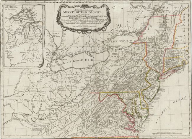
Auction 137, Lot 207
Subject: Colonial Mid-Atlantic
Sayer & Bennett
A General Map of the Middle British Colonies, in America, containing Virginia, Maryland, the Delaware Counties, Pennsylvania and New Jersey. With the Addition of New York, and of the Greatest Part of New England…, 1776
Size: 26 x 19 inches (66 x 48.3 cm)
Estimate: $2,200 - $3,000
Important Map of the Seat of War
Sold for: $2,000
Closed on 9/14/2011
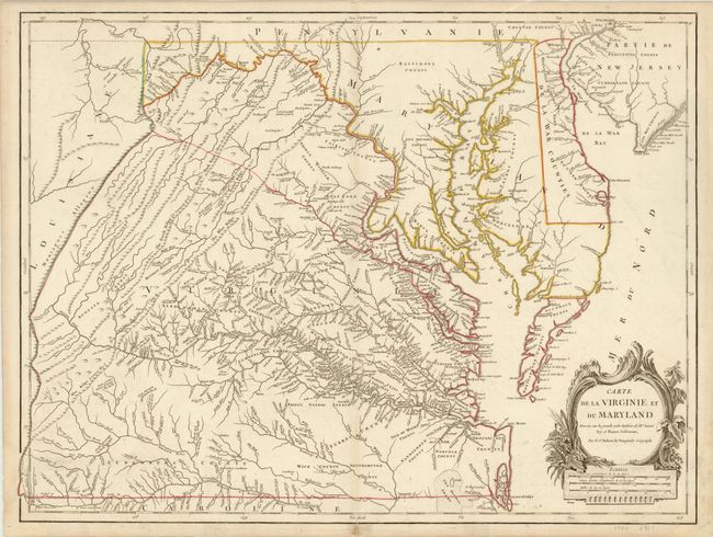
Auction 137, Lot 209
Subject: Colonial Mid-Atlantic
Robert de Vaugondy, Didier
Carte de la Virginie et du Maryland Dressee sur la Grande Carte Angloise de Mrs. Josue Fry et Pierre Jefferson…, 1793
Size: 25.5 x 19.3 inches (64.8 x 49 cm)
Estimate: $3,000 - $3,750
An Essential Map of Virginia and Maryland
Sold for: $2,200
Closed on 9/14/2011
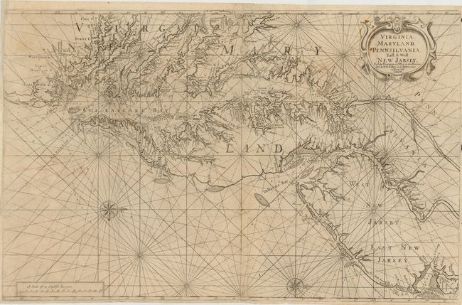
Auction 137, Lot 210
Subject: Mid-Atlantic United States
Thornton, John
Virginia, Maryland, Pennsilvania, East & West New Jarsey, 1698
Size: 31.5 x 20 inches (80 x 50.8 cm)
Estimate: $6,000 - $7,500
Scarce First Edition English Chart of the Chesapeake and Delaware Bays
Sold for: $6,500
Closed on 9/14/2011
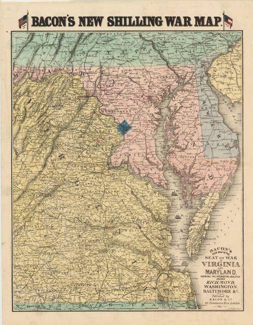
Auction 137, Lot 215
Subject: Mid-Atlantic United States
Bacon, G. W. & Company
Bacon's New Map of the Seat of War in Virginia and Maryland. Showing The Interesting Localities Around Richmond, Washington, Baltimore &c.…, 1862
Size: 18 x 22 inches (45.7 x 55.9 cm)
Estimate: $1,000 - $1,300
Rare British Civil War Map
Sold for: $950
Closed on 9/14/2011
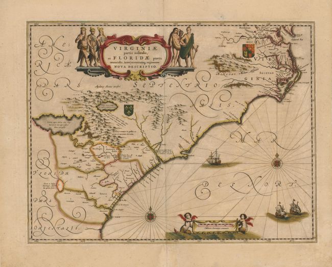
Auction 137, Lot 218
Subject: Colonial Southeast
Jansson, Jan
Virginiae Partis Australis, et Floridae Partis Orientalis, Interjacentiumq Regionum Nova Descriptio, 1645
Size: 19.8 x 15.2 inches (50.3 x 38.6 cm)
Estimate: $1,500 - $1,800
Unsold
Closed on 9/14/2011
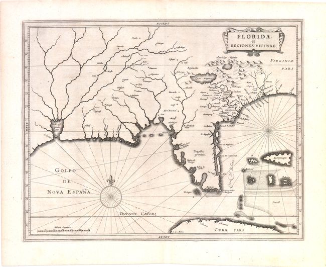
Auction 137, Lot 227
Subject: Colonial South
Gerritsz/De Laet
Florida, et Regiones Vicinae, 1630
Size: 14 x 11.3 inches (35.6 x 28.7 cm)
Estimate: $3,750 - $4,500
Unsold
Closed on 9/14/2011
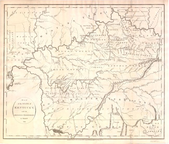
Auction 137, Lot 233
Subject: Kentucky and Tennessee
Russell, John C.
Map of the State of Kentucky; with the Adjoining Territories., 1794
Size: 17.8 x 15 inches (45.2 x 38.1 cm)
Estimate: $1,000 - $1,300
An Important Map of the Trans-Appalachian Frontier
Unsold
Closed on 9/14/2011
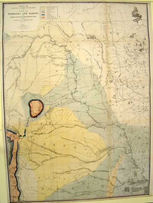
Auction 137, Lot 245
Subject: Upper Midwest United States
Warren, Lieut. G. K.
Map of Nebraska and Dakota, and Portions of the States and Territories Bordering Thereon…, 1867
Size: 31.5 x 43.5 inches (80 x 110.5 cm)
Estimate: $600 - $800
An Early Geological Map Focused on the Black Hills and Front Range
Sold for: $450
Closed on 9/14/2011
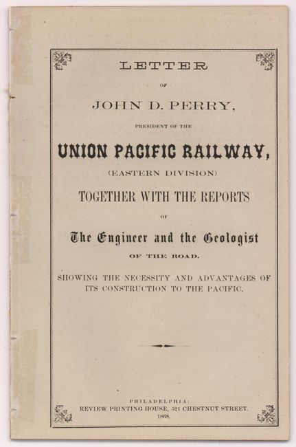
Auction 137, Lot 257
Subject: Western United States
Map of the Routes of the Union Pacific Railroads with Their Eastern Connections [with] Letter of John D. Perry, President of the Union Pacific Railway…, 1868
Size: 18 x 7 inches (45.7 x 17.8 cm)
Estimate: $400 - $500
Rare Union Pacific Railroad Pamphlet and Map
Sold for: $150
Closed on 9/14/2011
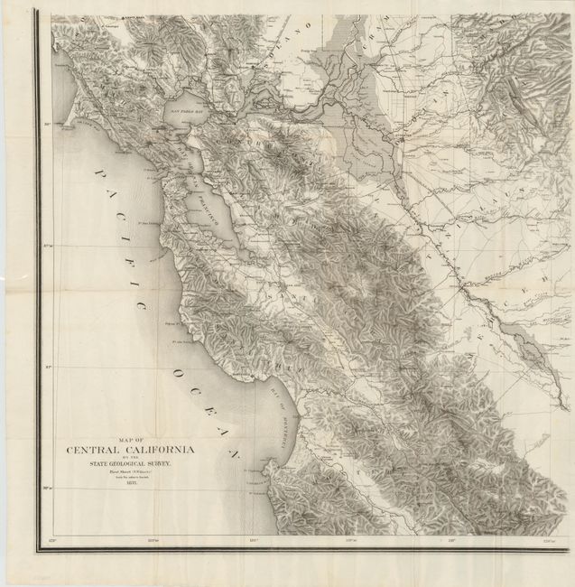
Auction 137, Lot 280
Subject: California
Map of Central California by the State Geological Survey - First Sheet (S.W. Quarter), 1871
Size: 24 x 24 inches (61 x 61 cm)
Estimate: $2,500 - $3,250
Scarce Topographical Map of California
Sold for: $1,800
Closed on 9/14/2011
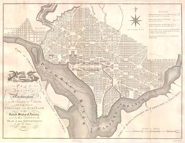
Auction 137, Lot 296
Subject: Washington, D.C.
Russell, John C.
Plan of the City of Washington, in the Territory of Columbia, Ceded by the States of Virginia and Maryland to the United States of America, and by Them Established as the Seat of Their Government, After the Year 1800, 1795
Size: 21 x 15.8 inches (53.3 x 40.1 cm)
Estimate: $3,500 - $4,500
Rare, Early Large Format Map of Washington D.C.
Sold for: $2,750
Closed on 9/14/2011
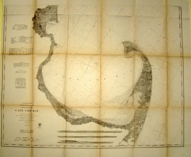
Auction 137, Lot 327
Subject: Massachusetts
U.S. Coast Survey
Coast Chart No. 10 - Cape Cod Bay Massachusetts, 1872
Size: 39 x 31.5 inches (99.1 x 80 cm)
Estimate: $300 - $400
Sold for: $220
Closed on 9/14/2011
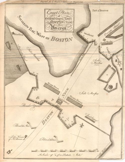
Auction 137, Lot 332
Subject: Boston, Massachusetts
Anon.
Exact Plan of General Gage's Lines on Boston Neck in America, 1775
Size: 8.7 x 11.5 inches (22.1 x 29.2 cm)
Estimate: $800 - $1,200
Early Plan of Boston at the Beginning of the American Revolution
Unsold
Closed on 9/14/2011
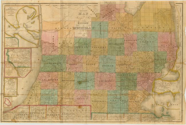
Auction 137, Lot 337
Subject: Michigan
Farmer, John
An Improved Edition of a Map of the Surveyed Part of the Territory of Michigan, 1836
Size: 31 x 21 inches (78.7 x 53.3 cm)
Estimate: $1,600 - $1,900
Sold for: $1,500
Closed on 9/14/2011
Auction 137, Lot 368
Subject: Pennsylvania
[Lot of 6] Second Geological Survey of Pennsylvania. Grand Atlas Division I, II, III, IV, V [and] VI, 1885
Size: 27 x 32 inches (68.6 x 81.3 cm)
Estimate: $2,000 - $3,000
Complete Set of the 2nd Geological Survey of Pennsylvania
Sold for: $1,000
Closed on 9/14/2011
94 lots
Page 1 of 2