Subject: World & Continents
Period: 1809-17 (dated)
Publication:
Color: Hand Color
Size:
12 x 16 inches
30.5 x 40.6 cm
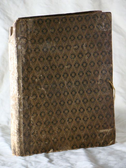
This is a fine set of matching maps showing major new discoveries around the world. The maps are dissected in 8 parts and linen-backed. All maps are folding, measure approximately 30 x 20" and are bound in decorative paper-board covers with a cloth spine.
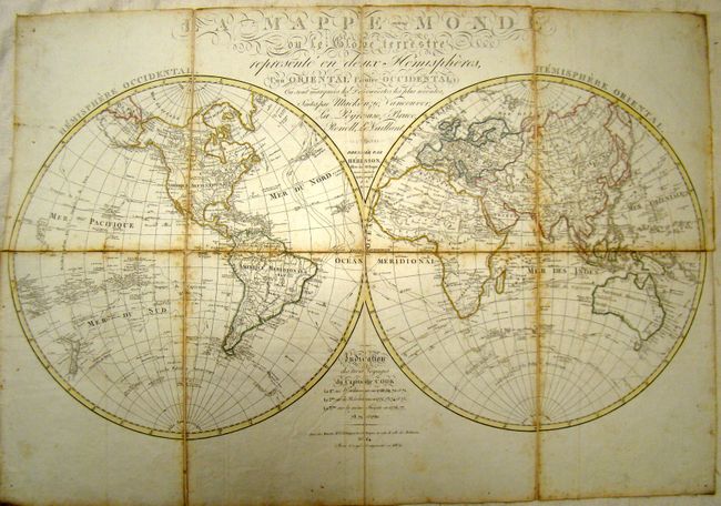
A. La Mappe-Monde ou le Globe Terrestre Represent en Deux Hemispheres..., dated 1809. Captain Cook's three voyages are chronicled on this scarce, large-scale chart. Precisely engraved and filled with finely rendered detail in the interior and along coastlines. The map includes the latest information from the discoveries of Cook. The legend gives the dates and delineates the route of the three different voyages. In the Pacific, New Zealand is shown with both its French title and the original Maori names for each island. In Africa the interior is left largely blank, but the Nile is still shown originating from a lake above the Mountains of the Moon. Cook's observations in Antarctica are detailed including large ice floes.
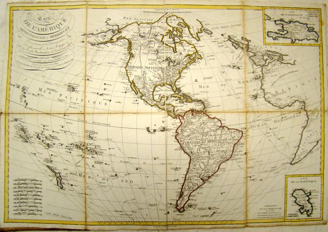
B. Carte de L'Amerique Septentrionale et Meridionale ou se Trouve les Decouvertes les plus Nouvelles et les Trois Voyages de Cook Mackenzie et Vancouver, dated 1809. This uncommon map of the Americas shows the three voyages of Captain Cook, along with the tracks of Vancouver and Mackenzie. The arctic passage of Cluny in 1768 is delineated. The map extends beyond the Americas to include nearly all the South Pacific with both islands of New Zealand shown. It also extends to show western Europe and Africa. Two insets feature the islands of Hispaniola and Martinique.
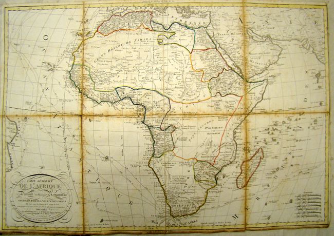
C. Carte Generale de L'Afrique Divisee en Plusieurs Royaumes Contenant aussi les Pays et Etats Voisins ou l'on Trace les Routes des 3 Voyages de Cook et les Decouvertes les plus Recentes de Bruce Renell et Levaillant, dated 1809. This map of Africa extends to the eastern coast of Brazil, and illustrates the three voyages of Captain Cook, as well as the new discoveries in Africa by James Bruce, James Rennell, and Francois Levaillant. Condition: Trimmed to neatline at upper right.
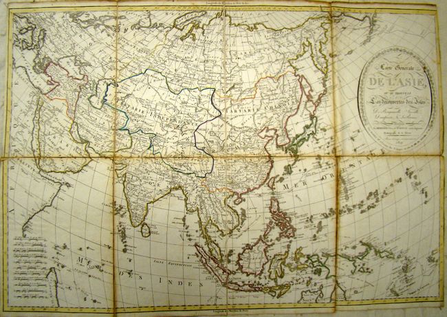
D. Carte Generale de L'Asie, ou se Trouve les Decouvertes des Isles de Bougainville, Surville, Dampierre, & La Perouse, dated 1809. This map charts the sea routes and discoveries of Cook and Surville in eastern Asia and the Pacific, and identifies additional discoveries by Bougainville, Dampierre and La Perouse. The southern coast of Papua New Guinea is still not delineated. Condition: Creasing along one fold, and trimmed to neatline at right.
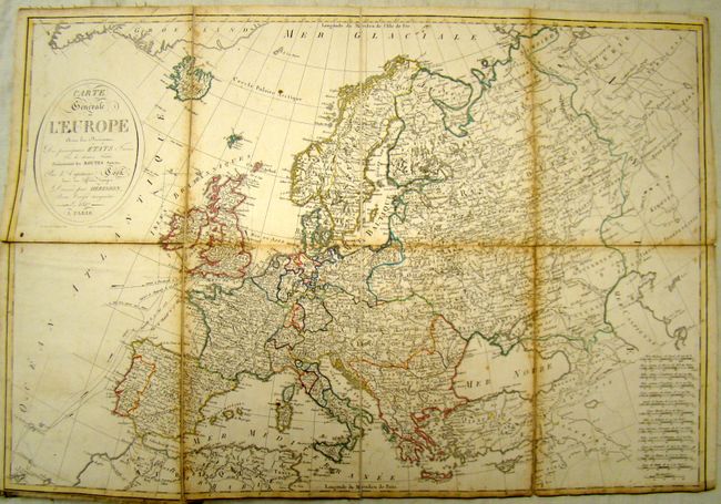
E. Carte Generale de L'Europe avec les Divisions des Principaux Etats…, dated 1817. This detailed map of Europe is divided by country, and shows Captain Cook's routes from his various voyages. Condition: Trimmed to neatline at bottom. Grid marks drawn around Great Britain in pencil.
References:
Condition: B
Foxing along folds with some toning and soiling in blank margins. Additional condition issues for individual maps noted in description. Covers are worn and stained, and the spine is missing in parts. Original owner has written his name in ink along with the date 1818 on the front pastedown.