Subject: Massachusetts
Period: 1872 (dated)
Publication:
Color: Black & White
Size:
39 x 31.5 inches
99.1 x 80 cm
The Office of Coast Survey is the oldest U.S. scientific organization, dating from 1807 when Congress directed that a "survey of the coast" be carried out. By 1836, it was called the U.S. Coast Survey and in 1878, the name was changed to the U.S. Coast and Geodetic Survey. Today the Office of Coast Survey is a division of the National Oceanic and Atmospheric Administration NOAA.
The survey teams, composed of civilians as well as Army and Naval officers, charted the nation's waterways and produced a wide array of reports, survey charts, hydrographic studies of tides and currents, astronomical studies and observations, and coastal pilots. These charts are an important record of the changing nature of the nation's coastlines. In additional to coastal charts, the U.S. Coast and Geodetic Survey produced land sketches, Civil War battle maps, and the early aeronautical charts.
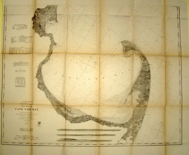
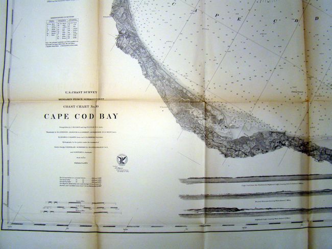
This exceptional sailing chart shows extraordinary detail for the entire Cape Cod Bay from Plymouth and Buxbury Bay in the north to the Provincetown Harbor and Race Point. The fine detail includes individual buildings, bottom conditions, hazards to navigation, and hundreds of sounds. Locates towns and villages including Provincetown, Rock Harbor, Brewster, Barnstable, Sandwich and many more. A large number of lighthouses are shown, including Sandy Neck and the Cape Cod light on the Atlantic side. Notations at left relate to sailing, tides, etc. This is the first edition of the map.
References:
Condition: B+
A few splits at fold intersections, which is typical for this type of map along with some minor toning.