Catalog Archive
Auction 137, Lot 215

Rare British Civil War Map

"Bacon's New Map of the Seat of War in Virginia and Maryland. Showing The Interesting Localities Around Richmond, Washington, Baltimore &c.…", Bacon, G. W. & Company

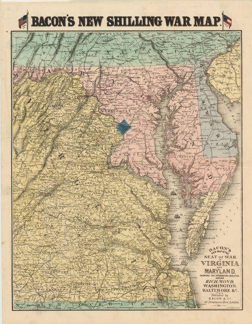
Subject: Mid-Atlantic United States

Period: 1862 (dated)

Publication:

Color: Hand Color

Size:
18 x 22 inches
45.7 x 55.9 cm
Download High Resolution Image
(or just click on image to launch the Zoom viewer)

Rare British map focused on the seat of war in Virginia and Maryland. The map is centered on the area between Richmond and Washington DC, with a number of important locations highlighted such as Leesburg, Manassas and Harpers Ferry. Bacon didn't highlight just battle locations, however, as Gordonsville is noted due to its strategic importance as railroads joined there and it had a substantial hospital serving primarily Confederate soldiers (70,000 were treated there). The map is also unique in that it displays both the US and Confederate flag next to the title. A great example for any Civil War collector.

References:

Condition: B

Nice clean, bright image. There is a 5-inch tear entering map at upper right that has been archivally repaired on verso and does not distract.

Estimate: $1,000 - $1,300

Sold for: $950

Closed on 9/14/2011

Archived