Catalog Archive
Auction 137, Lot 368
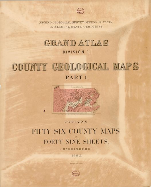
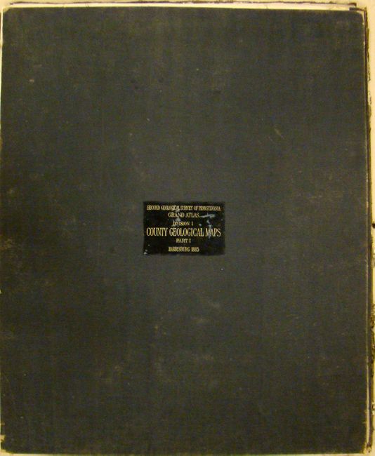
Complete Set of the 2nd Geological Survey of Pennsylvania
"[Lot of 6] Second Geological Survey of Pennsylvania. Grand Atlas Division I, II, III, IV, V [and] VI"
Subject: Pennsylvania
Period: 1885 (dated)
Publication:
Color: Printed Color
Size:
27 x 32 inches
68.6 x 81.3 cm
Download High Resolution Image
(or just click on image to launch the Zoom viewer)
(or just click on image to launch the Zoom viewer)
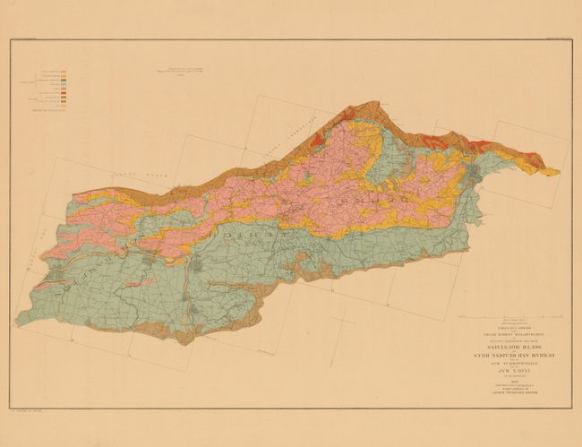
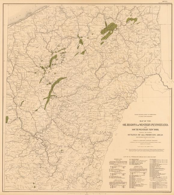
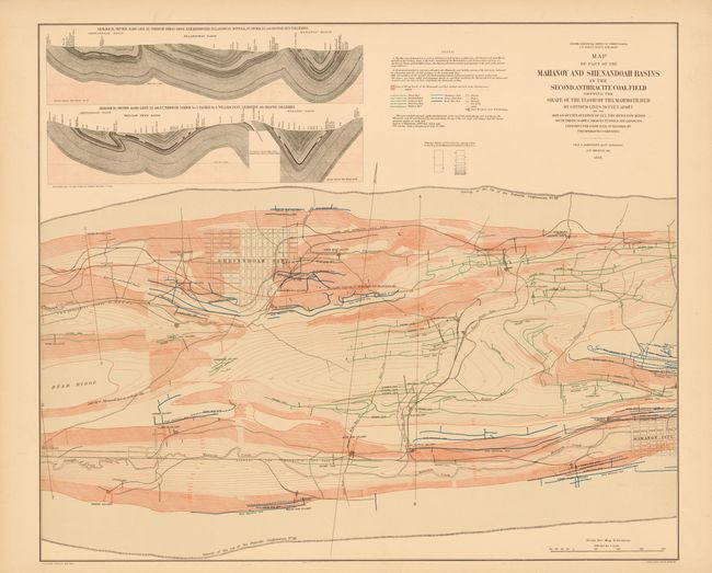
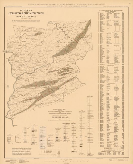
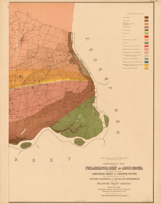
This is a complete set of six double-elephant folio atlases of maps, containing 201 sheets. The Second Geological Survey began after the Civil War and was overseen by J. P. Lesley, who became state geologist in 1874. This impressive work is one of the most ambitious and comprehensive geological surveys undertaken by any state and is quite scarce, especially complete and in good condition. Highlights of the set include the , 49 exquisite colored geological maps of most counties in Pennsylvania, as well as maps from the Oil Regions during the glory days of the one of the most important oil-producing regions of the world.
petroleum region of the state. Maps, many of which are colored, were lithographed by Julius Bien & Co. The volumes are bound in its original black pebbled cloth portfolios with gilt-lettered leather title labels on the front covers.
The six portfolios are titled:
A.Grand Atlas Division I County Geological Maps (56 counties, 49 sheets).
B.Grand Atlas Division II. Anthracite Coal Fields Part 1. Eastern Ends of the Western Middle and Southern Fields in Carbon, Schuylkill, Columbia and Northumberland Counties (26 sheets).
C.Grand Atlas Division II. Anthracite Coal Fields Part 2. Portions of the Northern and Eastern Middle Fields in Luzerne County (22 sheets).
D.Grand Atlas Division III. Petroleum and Bituminous Coal Fields. Portions of the Petroleum and Bituminous Coal Fields and Three Sheets Relating To The Quaternary Period (35 sheets).
E.Grand Atlas Division IV. South Mountain and Great Valley Topographical Maps. Thirty Sheets Relating to the Durham and Reading Hills and Bordering Valleys in Northampton, Lehigh, Bucks and Berks Counties, and thirteen sheets relating to the South Mountains in Adams, Franklin, Cumberland and York Counties (34 sheets, 9 not published).
F.Grand Atlas Division V. Central and South-Eastern Pennsylvania. Twenty-Nine Sheets Related to the Topography and Geology of the Paleozoic Strata in parts of Cambria, Blair, Bedford, Huntingdon, Mifflin, Centre and Union Counties. Five sheets contain a map and geological cross-section along the east bank of the Susquehanna River, Lancaster County. One sheet contains cross-sections of the Philadelphia Belt of Azoic Rocks (35 sheets).
*** Due to its size and weight, please call or email for a shipping quote prior to placing your bid ***