Showing Featured Lots(remove filter)
Showing results for:Auction 129
Catalog Archive
69 lots
Page 1 of 2
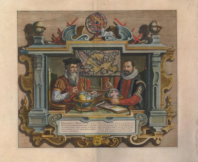
Auction 129, Lot 2
Subject: Title Pages
Hondius
Gerardus Mercator … Iudocus Hondius …, 1620
Size: 17.5 x 15 inches (44.5 x 38.1 cm)
Estimate: $3,000 - $3,500
Unsold
Closed on 9/23/2009
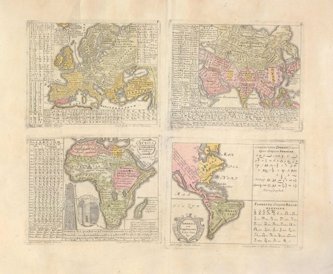
Auction 129, Lot 22
Subject: Continents
Homann Heirs
Europa Poly Glotta… [together with] Asia Poly-Glotta… [and] America cum Supplementis Poly-Glottis [and] Africa Poly-Glotta, 1741
Size: 17.5 x 15.3 inches (44.5 x 38.9 cm)
Estimate: $950 - $1,100
Sold for: $850
Closed on 9/23/2009
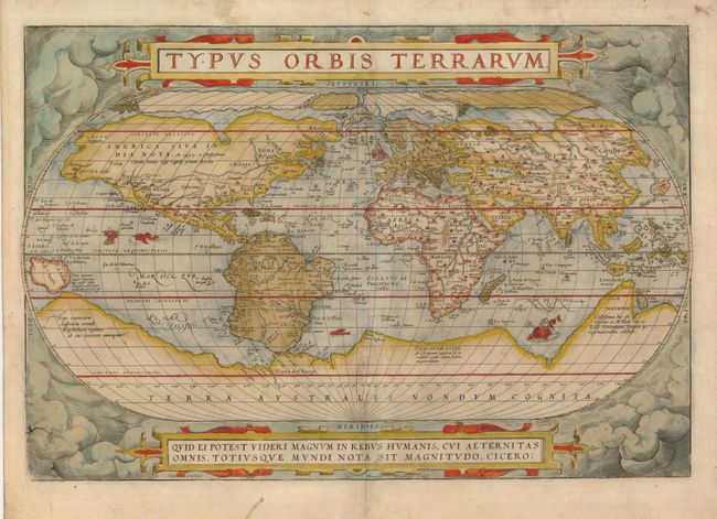
Auction 129, Lot 23
Subject: World
Ortelius, Abraham
Typus Orbis Terrarum, 1575
Size: 19.5 x 13.3 inches (49.5 x 33.8 cm)
Estimate: $6,000 - $7,000
Sold for: $5,500
Closed on 9/23/2009
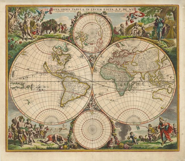
Auction 129, Lot 26
Subject: World
Wit, Frederick de
Nova Orbis Tabula, in Lucem Edita, 1688
Size: 21.8 x 18.3 inches (55.4 x 46.5 cm)
Estimate: $6,000 - $7,000
Sold for: $6,000
Closed on 9/23/2009
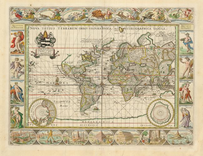
Auction 129, Lot 27
Subject: World
Pitt, Moses
Nova Totius Terrarum Orbis Geographica ac Hydrographica Tabula, 1680
Size: 20.8 x 15.5 inches (52.8 x 39.4 cm)
Estimate: $13,000 - $18,000
Sold for: $12,000
Closed on 9/23/2009
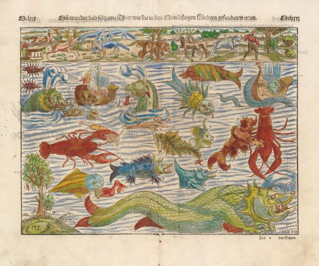
Auction 129, Lot 54
Subject: Cartographic Miscellany
Munster, Sebastian
[Monsters] Norewunder und Seltzame thier wiedie un Mitnachtigen landern gefunden werden, 1578
Size: 13.5 x 10.2 inches (34.3 x 25.9 cm)
Estimate: $1,200 - $1,400
Unsold
Closed on 9/23/2009
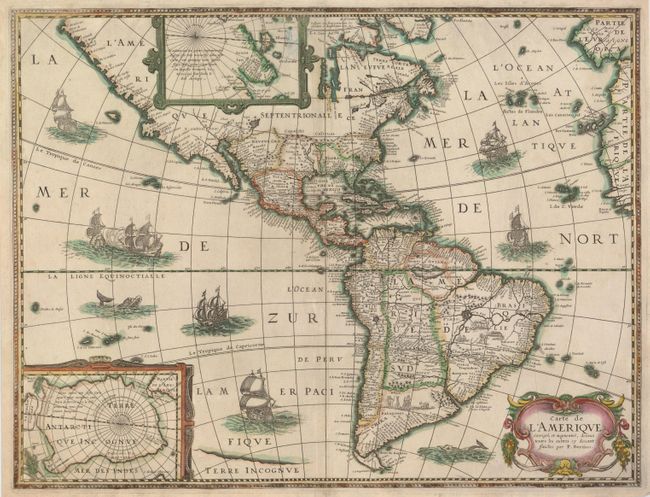
Auction 129, Lot 71
Subject: Western Hemisphere
Bertius/Tavernier
Carte de l'Amerique Corrigee et Augmentee, dessus Toutes les Aultres cy devant Faictes par P. Bertius, 1627
Size: 19.8 x 15 inches (50.3 x 38.1 cm)
Estimate: $2,000 - $2,500
Sold for: $1,400
Closed on 9/23/2009
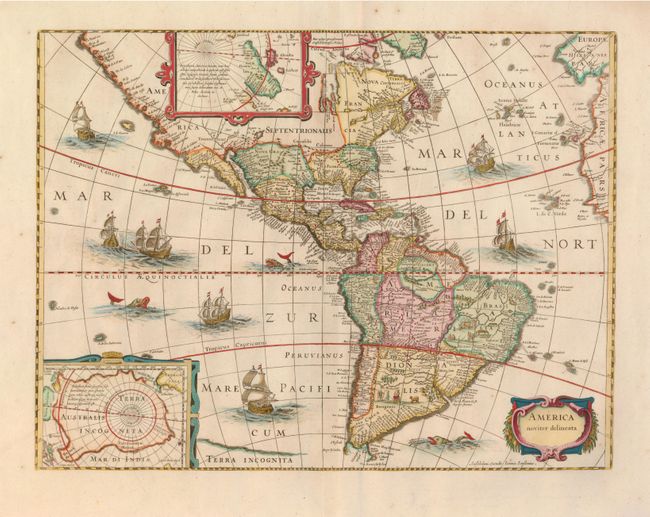
Auction 129, Lot 72
Subject: Western Hemisphere
Hondius/Jansson
America Noviter Delineata, 1660
Size: 19.5 x 14.8 inches (49.5 x 37.6 cm)
Estimate: $2,750 - $3,500
Sold for: $1,800
Closed on 9/23/2009
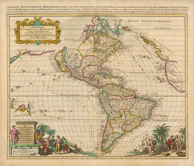
Auction 129, Lot 74
Subject: Western Hemisphere
Valck, Gerard
L'Amerique Septentrionale & Meridionale Divisee en ses Principales Parties…, 1695
Size: 22.8 x 19.3 inches (57.9 x 49 cm)
Estimate: $1,900 - $2,200
Sold for: $1,300
Closed on 9/23/2009
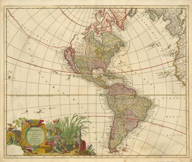
Auction 129, Lot 76
Subject: Western Hemisphere
Valck, Gerard and Leonard
America Aurea Pars Altera Mundi, 1708
Size: 23.5 x 19.3 inches (59.7 x 49 cm)
Estimate: $2,000 - $2,400
Unsold
Closed on 9/23/2009
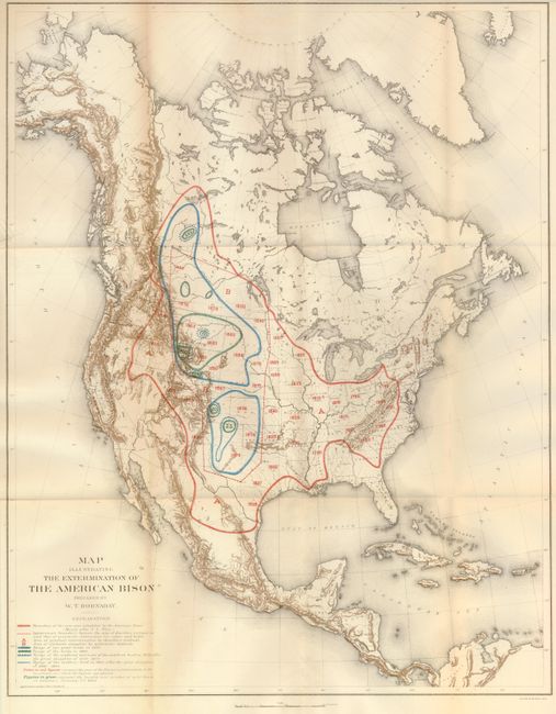
Auction 129, Lot 115
Subject: North America
Smithsonian Institute
Map Illustrating the Extermination of the American Bison Prepared by W.T. Hornaday, 1889
Size: 17.4 x 22 inches (44.2 x 55.9 cm)
Estimate: $200 - $300
Sold for: $150
Closed on 9/23/2009
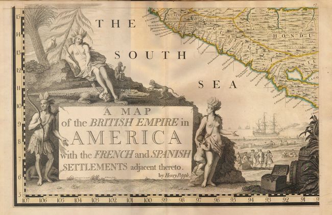
Auction 129, Lot 117
Subject: Colonial North America and West Indies
Popple, Henry
A Map of the British Empire in America with the French and Spanish Settlements Adjacent Thereto, 1734
Size: See Description
Estimate: $70,000 - $90,000
Sold for: $52,500
Closed on 9/23/2009
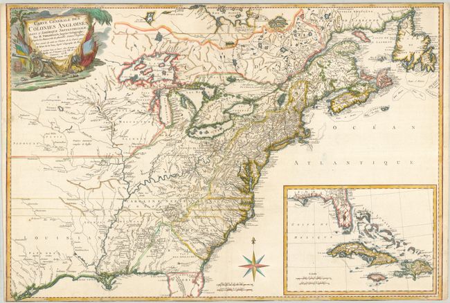
Auction 129, Lot 119
Subject: Colonial North America and West Indies
Phelipeaux/Brion de la Tour
Carte Generale des Colonies Angloises, dans l'Amerique Septentrionale, par M. Phelippeaux…, 1778
Size: 30 x 21.5 inches (76.2 x 54.6 cm)
Estimate: $4,000 - $6,000
Unsold
Closed on 9/23/2009
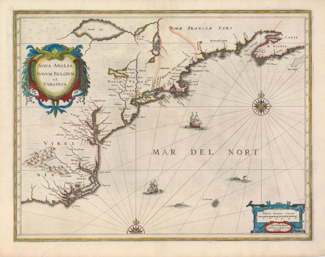
Auction 129, Lot 128
Subject: Colonial New England and Mid-Atlantic
Jansson, Jan
Nova Anglia Novum Belgium et Virginia, 1637
Size: 20 x 15.3 inches (50.8 x 38.9 cm)
Estimate: $1,900 - $2,300
Sold for: $1,400
Closed on 9/23/2009
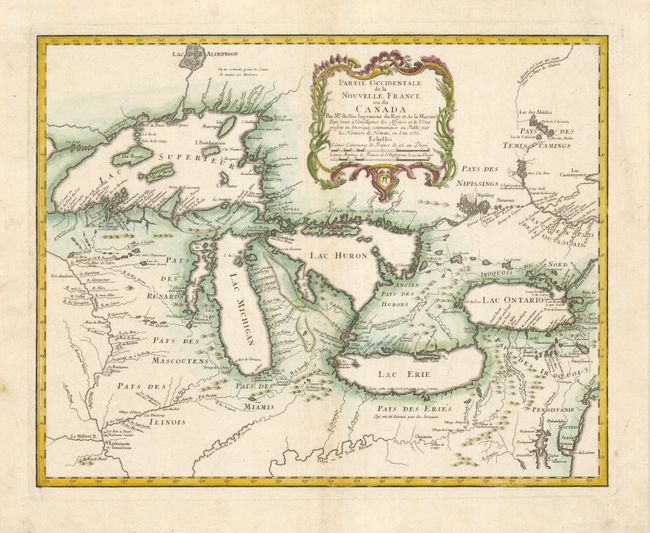
Auction 129, Lot 135
Subject: Great Lakes
Bellin/Homann Heirs
Partie Occidentale de la Nouvelle France ou du Canada, 1755
Size: 21.3 x 16.9 inches (54.1 x 42.9 cm)
Estimate: $2,100 - $2,400
Sold for: $1,300
Closed on 9/23/2009
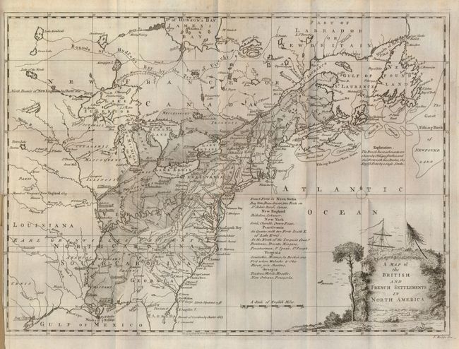
Auction 129, Lot 137
Subject: Colonial United States and Canada
Ridge, John
Map of the British and French Settlements in North America, 1758
Size: 15 x 10.8 inches (38.1 x 27.4 cm)
Estimate: $500 - $700
Sold for: $475
Closed on 9/23/2009
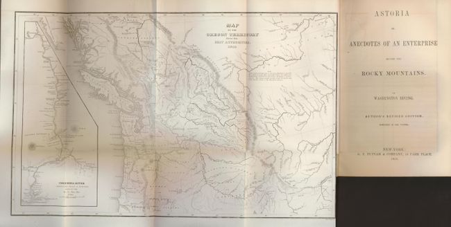
Auction 129, Lot 152
Subject: Western Canada and United States
Wilkes, Charles
Map of the Oregon Territory from the Best Authorities, 1854
Size: 13 x 8 inches (33 x 20.3 cm)
Estimate: $400 - $500
Sold for: $300
Closed on 9/23/2009
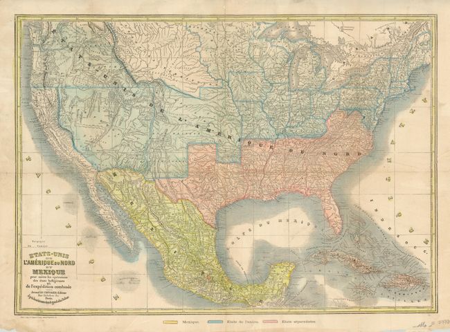
Auction 129, Lot 158
Subject: United States
Le Chevalier, Armand
Etats-Unis de l'Amerique du Nord et Mexique pour Suivre les Operations des Etats Belligerants et de l'Expedition Combinee, 1861
Size: 24 x 17 inches (61 x 43.2 cm)
Estimate: $750 - $850
Sold for: $650
Closed on 9/23/2009
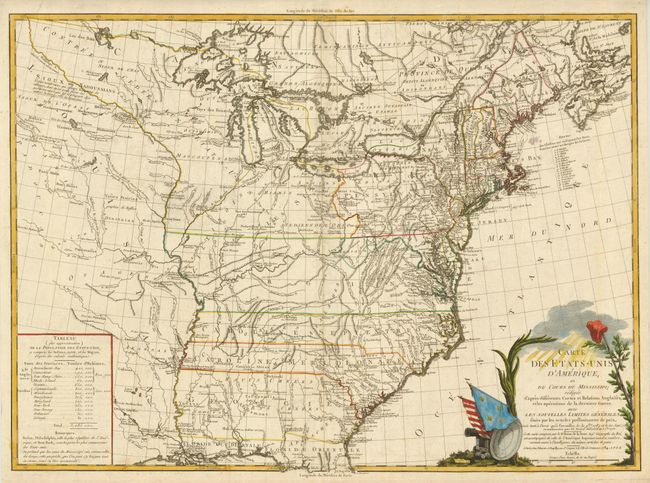
Auction 129, Lot 170
Subject: Eastern United States
Brion de la Tour, Louis
Carte des Etats-Unis d'Amerique et du Cours du Mississipi…, 1784
Size: 27.5 x 20 inches (69.9 x 50.8 cm)
Estimate: $3,000 - $3,750
Sold for: $1,800
Closed on 9/23/2009
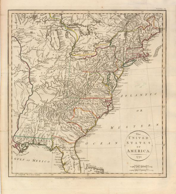
Auction 129, Lot 172
Subject: Eastern United States
Payne, John
The United States of America, 1791
Size: 13.5 x 14.5 inches (34.3 x 36.8 cm)
Estimate: $700 - $1,000
Sold for: $950
Closed on 9/23/2009
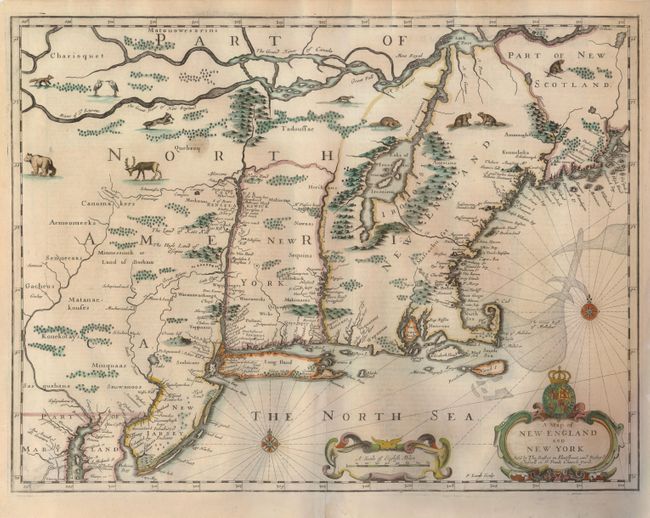
Auction 129, Lot 189
Subject: Colonial New England and New York
Speed/Lamb
A Map of New England and New York, 1676
Size: 19.7 x 15 inches (50 x 38.1 cm)
Estimate: $5,500 - $6,500
Sold for: $3,600
Closed on 9/23/2009
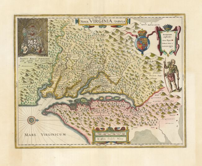
Auction 129, Lot 198
Subject: Colonial Mid-Atlantic
Hondius/Blaeu
Nova Virginiae Tabula, 1662
Size: 18.3 x 14.5 inches (46.5 x 36.8 cm)
Estimate: $2,400 - $3,000
Sold for: $1,800
Closed on 9/23/2009
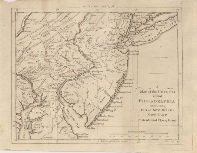
Auction 129, Lot 203
Subject: Colonial Mid-Atlantic
Scots Magazine
A Map of the Country round Philadelphia including Part of New Jersey, New York, Staten Island & Long Island, 1776
Size: 9 x 7 inches (22.9 x 17.8 cm)
Estimate: $250 - $300
Sold for: $210
Closed on 9/23/2009
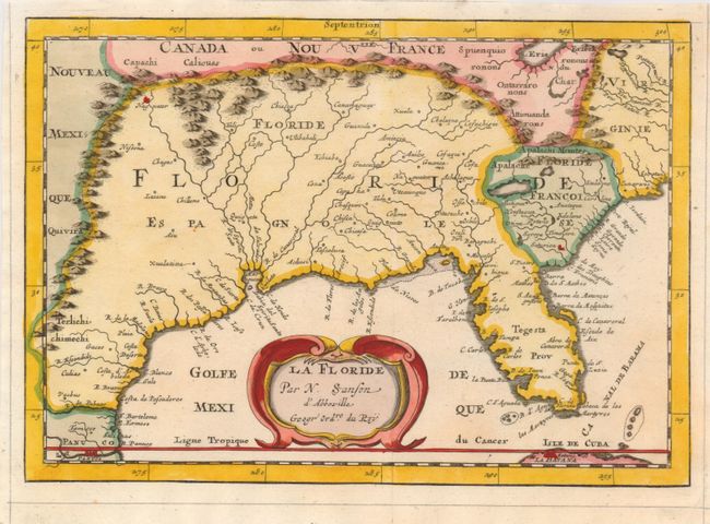
Auction 129, Lot 208
Subject: Colonial South
Sanson, Nicolas
La Floride, 1682
Size: 9.8 x 7 inches (24.9 x 17.8 cm)
Estimate: $500 - $700
Sold for: $850
Closed on 9/23/2009
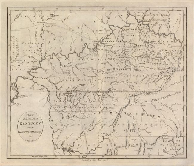
Auction 129, Lot 211
Subject: Southern United States - Kentucky and Tennessee
Reid, John
Map of the State of Kentucky; with the Adjoining Territories, 1795
Size: 17.5 x 14.5 inches (44.5 x 36.8 cm)
Estimate: $1,000 - $1,300
Sold for: $750
Closed on 9/23/2009
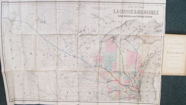
Auction 129, Lot 227
Subject: United States - Midwest
Colton, Joseph Hutchins
Map of the La Crosse & Milwaukee Railroad and Connections, 1857
Size: 33 x 20.5 inches (83.8 x 52.1 cm)
Estimate: $300 - $500
Sold for: $375
Closed on 9/23/2009
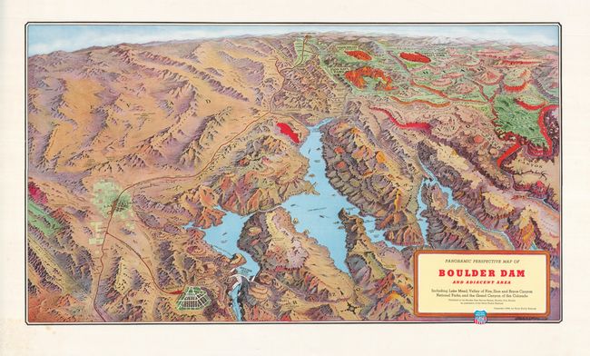
Auction 129, Lot 240
Subject: Southwestern United States
Railroad Companies, (Various)
Panoramic Perspective Map of Boulder Dam and Adjacent Area Including Lake Mead, Valley of Fire, Zion and Bryce Canyon National Parks, and the Grand Canyon of the Colorado, 1938
Size: 30 x 17 inches (76.2 x 43.2 cm)
Estimate: $200 - $300
Sold for: $150
Closed on 9/23/2009
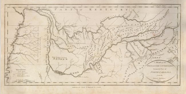
Auction 129, Lot 276
Subject: Tennessee
Reid, John
A Map of the Tennassee Government formerly Part of North Carolina from the latest Surveys, 1795
Size: 15.2 x 7 inches (38.6 x 17.8 cm)
Estimate: $1,100 - $1,400
Sold for: $1,000
Closed on 9/23/2009
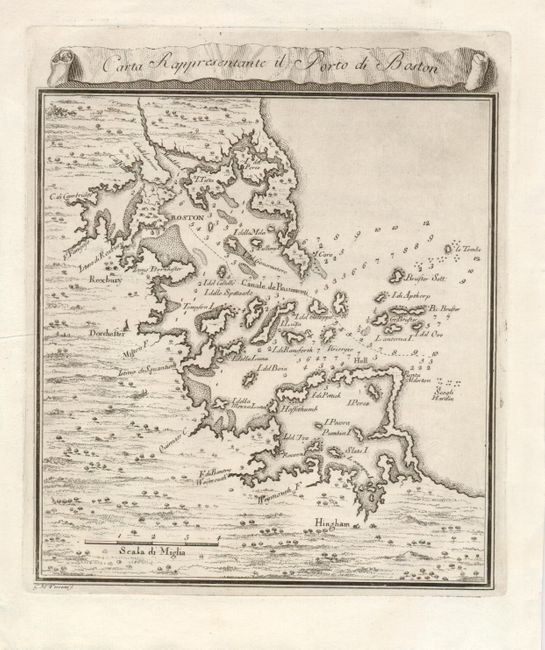
Auction 129, Lot 282
Subject: Boston, Massachusetts
Gazzettiere Americano
Carte Rappresentante il Porto di Boston, 1757
Size: 7 x 7.5 inches (17.8 x 19.1 cm)
Estimate: $250 - $300
Sold for: $190
Closed on 9/23/2009
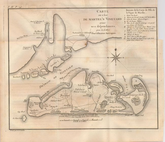
Auction 129, Lot 284
Subject: Massachusetts
Tardieu, Pierre Francois
Carte de l'Ile de Martha's Vineyard avec ses dependances…, 1787
Size: 10.3 x 8.3 inches (26.2 x 21.1 cm)
Estimate: $1,400 - $1,600
Sold for: $1,200
Closed on 9/23/2009
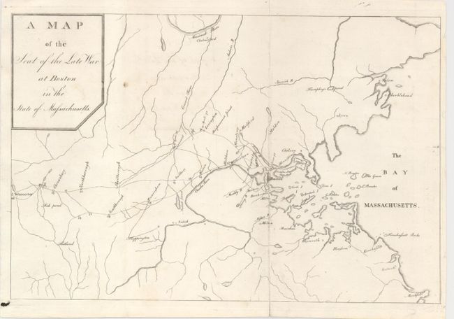
Auction 129, Lot 285
Subject: Boston, Massachusetts
A Map of the Seat of the Late War at Boston in the State of Massachusetts, 1789
Size: 10.2 x 6.8 inches (25.9 x 17.3 cm)
Estimate: $350 - $450
Sold for: $190
Closed on 9/23/2009
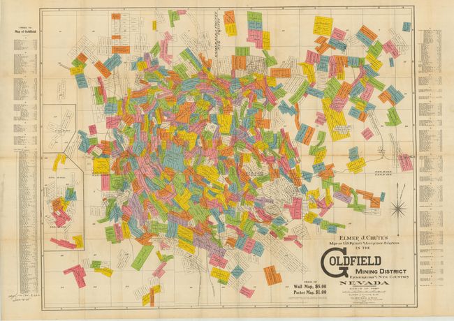
Auction 129, Lot 299
Subject: Nevada
Map of the U.S. Patent and Location Surveys in the Goldfield Mining District Esmeralda and Nye Counties Nevada, 1907
Size: 32 x 20.5 inches (81.3 x 52.1 cm)
Estimate: $450 - $600
Sold for: $375
Closed on 9/23/2009
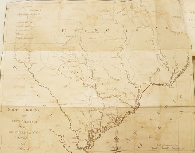
Auction 129, Lot 330
Subject: South Carolina
The History of the Revolution of South Carolina, from a British Province to an Independent State… in Two Volumes, 1785
Size: 5.3 x 8 inches (13.5 x 20.3 cm)
Estimate: $1,600 - $2,000
Sold for: $2,500
Closed on 9/23/2009
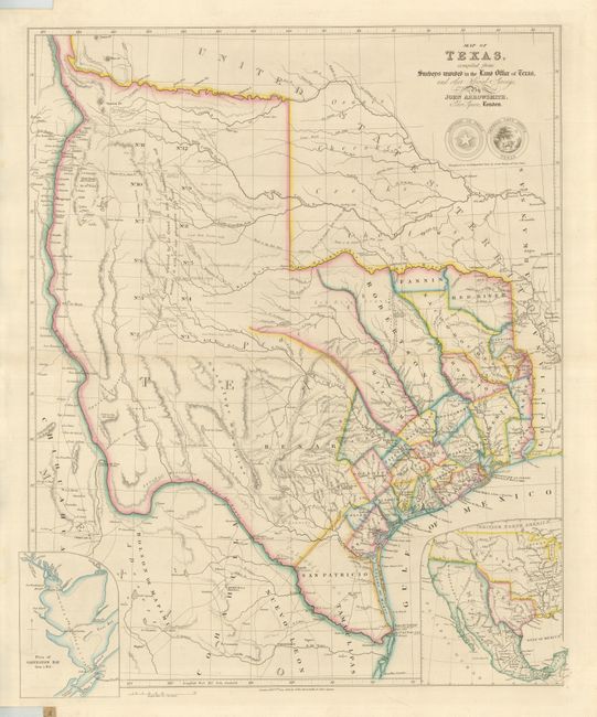
Auction 129, Lot 333
Subject: Texas
Arrowsmith, John
Map of Texas, compiled from Surveys recorded in the Land Office of Texas, and other Official Surveys, 1843
Size: 19.8 x 24 inches (50.3 x 61 cm)
Estimate: $12,000 - $16,000
Sold for: $18,000
Closed on 9/23/2009
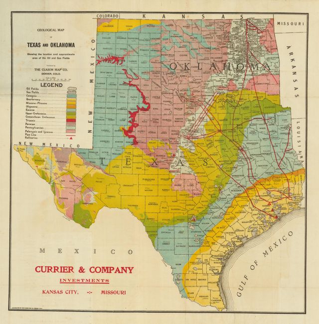
Auction 129, Lot 342
Subject: Texas and Oklahoma
Clason Map Company
Geological Map of Texas and Oklahoma Showing the Location and Approximate Area of the Oil and Gas Fields, 1919
Size: 18 x 20 inches (45.7 x 50.8 cm)
Estimate: $300 - $400
Sold for: $375
Closed on 9/23/2009
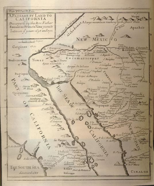
Auction 129, Lot 355
Subject: Southwestern United States, California and Mexico
Kino, Eusebio Francisco, SJ
A Passage by Land to California Discover'd by the Rev. Father Eusebius Francis Kino Jesuite between ye years 1698 and 1701, 1721
Size: 7.8 x 9 inches (19.8 x 22.9 cm)
Estimate: $1,400 - $1,600
Sold for: $1,200
Closed on 9/23/2009
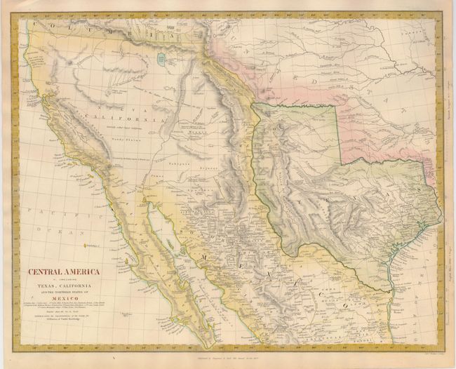
Auction 129, Lot 362
Subject: Southwestern United States, Texas and Mexico
SDUK Society for the Diffusion of Useful Knowledge
Central America II. Including Texas, California and the Northern States of Mexico, 1842
Size: 15.5 x 12 inches (39.4 x 30.5 cm)
Estimate: $500 - $700
Sold for: $600
Closed on 9/23/2009
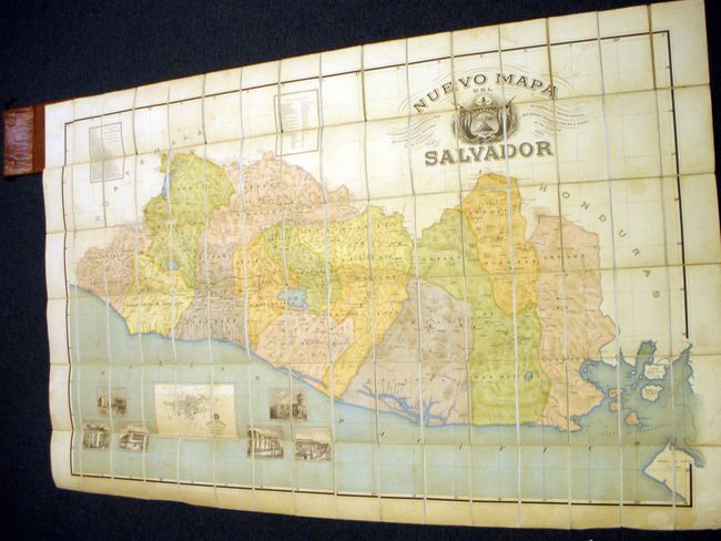
Auction 129, Lot 375
Subject: Central America, El Salvador
Barberena and Alcaine
Nuevo Mapa del Salvador…, 1905
Size: 63 x 39 inches (160 x 99.1 cm)
Estimate: $400 - $600
Sold for: $200
Closed on 9/23/2009
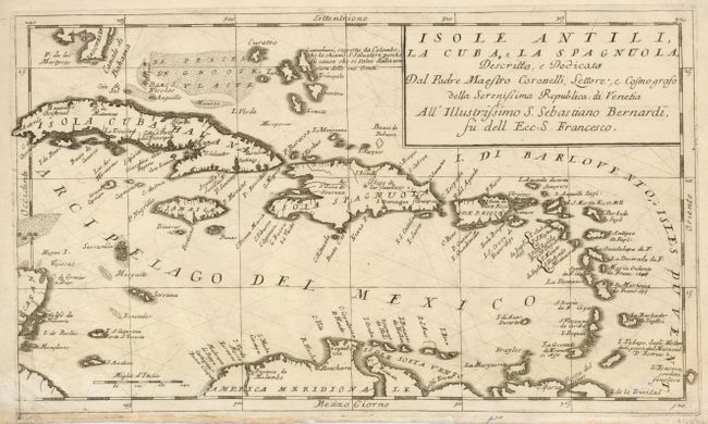
Auction 129, Lot 381
Subject: Caribbean
Coronelli, Vincenzo Maria
Isole Antili, la Cuba, e la Spagnuola…, 1690
Size: 17 x 10.5 inches (43.2 x 26.7 cm)
Estimate: $1,100 - $1,500
Sold for: $700
Closed on 9/23/2009
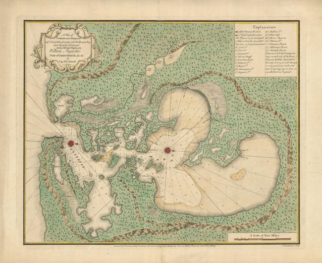
Auction 129, Lot 384
Subject: Cuba, Guantanamo Bay
Durell, Philip
A Plan of Cumberland Harbour on ye So. Side of Cuba Formerly call'd Walltenam Bay…, 1741
Size: 22.5 x 18.5 inches (57.2 x 47 cm)
Estimate: $6,000 - $10,000
Unsold
Closed on 9/23/2009
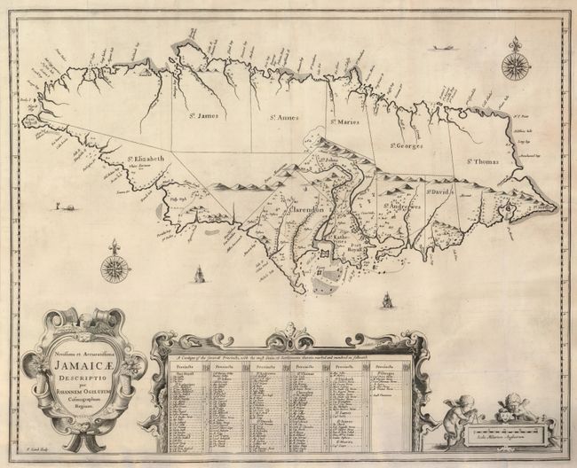
Auction 129, Lot 389
Subject: Jamaica
Ogilby, John
Novissima et Accuratissima Jamaicae Descriptio, 1671
Size: 21 x 17 inches (53.3 x 43.2 cm)
Estimate: $1,000 - $1,300
Sold for: $1,100
Closed on 9/23/2009
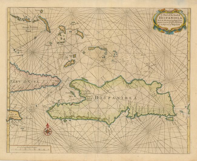
Auction 129, Lot 393
Subject: Hispaniola
Thornton & Seller
A Chart of the Iland of Hispaniola, with the Windward Passage from Iamaica between ye East End of Cuba & the West End of Hispaniola, 1700
Size: 20.8 x 16.5 inches (52.8 x 41.9 cm)
Estimate: $900 - $1,000
Sold for: $750
Closed on 9/23/2009
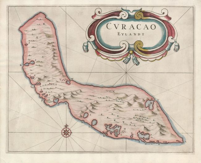
Auction 129, Lot 401
Subject: Curacao
de Laet, Joannes
Curacao Eylandt, 1644
Size: 13.3 x 10.5 inches (33.8 x 26.7 cm)
Estimate: $1,900 - $2,500
Sold for: $1,400
Closed on 9/23/2009
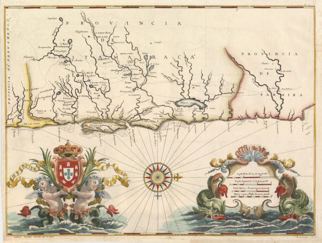
Auction 129, Lot 423
Subject: Brazil
Horatius, Andreas Antonius
[Itamaraca, Brazil], 1698
Size: 19.8 x 14.8 inches (50.3 x 37.6 cm)
Estimate: $600 - $800
Sold for: $1,900
Closed on 9/23/2009
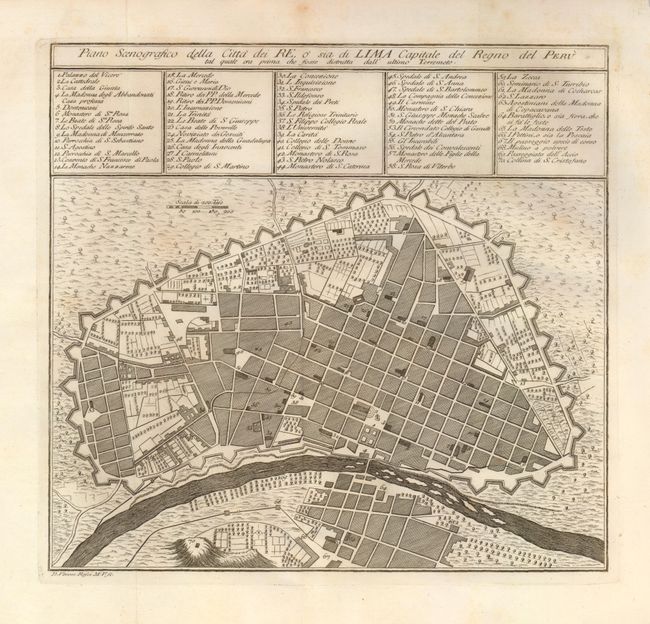
Auction 129, Lot 433
Subject: Lima, Peru
Gazzettiere Americano
Piano Scenografico della Citta dei Re, o sia do Lima Capitale del Regno del Peru…, 1763
Size: 10.8 x 10 inches (27.4 x 25.4 cm)
Estimate: $250 - $300
Sold for: $120
Closed on 9/23/2009
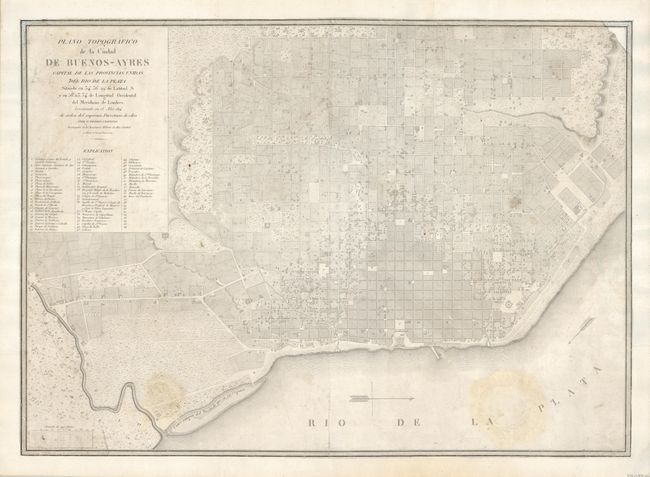
Auction 129, Lot 435
Subject: Buenos Aires, Argentina
Cervino, Pedro Antonio
Plano Topografico de la Ciudad de Buenos-Ayres Capital de las Provincias Unidas del Rio de la Plata…, 1817
Size: 28.3 x 20.3 inches (71.9 x 51.6 cm)
Estimate: $700 - $900
Sold for: $1,200
Closed on 9/23/2009
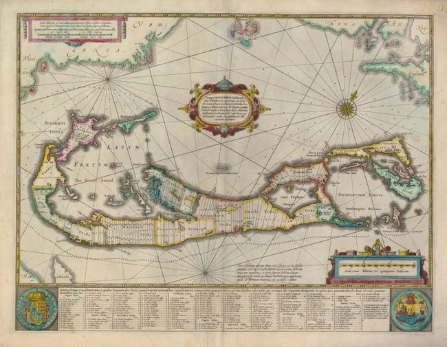
Auction 129, Lot 447
Subject: Bermuda
Hondius, Henricus
Mappa Aestivarum Insularum, alias Barmudas Dictarum…, 1633
Size: 20.3 x 15.5 inches (51.6 x 39.4 cm)
Estimate: $1,400 - $1,800
Sold for: $1,000
Closed on 9/23/2009
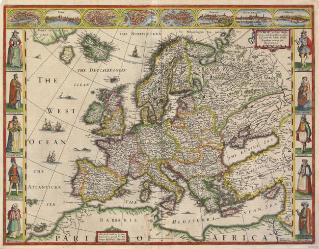
Auction 129, Lot 457
Subject: Europe
Speed, John
Europ, and the Cheife Cities Contayned therein Described; with the Habits of Most Kingdoms Now in Use, 1626
Size: 20.3 x 15.5 inches (51.6 x 39.4 cm)
Estimate: $4,000 - $5,000
Sold for: $3,750
Closed on 9/23/2009
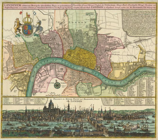
Auction 129, Lot 480
Subject: London, England
Seutter, Matthias
Londinum Celeberrima Metropolis, Splendidissima, Regia et Opulentissimum Angliae Emporium…, 1720
Size: 22.8 x 19.5 inches (57.9 x 49.5 cm)
Estimate: $2,000 - $2,500
Sold for: $2,500
Closed on 9/23/2009
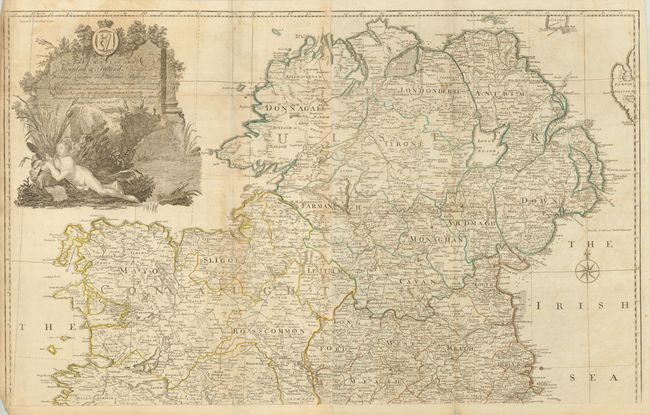
Auction 129, Lot 499
Subject: Ireland
Rocque, John
A Map of the Kingdom of Ireland, Divided into Provinces Counties and Baronies…, 1782
Size: 38 x 23.5 inches (96.5 x 59.7 cm)
Estimate: $600 - $800
Sold for: $450
Closed on 9/23/2009
69 lots
Page 1 of 2