Subject: Central America, El Salvador
Period: 1905 (dated)
Publication:
Color: Printed Color
Size:
63 x 39 inches
160 x 99.1 cm
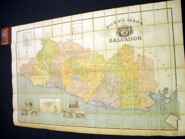
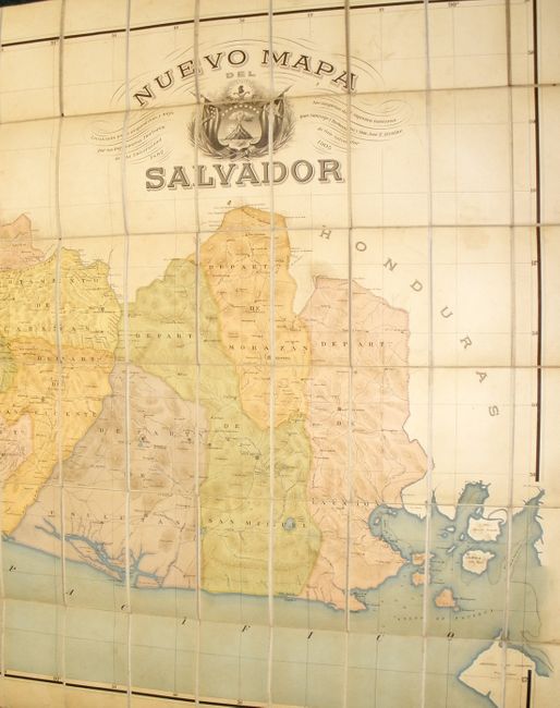
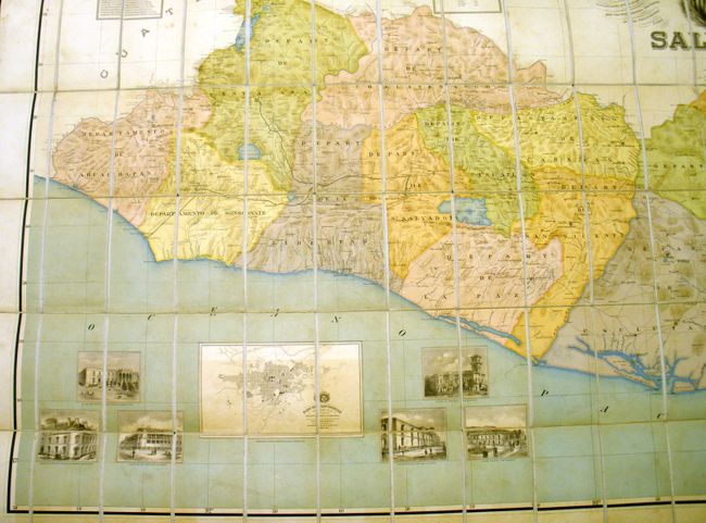
This rare sectioned wall map shows the entire country in astounding detail. The map, published in San Salvador, was created by Jose E. Alcaine and Santiago I. Barbernay (1851-1916) both of the Universidad de San Salvador. The map locates cities, towns and villages, roads, trails, mountains and watershed. In the Golfo de Fonseca all islands are detailed including limited soundings. The map has two large tables: the first lists geographical locations and the heights of mountains, the second is a table of distances between the prominent towns and villages of the country. The large inset "Plano de San Salvador," by Jose M. Peralta and Domingo Call, delineates the city in a street plan view with major buildings shown but not named. Surrounding the city plan are six views of important buildings in San Salvador including municipal buildings, Governor's Palace, National Theatre, and the National University. The decorative and very large title cartouche includes fancy lettering and a large pre-1912 coat of arms for El Salvador. Its center consists of a triangle with a single volcano rising from the sea. Above the volcano is a Phrygian cap on a staff with a sunburst behind and two large cornucopia below. In 1912 the single volcano was replaced by five volcanoes to symbolize the five member states of the United Provinces of Central America. Alcaine designed the current National Palace.
This huge map is sectioned into 96 parts attached to the original linen and folding into the original hard covers. The orange covers have marbled paper inside and gilt stamped titling on the cover. While any map published from San Salvador is scarce, a segmented map of this size is undoubtedly rare. No references or prior sales located.
References:
Condition: B+
The map and original linen are in remarkable condition for a map of this size. While there are a few very light areas of soiling the paper and linen are in very sound, clean condition. The original cover is rubbed and a little faded with tears along the spine. The original cloth ties are mostly perished.