Subject: Jamaica
Period: 1671 (dated)
Publication: America
Color: Black & White
Size:
21 x 17 inches
53.3 x 43.2 cm
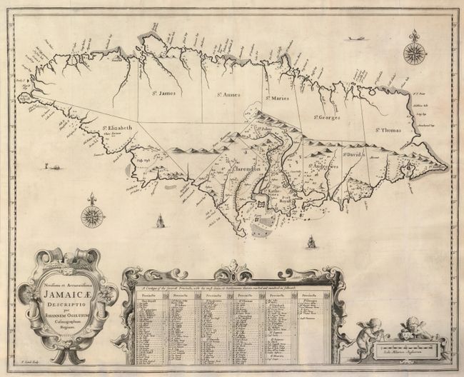
This important map of Jamaica was based on a 1670 survey ordered by Sir Thomas Modyford. The island is divided into precincts with the most prominent settlements located and with the prominent landowners named in the large key at bottom. Port Royal is shown in the vicinity of Spanish Town. The map is richly embellished with sea monsters, compass roses, sailing ships, and elaborate cartouches, all elegantly engraved by Francis Lamb. Ogilby's map became the model for many later maps of the island.
References:
Condition: A
Nice impression printed on sturdy paper with a hint of surface soil, else fine. Issued folded, now flattened.