Subject: Buenos Aires, Argentina
Period: 1817 (dated)
Publication:
Color: Black & White
Size:
28.3 x 20.3 inches
71.9 x 51.6 cm
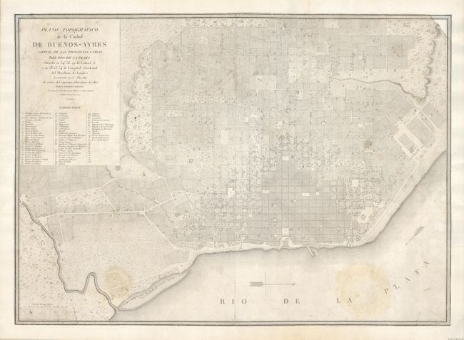
This is a very rare city plan of Buenos Aires produced by one of the earlier revolutionary governments of Argentina noted in the title (de orden del supremo Directorio de ellas). It provides a detailed view of the city including the urban grid and the original forts. It clearly shows two canals in the Boca del Riachuelo, the main natural port along the Rio de la Plata estuary. A key in the title block identifies 56 important sites within the city. Cervino, a Spanish engineer, originally came to Argentina in the 1780s to work for the commission assigned to mark the boundaries between Spain and Portugal in South America. He remained in Buenos Aires during the War of Independence and in 1813 he headed the Academia Militar de Matemáticas.
References:
Condition: B
The map has been backed with Japanese tissue with margins added all around and the corners of the borders at top have been neatly replaced in facsimile. There are a couple light stains in the map.