Subject: Hispaniola
Period: 1700 (circa)
Publication: The English Pilot, Fourth Book
Color: Hand Color
Size:
20.8 x 16.5 inches
52.8 x 41.9 cm
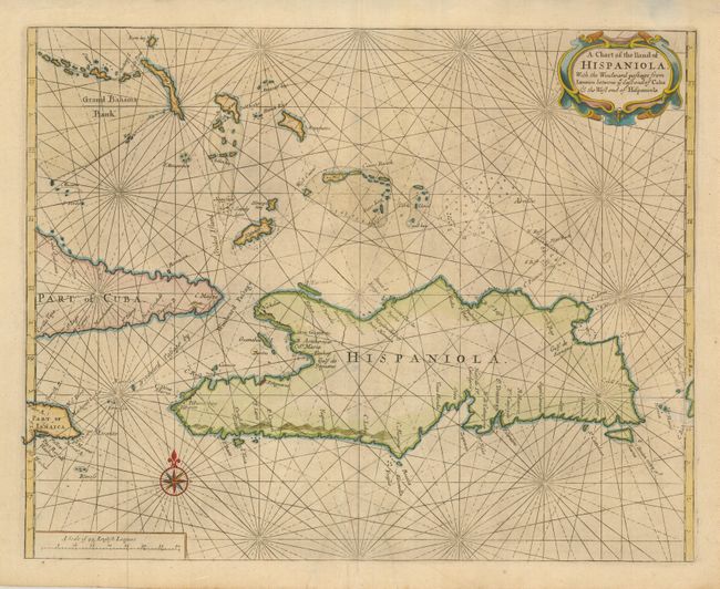
This is a very scarce chart of the island of Hispaniola showing the Windward Passage, the important shipping lane between Cuba and Hispaniola that connects the Caribbean Sea with the Atlantic. The map is from the important first English sea-atlas of American waters. br>
John Seller was a pioneering British publisher of nautical charts and one of the most important figures in the early history of British cartography. Seller's shop, located near the Tower of London in Wapping, became a gathering place for seamen arriving with the latest news of distant places such as the West Indies and provided Seller with information critical to his nautical chart business. In addition to sea charts, he produced a vast array of cartographic material, the first to rival the large Dutch firms such as Blaeu and Jansson. Seller was appointed Royal Hydrographer by Charles II in 1671, and also served under James II and William III. Unfortunately his business was built on a shaky foundation and though he made several attempts to avoid bankruptcy including a consortium partnership with other cartographers such as William Fisher and John Thornton, he was ultimately unsuccessful.
References:
Condition: A
Lightly toned with good original margins. There are a couple of light stains and edge tears, not affecting the map.