Filtered by Category:United States(Show All Categories)
Showing results for:Auction 93
Catalog Archive
74 lots
Page 1 of 2
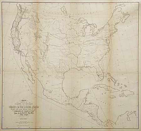
Auction 93, Lot 89
Subject: North America
U.S. War Dept.
Map Exhibiting the Lines of March passed over by troops of the United States during the year ending June 30th, 1858, 1858
Size: 18.8 x 17.2 inches (47.8 x 43.7 cm)
Estimate: $150 - $200
Sold for: $80
Closed on 12/6/2000
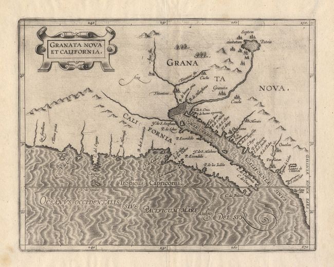
Auction 93, Lot 90
Subject: Southwestern United States & MexicoCoast
Wytfliet, Cornelis
Granata Nova et California, 1597
Size: 11.5 x 9 inches (29.2 x 22.9 cm)
Estimate: $2,750 - $3,500
Sold for: $2,500
Closed on 12/6/2000
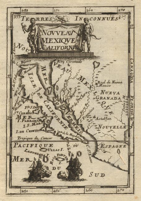
Auction 93, Lot 91
Subject: Southwestern United States
Mallet, Alain Manesson
Nouveau Mexique et Californie, 1683
Size: 3.8 x 5.6 inches (9.7 x 14.2 cm)
Estimate: $600 - $650
Sold for: $500
Closed on 12/6/2000
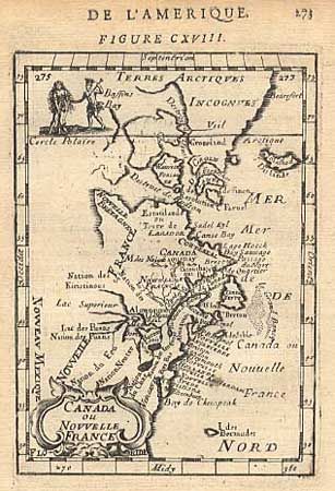
Auction 93, Lot 92
Subject: Colonial Canada and New England
Mallet, Alain Manesson
Canada ou Nouvelle France, 1683
Size: 4 x 5.5 inches (10.2 x 14 cm)
Estimate: $220 - $250
Sold for: $200
Closed on 12/6/2000
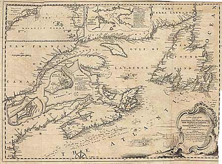
Auction 93, Lot 93
Subject: Colonial United States and Canada
Jefferys, T.
A New Chart of the Coast of New England, Nova Scotia, New France or Canada, with the Islands of Newfoundld. Cape Breton St. John's &c…, 1746
Size: 18.5 x 13.5 inches (47 x 34.3 cm)
Estimate: $250 - $280
Sold for: $170
Closed on 12/6/2000
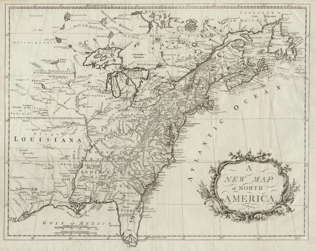
Auction 93, Lot 94
Subject: Colonial United States and Canada
Anon.
A New Map of North America, 1779-80
Size: 21.7 x 16.7 inches (55.1 x 42.4 cm)
Estimate: $1,500 - $1,600
Sold for: $1,100
Closed on 12/6/2000
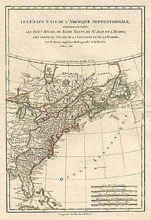
Auction 93, Lot 95
Subject: Colonial United States and Canada
Bonne, Rigobert
Les Etats Unis de l'Amerique Septentrionale, contenant en outre, les Isle Royale de Terre Neuve, de St. Jean et l'Acadie, avec Partie du Canada, de la Louisiane et de la Floride, 1781
Size: 8.5 x 12.4 inches (21.6 x 31.5 cm)
Estimate: $170 - $200
Sold for: $180
Closed on 12/6/2000
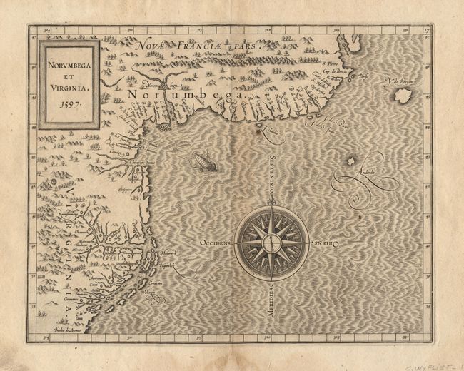
Auction 93, Lot 96
Subject: Colonial United States and Canada
Wytfliet, Cornelis
Norumbega et Virginia, 1597
Size: 11.5 x 9 inches (29.2 x 22.9 cm)
Estimate: $3,500 - $4,000
Sold for: $3,250
Closed on 12/6/2000
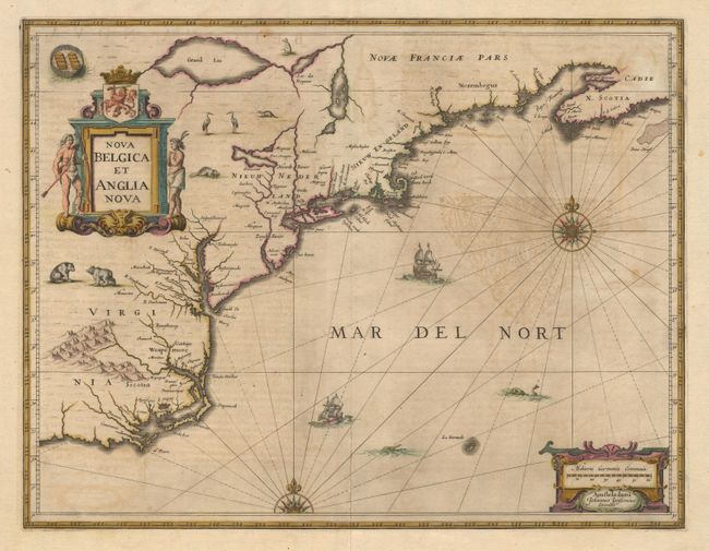
Auction 93, Lot 97
Subject: Colonial United States
Jansson
Nova Belgica et Anglia Nova, 1647-58
Size: 20 x 15.2 inches (50.8 x 38.6 cm)
Estimate: $2,400 - $2,500
Sold for: $2,400
Closed on 12/6/2000
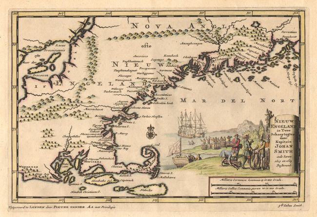
Auction 93, Lot 98
Subject: Colonial New England
Aa, Pieter van der
Nieuw Engeland in Twee Scheepstogten door Kapitein Johan Smith in de Jaren 1614 en 1615, 1710
Size: 9.3 x 6.4 inches (23.6 x 16.3 cm)
Estimate: $600 - $700
Sold for: $650
Closed on 12/6/2000
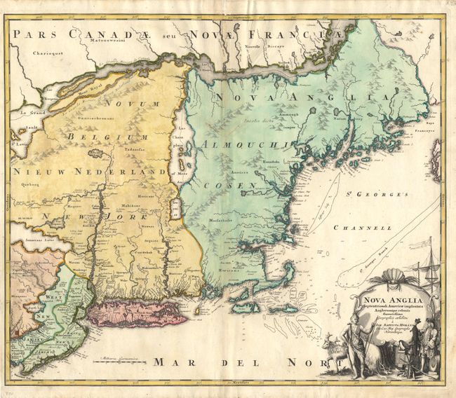
Auction 93, Lot 99
Subject: Colonial New England and Mid-Atlantic
Homann, Johann Baptist
Nova Anglia Septentrionali Americae implantata Anglorumque coloniis florentissima, 1720
Size: 22.5 x 19 inches (57.2 x 48.3 cm)
Estimate: $1,600 - $1,700
Sold for: $1,400
Closed on 12/6/2000
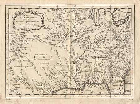
Auction 93, Lot 100
Subject: Colonial Louisiana
Bellin, Jacques Nicolas
Carte de la Louisiane et Pays Voisins, 1757
Size: 11.8 x 8.7 inches (30 x 22.1 cm)
Estimate: $400 - $450
Sold for: $325
Closed on 12/6/2000
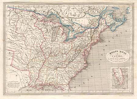
Auction 93, Lot 104
Subject: Eastern United States and Canada
Monin, Charles V.
Etats Unis et Canada, 1850
Size: 17.8 x 12.5 inches (45.2 x 31.8 cm)
Estimate: $170 - $200
Sold for: $95
Closed on 12/6/2000
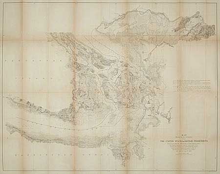
Auction 93, Lot 105
Subject: United States and Canada
Bowen & Co., John T.
Map showing the line of Boundary between the United States and British Possessions, 1872
Size: 36.3 x 28.2 inches (92.2 x 71.6 cm)
Estimate: $250 - $300
Sold for: $325
Closed on 12/6/2000
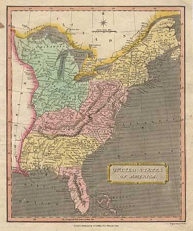
Auction 93, Lot 106
Subject: United States
Wallis, James
United States of America, 1811
Size: 8.5 x 10.1 inches (21.6 x 25.7 cm)
Estimate: $40 - $50
Sold for: $95
Closed on 12/6/2000
Auction 93, Lot 107
Subject: United States
Burr, David H.
Map of the United States Exhibiting the Several Collection Districts, 1856
Size: 49.3 x 31.2 inches (125.2 x 79.2 cm)
Estimate: $150 - $200
Sold for: $550
Closed on 12/6/2000
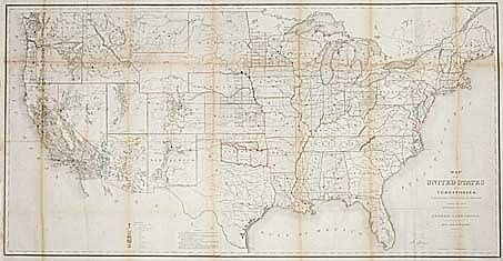
Auction 93, Lot 108
Subject: United States
General Land Office
Map of the United States and Territories Showing the extent of Public Surveys and other details constructed from the Plats and official sources of the General Land Office…, 1866
Size: 54.5 x 28 inches (138.4 x 71.1 cm)
Estimate: $400 - $500
Sold for: $300
Closed on 12/6/2000
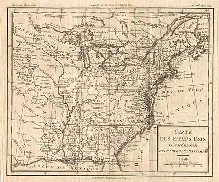
Auction 93, Lot 109
Subject: Eastern United States
Brion de la Tour, Louis
Carte des Etats-Unis d'Amerique et du Cours du Mississipi…, 1790
Size: 10.5 x 8.8 inches (26.7 x 22.4 cm)
Estimate: $500 - $550
Sold for: $550
Closed on 12/6/2000
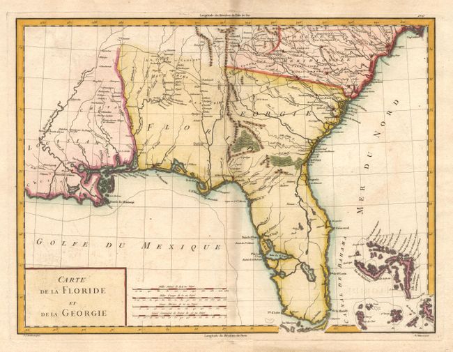
Auction 93, Lot 110
Subject: Southeastern United States
Tardieu, Pierre Francois
Carte de la Floride et de la Georgie, 1792
Size: 16.8 x 12.5 inches (42.7 x 31.8 cm)
Estimate: $500 - $600
Sold for: $425
Closed on 12/6/2000
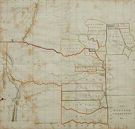
Auction 93, Lot 111
Subject: Central United States
Hood, Washington (Lt.)
Map of the Western Territory &c., 1833
Size: 17.7 x 17 inches (45 x 43.2 cm)
Estimate: $350 - $400
Sold for: $400
Closed on 12/6/2000
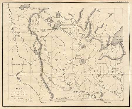
Auction 93, Lot 112
Subject: North Central United States
Allen, James (Lt.)
Map of the Route Passed over by an Expedition into the Indian Country in 1832 to the Source of the Mississippi, 1860-61
Size: 18.8 x 15.2 inches (47.8 x 38.6 cm)
Estimate: $100 - $140
Sold for: $130
Closed on 12/6/2000
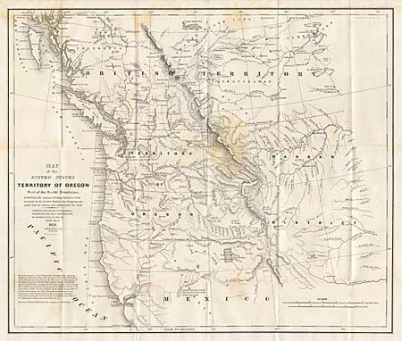
Auction 93, Lot 113
Subject: Western United States
Abert/Hood
Map of the United States Territory of Oregon West of the Rocky Mountains Exhibiting the vaious Trading Depots or Forts occupied by the British Hudson Bay Company connected with the Western and Northwestern Fur Trade, 1838
Size: 20.5 x 17.3 inches (52.1 x 43.9 cm)
Estimate: $350 - $400
Sold for: $275
Closed on 12/6/2000
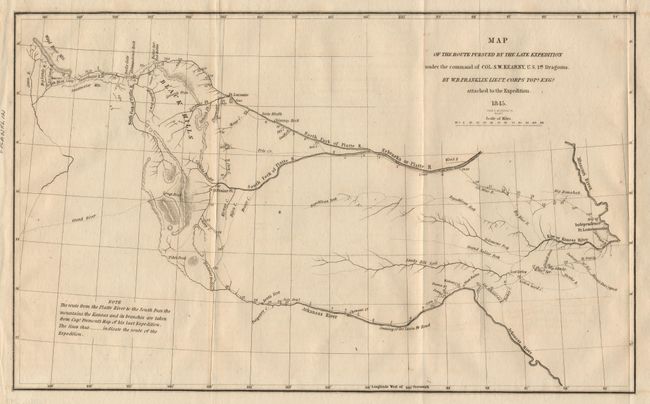
Auction 93, Lot 114
Subject: Western United States
Franklin, William Buell [Lt.]
Map of the Route Pursued by the Late Expedition under the Command of Col. S.W. Kearney, U.S. 1st Dragoons, 1845
Size: 12.8 x 8 inches (32.5 x 20.3 cm)
Estimate: $200 - $250
Sold for: $200
Closed on 12/6/2000
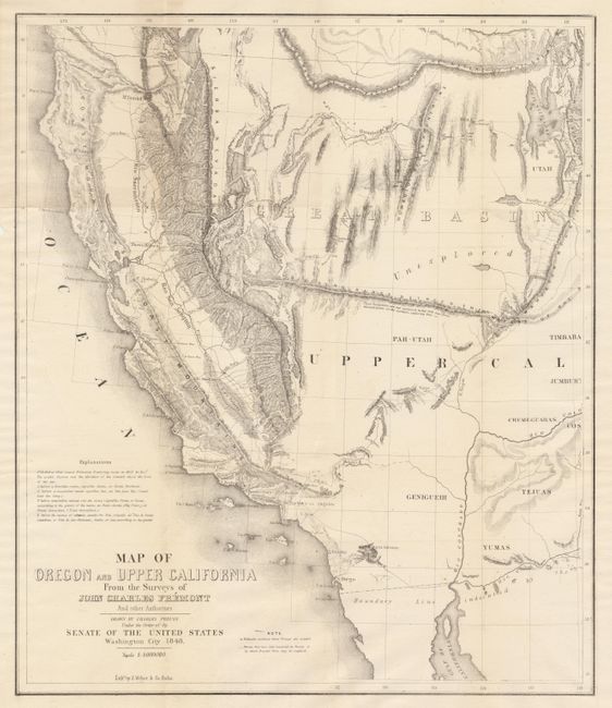
Auction 93, Lot 115
Subject: Western United States
Fremont/Preuss
Map of Oregon and Upper California from the Surveys of John Charles Fremont and other Authorities, 1850
Size: 16.5 x 19 inches (41.9 x 48.3 cm)
Estimate: $350 - $400
Sold for: $475
Closed on 12/6/2000
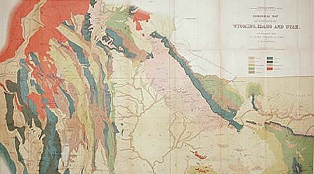
Auction 93, Lot 116
Subject: Western United States
Hayden, Ferdinand Vandeveer
Geological Map of Portions of Wyoming, Idaho and Utah…, 1885
Size: 36.1 x 20.3 inches (91.7 x 51.6 cm)
Estimate: $120 - $160
Sold for: $80
Closed on 12/6/2000
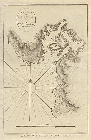
Auction 93, Lot 117
Subject: Alaska
Hogg, Alexander
Sketch of Nootka Sound. A. Ship Cove {Lat. 49.36'.N. Long. 233.18.E. Var. 17.49.E. 1778, 1778
Size: 8.4 x 12.7 inches (21.3 x 32.3 cm)
Estimate: $120 - $150
Sold for: $60
Closed on 12/6/2000

Auction 93, Lot 118
Subject: Alaska
Hogg, Alexander
Sketch of the Harbour of Samganooda, on the Island Oonalaska. Lat. 53°3 5' N. Long. 193° 30' E. Variation 20° 3' E., 1778
Size: 13 x 8 inches (33 x 20.3 cm)
Estimate: $30 - $40
Sold for: $22
Closed on 12/6/2000
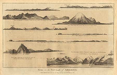
Auction 93, Lot 119
Subject: Alaska
Hogg, Alexander
Views on the West Coast of America, 1784
Size: 14.7 x 8.6 inches (37.3 x 21.8 cm)
Estimate: $40 - $40
Sold for: $60
Closed on 12/6/2000
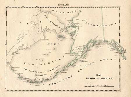
Auction 93, Lot 120
Subject: Alaska
Anon.
Das Russische Amerika, 1840
Size: 11 x 7.8 inches (27.9 x 19.8 cm)
Estimate: $150 - $170
Sold for: $120
Closed on 12/6/2000
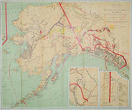
Auction 93, Lot 121
Subject: Alaska
U.S. Geological Survey (USGS)
The Gold and Coal Fields of Alaska Together with the Principal Steamer Routes and Trails, 1898
Size: 28.5 x 23.5 inches (72.4 x 59.7 cm)
Estimate: $200 - $250
Sold for: $160
Closed on 12/6/2000
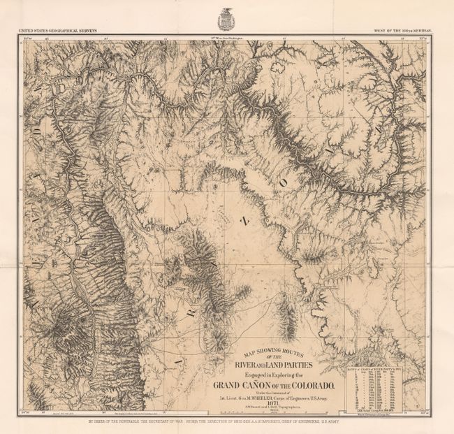
Auction 93, Lot 122
Subject: Arizona
Wheeler, George (Lt)
Map Showing Routes of the River and Land Parties Engaged in Exploring the Grand Canon of the Colorado, 1871
Size: 16.2 x 15 inches (41.1 x 38.1 cm)
Estimate: $200 - $250
Sold for: $300
Closed on 12/6/2000
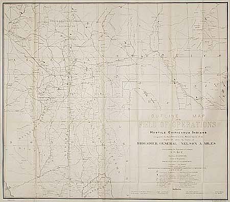
Auction 93, Lot 123
Subject: Arizona and New Mexico
U.S. War Dept.
Outline map of the Field of Operations against hostile Chiricahua Indians, 1886
Size: 28.8 x 25.2 inches (73.2 x 64 cm)
Estimate: $350 - $400
Sold for: $450
Closed on 12/6/2000
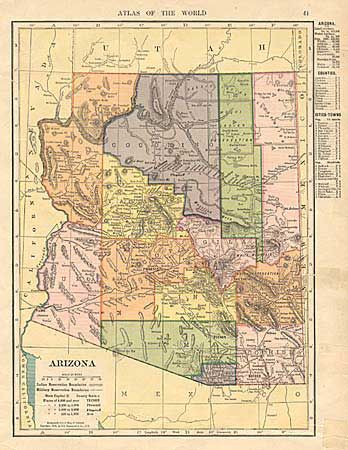
Auction 93, Lot 124
Subject: Arizona
Hammond Publishing Co.
Arizona, 1904
Size: 8 x 11 inches (20.3 x 27.9 cm)
Estimate: $15 - $20
Sold for: $11
Closed on 12/6/2000
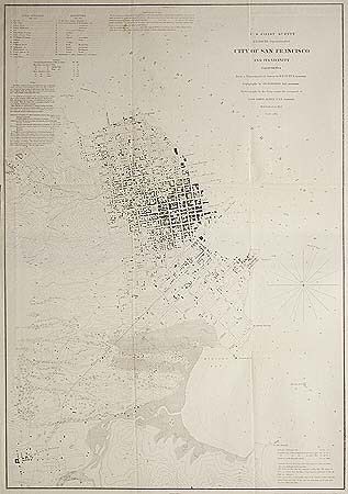
Auction 93, Lot 125
Subject: San Francisco, California
Bache, Alex D.
City of San Francisco and its Vicinity California, 1853
Size: 17.7 x 25.7 inches (45 x 65.3 cm)
Estimate: $300 - $350
Sold for: $300
Closed on 12/6/2000
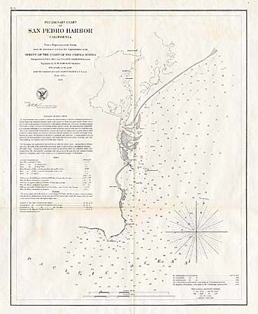
Auction 93, Lot 126
Subject: California
U.S. Coast Survey
Preliminary Chart of San Pedro Harbor California, 1859
Size: 12 x 15 inches (30.5 x 38.1 cm)
Estimate: $60 - $80
Sold for: $30
Closed on 12/6/2000
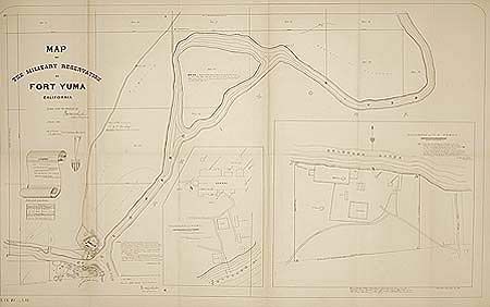
Auction 93, Lot 127
Subject: California
Wheeler, George (Lt)
Map of the Military Reservation at Fort Yuma California, 1869
Size: 23 x 15 inches (58.4 x 38.1 cm)
Estimate: $70 - $100
Sold for: $0
Closed on 12/6/2000
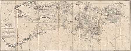
Auction 93, Lot 128
Subject: Colorado
Bechler, Gustavus R.
Map of the Country between the Yampa and White Rivers, 1876
Size: 29.7 x 11.5 inches (75.4 x 29.2 cm)
Estimate: $80 - $100
Sold for: $200
Closed on 12/6/2000
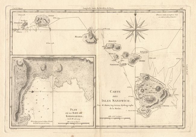
Auction 93, Lot 129
Subject: Hawaii
Bonne, Rigobert
Carte des Isles Sandwich, 1787
Size: 13.5 x 9 inches (34.3 x 22.9 cm)
Estimate: $325 - $375
Sold for: $300
Closed on 12/6/2000

Auction 93, Lot 130
Subject: Hawaii
Petermann, Augustus Herman
Karte von Hawaii mit Benutzung der daten, 1876
Size: 7.5 x 9.5 inches (19.1 x 24.1 cm)
Estimate: $180 - $225
Unsold
Closed on 12/6/2000

Auction 93, Lot 131
Subject: Hawaii
Anon.
Sandwich Eilanden, 1898
Size: 5.5 x 4 inches (14 x 10.2 cm)
Estimate: $55 - $65
Unsold
Closed on 12/6/2000
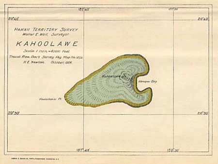
Auction 93, Lot 132
Subject: Hawaii
Hawaii Territorial Surveys
Hawaii, Hawaiian Islands [together with] Kahoolawe, 1901-06
Size: See Description
Estimate: $120 - $150
Sold for: $75
Closed on 12/6/2000
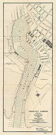
Auction 93, Lot 133
Subject: Hawaii
U.S. War Dept.
Honolulu Harbor, 1906
Size: 8 x 20.7 inches (20.3 x 52.6 cm)
Estimate: $60 - $80
Sold for: $85
Closed on 12/6/2000
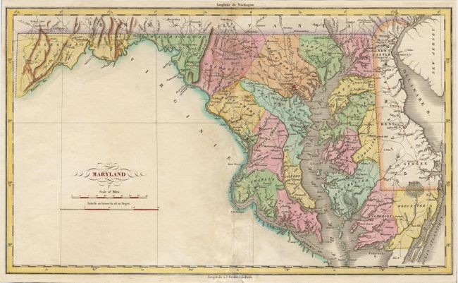
Auction 93, Lot 134
Subject: Maryland and Delaware
Buchon, Jean Alexandre
Maryland, 1825
Size: 18.5 x 11 inches (47 x 27.9 cm)
Estimate: $275 - $325
Sold for: $210
Closed on 12/6/2000

Auction 93, Lot 135
Subject: Maryland
U.S. Coast Survey
St. Mary's River Cornfield Harbor and Point Lookout Maryland, 1859
Size: 16 x 18 inches (40.6 x 45.7 cm)
Estimate: $40 - $50
Unsold
Closed on 12/6/2000
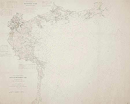
Auction 93, Lot 136
Subject: Massachusetts
U.S. Geographical Survey
Coast Charts No. 10 & 11 - Massachusetts Bay with the Coast from Cape Ann to Cape Cod, 1866
Size: 38.5 x 31 inches (97.8 x 78.7 cm)
Estimate: $400 - $450
Sold for: $300
Closed on 12/6/2000
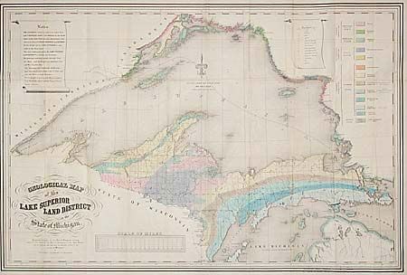
Auction 93, Lot 137
Subject: Michigan
U.S. Government
Geological Map of the Lake Superior Land District in the State of Michigan, 1847
Size: 29 x 25.7 inches (73.7 x 65.3 cm)
Estimate: $150 - $200
Sold for: $700
Closed on 12/6/2000
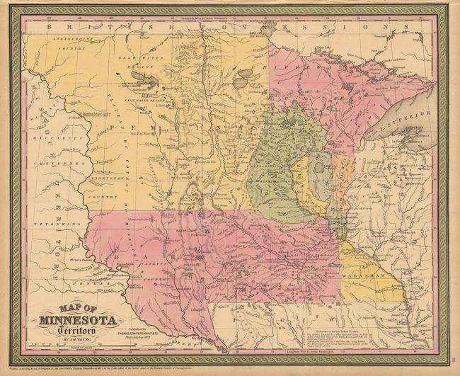
Auction 93, Lot 138
Subject: Minnesota
Young, James H.
Map of Minnesota Territory, 1852
Size: 16 x 13.2 inches (40.6 x 33.5 cm)
Estimate: $120 - $150
Sold for: $120
Closed on 12/6/2000
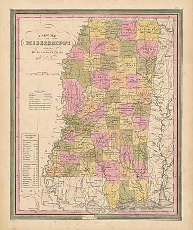
Auction 93, Lot 139
Subject: Mississippi
Tanner, Henry Schenck
A New Map of Mississippi with its Roads & Distances, 1836
Size: 11.1 x 13.7 inches (28.2 x 34.8 cm)
Estimate: $150 - $170
Sold for: $130
Closed on 12/6/2000
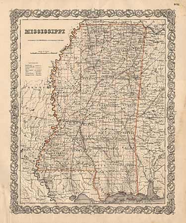
Auction 93, Lot 140
Subject: Mississippi
Colton, Joseph Hutchins
Mississippi, 1856
Size: 12.7 x 15.7 inches (32.3 x 39.9 cm)
Estimate: $40 - $50
Sold for: $75
Closed on 12/6/2000
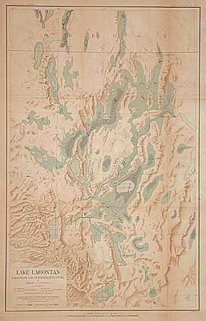
Auction 93, Lot 141
Subject: Nevada
U.S. Geological Survey (USGS)
Lake Lahontan. A Quaternary Lake of Northeastern Nevada, 1883
Size: 18.2 x 28.5 inches (46.2 x 72.4 cm)
Estimate: $70 - $90
Sold for: $50
Closed on 12/6/2000
74 lots
Page 1 of 2