Subject: Southwestern United States & MexicoCoast
Period: 1597 (circa)
Publication: Descriptionis Ptolemaicae Augmentum
Color: Black & White
Size:
11.5 x 9 inches
29.2 x 22.9 cm
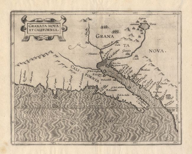
This is the first printed map to focus on California and the American Southwest, and the first atlas devoted entirely to maps of the Americas. The basis of this map is taken from Petrus Plancius's influential world map of 1592, including the error in naming the "Tropic of Capricorni" instead of the correct Cancer. The most notable feature of the map is the location of the legendary seven cities of Cibola, "Septem civitatum Patria", shown surrounding a lake, out of which flows a river that empties into the "Mar Vermeio" or Gulf of California. The information on the map is from Spanish sources including the narrative of Fray Marco de Niza in 1539 and the account of a rescue party led by Antonio de Espego in 1582.
References: Burden #106; Heckrotte #7, Wheat (TWM) #29.
Condition: A+
Good impression of this important map.