Catalog Archive
Auction 93, Lot 99

"Nova Anglia Septentrionali Americae implantata Anglorumque coloniis florentissima", Homann, Johann Baptist

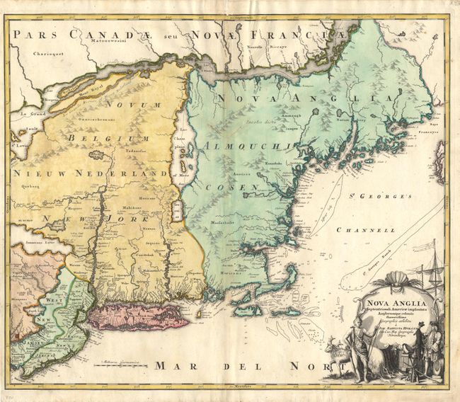
Subject: Colonial New England and Mid-Atlantic

Period: 1720 (circa)

Publication:

Color: Hand Color

Size:
22.5 x 19 inches
57.2 x 48.3 cm
Download High Resolution Image
(or just click on image to launch the Zoom viewer)

Hand colored copper engraved map of New England, from Delaware Bay to the St. John River, which formed the boundary between New England and New France. The most prominent feature of the map is the large Lake Champlain with its broad channel flowing into the St Lawrence River. Detail of settlements, both Colonial and Indian, are confined to the waterways. The eastern part of Cape Cod is shown as an island. Philadelphia and Boston are shown as the major cities, while New York is not shown. The large (uncolored) title cartouche features a European trading with an Indian chief. A very attractive 18th century map.

References: Goss #50, Protinaro & Knirsch pl. 116.

Condition: A

Repairs on centerfold with Japanese tissue.

Estimate: $1,600 - $1,700

Sold for: $1,400

Closed on 12/6/2000

Archived