Catalog Archive
Auction 93, Lot 128

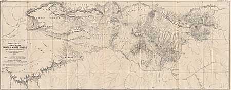
"Map of the Country between the Yampa and White Rivers", Bechler, Gustavus R.
Subject: Colorado

Period: 1876 (dated)

Publication:

Color: Black & White

Size:
29.7 x 11.5 inches
75.4 x 29.2 cm
Download High Resolution Image
(or just click on image to launch the Zoom viewer)

A map of an area of western Colorado in 1876 (the year of statehood) that includes a portion of the Green River and Split Mountain Gorge in NE Utah. The White River Agency appears to be the only inhabited site named. Several trails are noted, including the trail between the Uintah and White River Indian Agencies. Ravens, Powells, and Simpsons Parks are noted, as is the Great Yampa Plateau, Axial Basin, and Coyote Basin. Great detail.

References:

Condition: A+

Estimate: $80 - $100

Sold for: $200

Closed on 12/6/2000

Archived