Catalog Archive
Auction 93, Lot 100

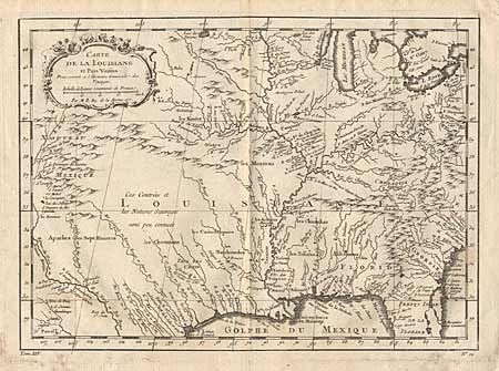
"Carte de la Louisiane et Pays Voisins", Bellin, Jacques Nicolas
Subject: Colonial Louisiana

Period: 1757 (circa)

Publication: l'Histoire Generale des Voyages

Color: Black & White

Size:
11.8 x 8.7 inches
30 x 22.1 cm
Download High Resolution Image
(or just click on image to launch the Zoom viewer)

Attractive map of the central part of North America stretching from "Nouveau Mexique" to the Carolinas, and from the Great Lakes to the Gulf of Mexico. The cartography is based on the work of Guillaume Delisle's great map which properly located the lower Mississippi River. The map shows strategic forts and areas claimed by the French just prior to the French and Indian War. Many Indian names, as well as early European settlements. Decorative title cartouche.

References:

Condition: B

Very faint dampstain, else fine.

Estimate: $400 - $450

Sold for: $325

Closed on 12/6/2000

Archived