Filtered by Category:United States(Show All Categories)
Showing results for:Auction 194
Catalog Archive
220 lots
Page 1 of 5
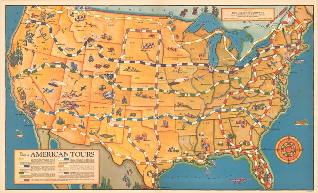
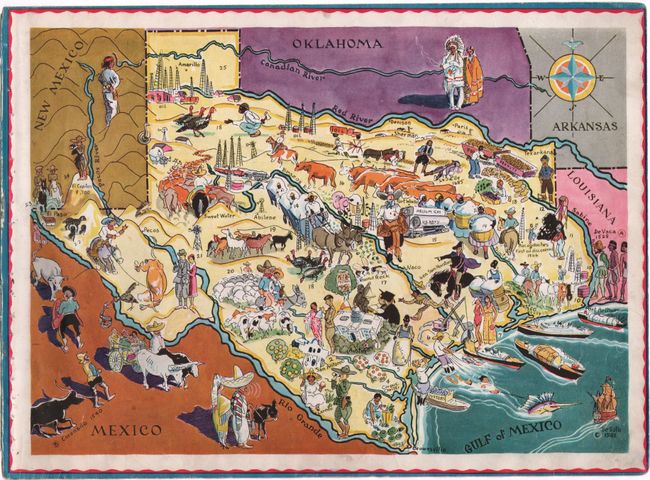
Auction 194, Lot 47
Subject: Cartographic Miscellany, Games, United States
The Game of American Tours, 1933
Size: 28.6 x 17.3 inches (72.6 x 43.9 cm)
Estimate: $275 - $350
Complete Depression-Era Map Board Game
Sold for: $210
Closed on 9/13/2023
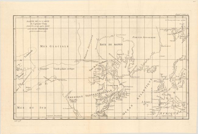
Auction 194, Lot 103
Subject: Colonial United States & Canada, Arctic
Robert de Vaugondy, Didier
Partie de la Carte du Capitaine Cluny Auteur d'un Ouvrage Anglois Intitule American Traveller, 1773
Size: 19 x 11.5 inches (48.3 x 29.2 cm)
Estimate: $120 - $150
Sold for: $90
Closed on 9/13/2023
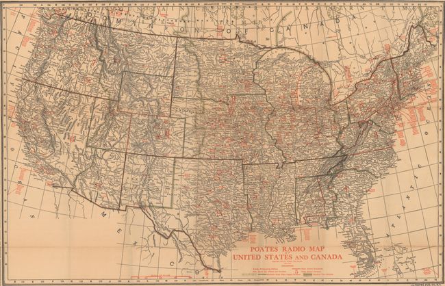
Auction 194, Lot 104
Subject: United States & Southern Canada
Poates Radio Map of United States and Canada, 1924
Size: 29.8 x 19.3 inches (75.7 x 49 cm)
Estimate: $160 - $190
Sold for: $130
Closed on 9/13/2023
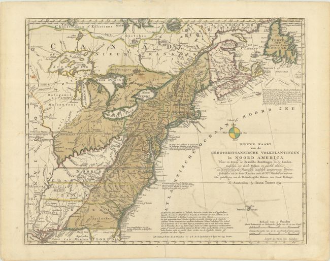
Auction 194, Lot 105
Subject: Colonial Eastern United States & Canada
Tirion, Isaac
Nieuwe Kaart van de Grootbrittannische Volkplantingen in Noord America waar in Tevens de Fransche Bezittingen en de Landen..., 1755
Size: 17.8 x 14.4 inches (45.2 x 36.6 cm)
Estimate: $550 - $700
Sold for: $400
Closed on 9/13/2023
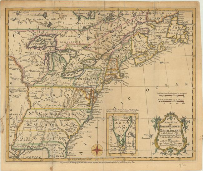
Auction 194, Lot 106
Subject: Colonial Eastern United States & Canada
Kitchin, Thomas
A New Map of the British Dominions in North America; with the Limits of the Governments Annexed Thereto by the Late Treaty of Peace, and Settled by Proclamation, October 7th, 1763, 1763
Size: 11.8 x 9.5 inches (30 x 24.1 cm)
Estimate: $400 - $475
Sold for: $700
Closed on 9/13/2023
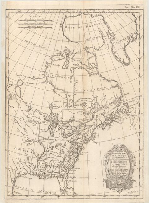
Auction 194, Lot 107
Subject: Colonial Eastern United States & Canada
Bonne, Rigobert
Partie du Nord de l'Amerique Septentrionale, pour Servir a l'Histoire Philosophique et Politique des Etablissemens et du Commerce des Europeens dans les Deux Indes, 1774
Size: 9.3 x 12.7 inches (23.6 x 32.3 cm)
Estimate: $150 - $180
Sold for: $95
Closed on 9/13/2023
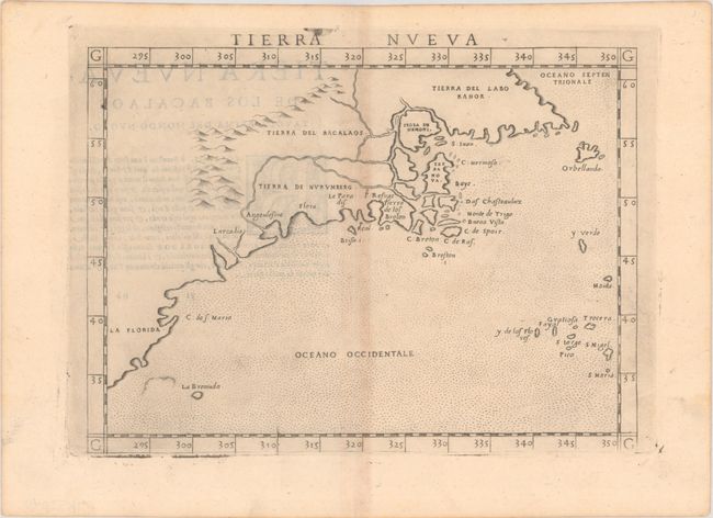
Auction 194, Lot 108
Subject: Eastern United States & Canada
Ruscelli, Girolamo
Tierra Nueva, 1574
Size: 9.8 x 7.1 inches (24.9 x 18 cm)
Estimate: $1,200 - $1,500
Ruscelli's Map of the East Coast
Sold for: $750
Closed on 9/13/2023
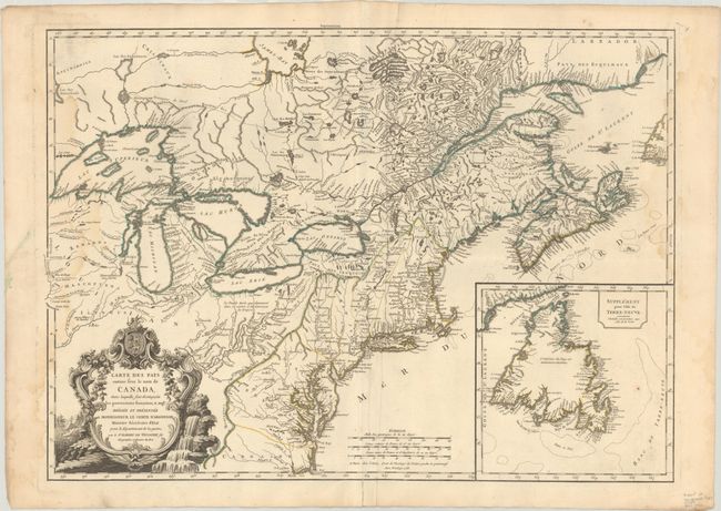
Auction 194, Lot 109
Subject: Colonial Northeastern United States & Canada
Robert de Vaugondy, Didier
Carte des Pays Connus sous le Nom de Canada, dans Laquelle sont Distinguees les Possessions Francoises, & Angl?..., 1755
Size: 26.4 x 18.9 inches (67.1 x 48 cm)
Estimate: $2,000 - $2,400
A Separately Issued, French Political Propaganda Map at the Outset of the French & Indian War
Sold for: $1,500
Closed on 9/13/2023
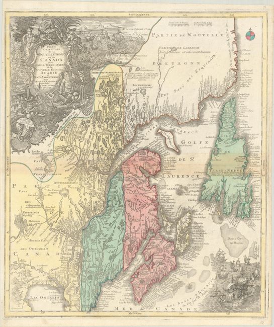
Auction 194, Lot 110
Subject: Colonial Northeastern United States & Canada
Seutter/Lotter
Partie Orientale de la Nouvelle France ou du Canada avec l'Isle de Terre-Neuve et de Nouvelle Escosse, Acadie et Nouv. Angleterre…, 1756
Size: 19.5 x 22.7 inches (49.5 x 57.7 cm)
Estimate: $1,100 - $1,400
Sold for: $800
Closed on 9/13/2023
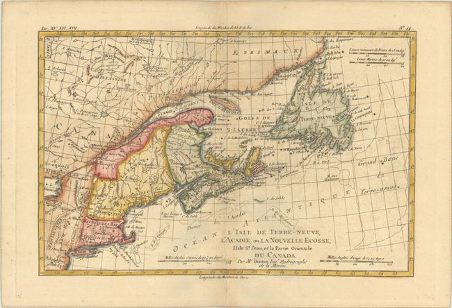
Auction 194, Lot 111
Subject: Colonial Northeastern United States & Canada
Bonne, Rigobert
L'Isle de Terre-Neuve, l'Acadie, ou la Nouvelle Ecosse, l'Isle St. Jean, et la Partie Orientale du Canada, 1782
Size: 12.4 x 8.1 inches (31.5 x 20.6 cm)
Estimate: $140 - $170
Sold for: $100
Closed on 9/13/2023
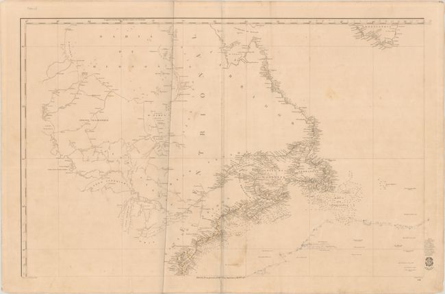
Auction 194, Lot 112
Subject: Northeastern United States & Canada
Direccion de Hidrografia
[Carta General del Oceano Atlantico Septentrional en Cuatro Hojas... - Northwestern Sheet] Hoja 3a. su Precio 13 Rs. Vn. En America 7 Rs. Pta. Fte., 1855
Size: 35.8 x 22.9 inches (90.9 x 58.2 cm)
Estimate: $300 - $400
NO RESERVE
Sold for: $21
Closed on 9/13/2023
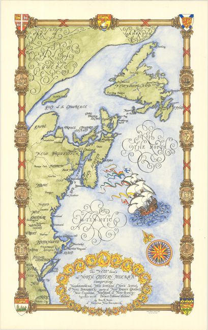
Auction 194, Lot 113
Subject: Northeastern United States & Canada
The "New" Lands of North Eastern America. Comprising Newfoundland, New Scotland (Nova Scotia), & New Brunswick: Parts of New France (Quebec), New England, New York & New Jersey..., 1960
Size: 13.3 x 22.2 inches (33.8 x 56.4 cm)
Estimate: $500 - $650
Rare Hand Colored Pictorial Map of New England and Eastern Canada, from the Estate of the Artist
Sold for: $300
Closed on 9/13/2023
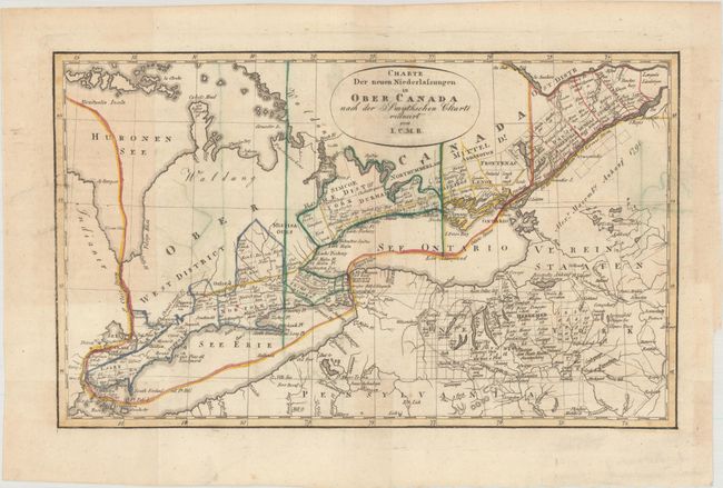
Auction 194, Lot 114
Subject: Northeastern United States & Canada, Great Lakes
I.C.M.R.
Charte der Neuen Niederlassungen in Ober Canada nach der Smythschen Charte, 1815
Size: 12.1 x 7.4 inches (30.7 x 18.8 cm)
Estimate: $200 - $230
Sold for: $150
Closed on 9/13/2023
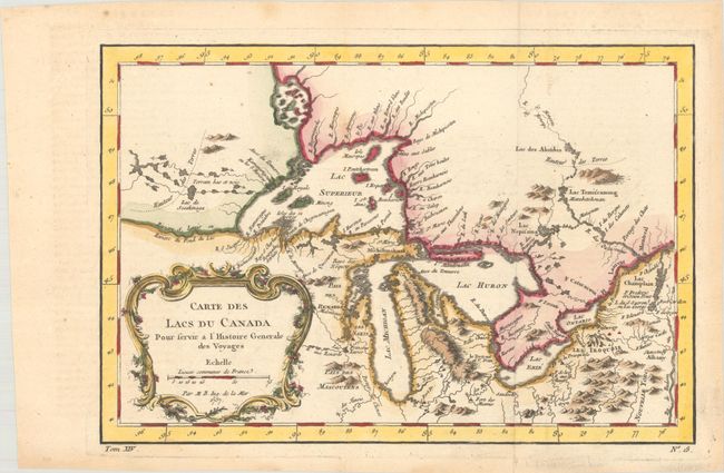
Auction 194, Lot 115
Subject: Colonial Great Lakes
Bellin, Jacques Nicolas
Carte des Lacs du Canada pour Servir a l'Histoire Generale de Voyages, 1757
Size: 11.5 x 7.8 inches (29.2 x 19.8 cm)
Estimate: $450 - $550
Sold for: $400
Closed on 9/13/2023
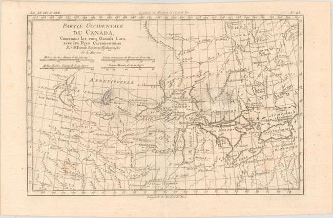
Auction 194, Lot 116
Subject: Colonial Great Lakes
Bonne, Rigobert
Partie Occidentale du Canada, Contenant les Cinq Grands Lacs, avec les Pays Circonvoisins, 1780
Size: 12.5 x 8.1 inches (31.8 x 20.6 cm)
Estimate: $200 - $230
Sold for: $150
Closed on 9/13/2023
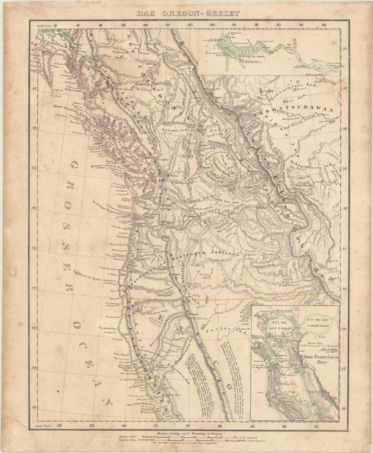
Auction 194, Lot 117
Subject: Western United States & Canada
Flemming, Carl
Das Oregon-Gebiet, 1848
Size: 12.6 x 16.1 inches (32 x 40.9 cm)
Estimate: $180 - $220
Sold for: $100
Closed on 9/13/2023
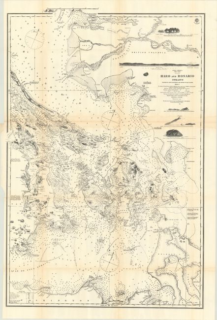
Auction 194, Lot 118
Subject: Washington & British Columbia
British Admiralty
[Reproduction] North America West Coast Haro and Rosario Straits Surveyed by Captn. G.H. Richards & the Officers of H.M.S. Plumper 1858-9, the Shores of Juan de Fuca Strait to Admiralty Inlet from Captn. H. Kellett’s Survey, 1847…, 1872
Size: 22.8 x 34.1 inches (57.9 x 86.6 cm)
Estimate: $160 - $190
Sold for: $70
Closed on 9/13/2023
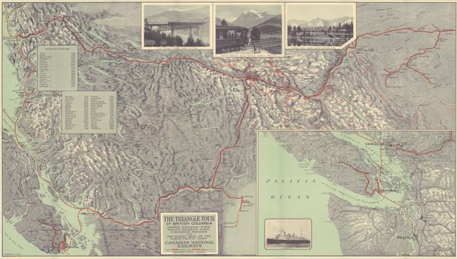
Auction 194, Lot 119
Subject: Washington & British Columbia
The Triangle Tour of British Columbia Jasper National Park Mount Robson Park Canadian Rockies and the Scenic Seas of the North Pacific Coast Canadian National Railways, 1930
Size: 29.8 x 16.8 inches (75.7 x 42.7 cm)
Estimate: $200 - $230
Sold for: $70
Closed on 9/13/2023
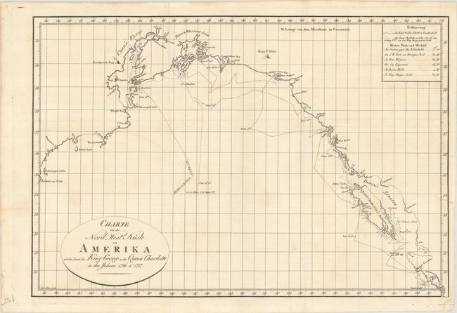
Auction 194, Lot 120
Subject: Western Canada & Alaska
Charte von der Nord-West Kuste von Amerika mit dem Laufe des King George u: der Queen Charlotte in den Jahren 1786 & 1787, 1791
Size: 17.4 x 11.8 inches (44.2 x 30 cm)
Estimate: $275 - $350
Sold for: $200
Closed on 9/13/2023
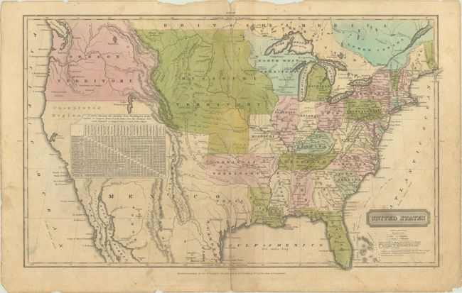
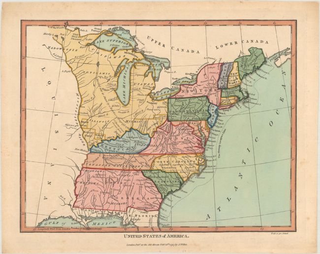
Auction 194, Lot 121
Subject: United States
Robinson, D.F. & Co.
United States, 1828
Size: 16.9 x 10.3 inches (42.9 x 26.2 cm)
Estimate: $220 - $250
Sold for: $425
Closed on 9/13/2023
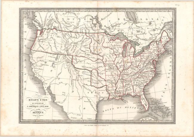
Auction 194, Lot 122
Subject: United States, Republic of Texas
Anon.
Etats Unis et Partie de l'Amerique Anglaise et du Mexique Corriges et Augmentes, 1836
Size: 13.9 x 10.4 inches (35.3 x 26.4 cm)
Estimate: $160 - $190
Sold for: $250
Closed on 9/13/2023
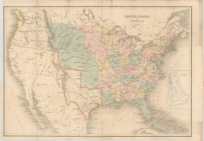
Auction 194, Lot 123
Subject: United States, Texas
Wyld, James
United States of America, 1845
Size: 21.4 x 14.9 inches (54.4 x 37.8 cm)
Estimate: $700 - $850
Sold for: $800
Closed on 9/13/2023
Auction 194, Lot 124
Subject: United States
Phelps & Watson
Phelps' New National Map of the United States, 1859
Size: 35.8 x 38 inches (90.9 x 96.5 cm)
Estimate: $2,400 - $3,000
Attractive Wall Map Issued at the Onset of the Civil War
Sold for: $1,800
Closed on 9/13/2023
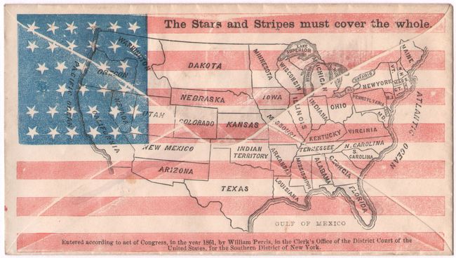
Auction 194, Lot 125
Subject: United States, Civil War
[Unused Civil War Envelope] The Stars and Stripes Must Cover the Whole, 1861
Size: 5.3 x 3 inches (13.5 x 7.6 cm)
Estimate: $60 - $80
NO RESERVE
Sold for: $140
Closed on 9/13/2023
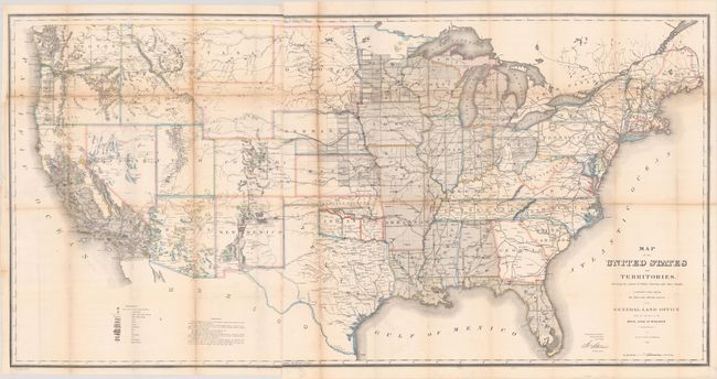
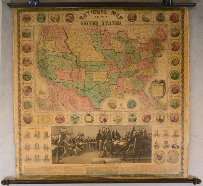
Auction 194, Lot 126
Subject: United States
General Land Office
Map of the United States and Territories, Shewing the Extent of Public Surveys and Other Details... [with] Vericht des Commissionar des General-Landamtes, der Vereinigten Staaten von Amerika..., 1867
Size: 55.4 x 28 inches (140.7 x 71.1 cm)
Estimate: $300 - $375
Sold for: $220
Closed on 9/13/2023
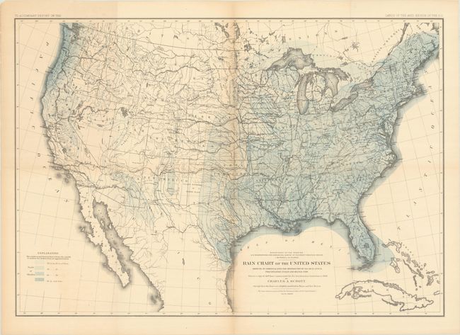
Auction 194, Lot 127
Subject: United States
Powell, John Wesley
Rain Chart of the United States Showing by Isohyetal Lines the Distribution of the Mean Annual Precipitation in Rain and Melted Snow, 1878
Size: 28.4 x 19.9 inches (72.1 x 50.5 cm)
Estimate: $140 - $170
Sold for: $70
Closed on 9/13/2023
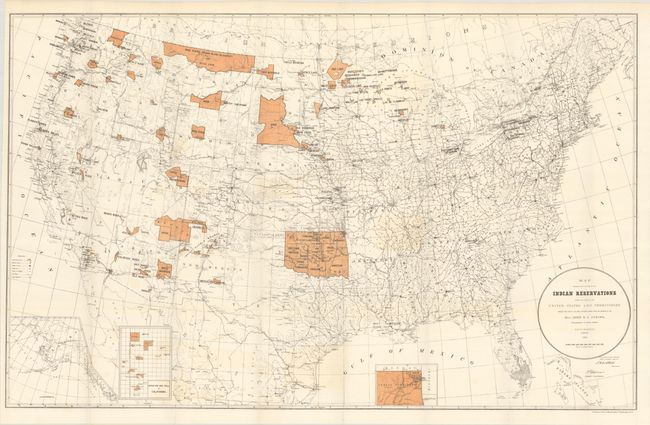
Auction 194, Lot 128
Subject: United States, Native Americans
U.S. Bureau of Indian Affairs
Map Showing the Location of the Indian Reservations Within the Limits of the United States and Territories..., 1887
Size: 33.3 x 21 inches (84.6 x 53.3 cm)
Estimate: $180 - $220
Sold for: $200
Closed on 9/13/2023
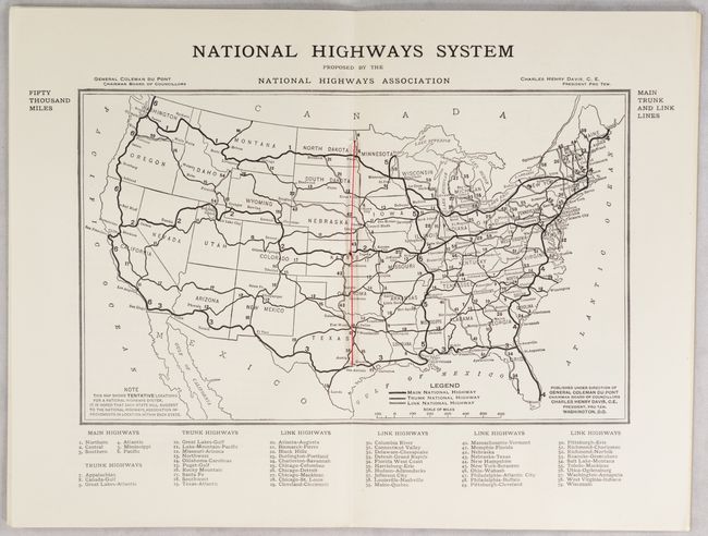
Auction 194, Lot 129
Subject: United States
National Highways, 1913
Size: 6.3 x 9.3 inches (16 x 23.6 cm)
Estimate: $160 - $190
Sold for: $450
Closed on 9/13/2023
Auction 194, Lot 130
Subject: United States, Atlases
Harper Bros.
Berta and Elmer Hader's Picture Book of the States, 1932
Size: 12.4 x 9.3 inches (31.5 x 23.6 cm)
Estimate: $240 - $300
Sold for: $180
Closed on 9/13/2023
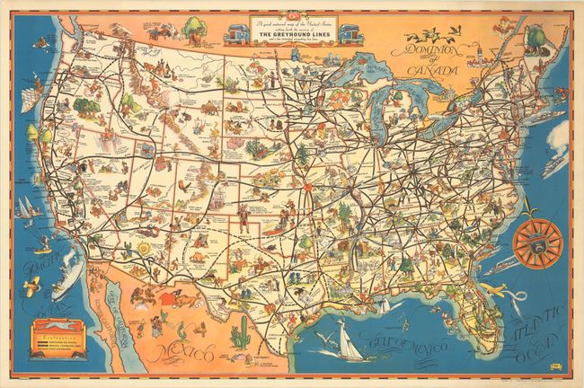
Auction 194, Lot 131
Subject: United States
A Good-Natured Map of the United States Setting Forth the Services of the Greyhound Lines and a Few Principal Connecting Bus Lines, 1934
Size: 29.1 x 19.1 inches (73.9 x 48.5 cm)
Estimate: $240 - $300
Unsold
Closed on 9/13/2023
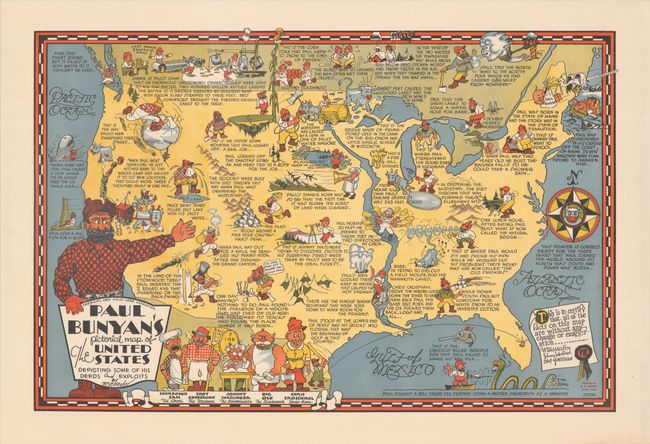
Auction 194, Lot 132
Subject: United States
Paul Bunyan's Pictorial Map of the United States Depicting Some of His Deeds and Exploits, 1935
Size: 28.8 x 19.1 inches (73.2 x 48.5 cm)
Estimate: $400 - $475
Sold for: $300
Closed on 9/13/2023
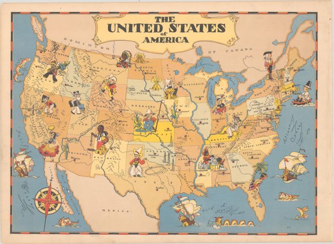
Auction 194, Lot 133
Subject: United States
White, Ruth Taylor
The United States of America, 1935
Size: 11.7 x 8.6 inches (29.7 x 21.8 cm)
Estimate: $90 - $110
Sold for: $45
Closed on 9/13/2023
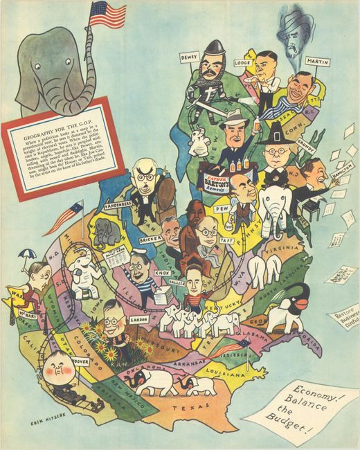
Auction 194, Lot 134
Subject: United States
[Lot of 2] Geography for the G.O.P. [and] The 50 United States of America, 1939-60
Size: See Description
Estimate: $160 - $190
Sold for: $120
Closed on 9/13/2023
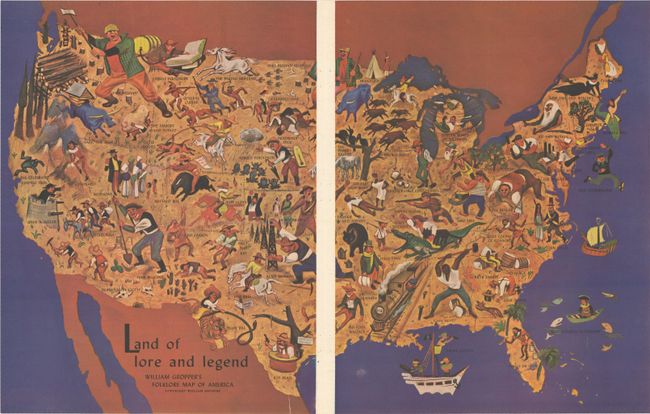
Auction 194, Lot 135
Subject: United States
Land of Lore and Legend - William Gropper's Folklore Map of America, 1946
Size: 21.5 x 13.7 inches (54.6 x 34.8 cm)
Estimate: $200 - $230
Sold for: $150
Closed on 9/13/2023
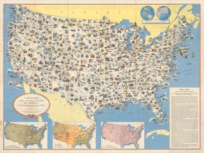
Auction 194, Lot 136
Subject: United States
A Pictorial Map of the United States of America Showing Principal Regional Resources, Products, and Natural Features, 1950
Size: 31.3 x 23.3 inches (79.5 x 59.2 cm)
Estimate: $120 - $150
Sold for: $50
Closed on 9/13/2023
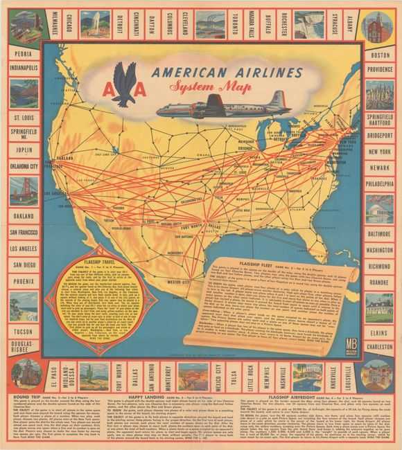
Auction 194, Lot 137
Subject: United States, Aviation, Games
Milton Bradley Co.
American Airlines System Map, 1955
Size: 15 x 16.8 inches (38.1 x 42.7 cm)
Estimate: $80 - $100
NO RESERVE
Sold for: $55
Closed on 9/13/2023
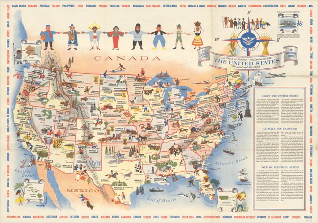
Auction 194, Lot 138
Subject: United States
The United States - The Land and the People, 1958
Size: 25.9 x 18.3 inches (65.8 x 46.5 cm)
Estimate: $160 - $190
Sold for: $120
Closed on 9/13/2023
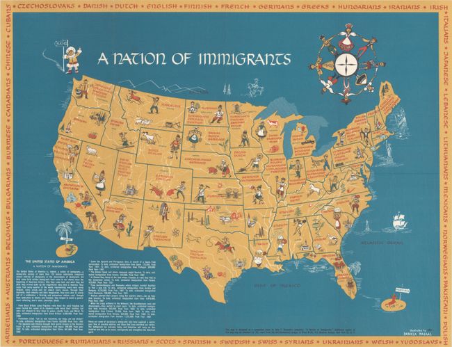
Auction 194, Lot 139
Subject: United States
[Map with Pamphlet] A Nation of Immigrants , 1963
Size: 21.5 x 16.6 inches (54.6 x 42.2 cm)
Estimate: $475 - $600
Sold for: $550
Closed on 9/13/2023
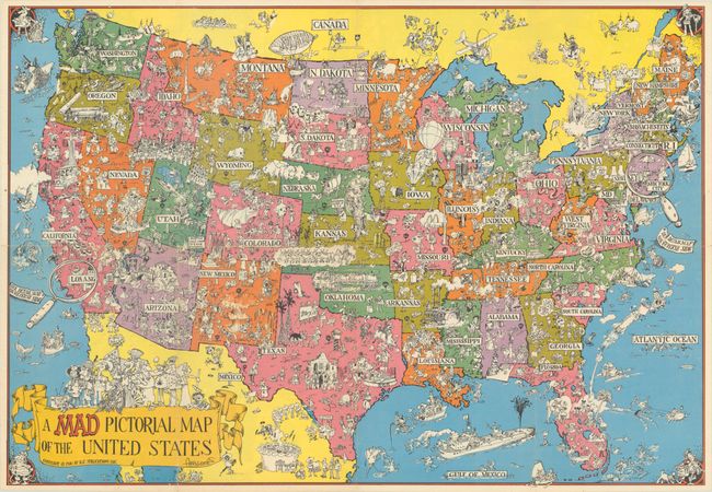
Auction 194, Lot 140
Subject: United States
A Mad Pictorial Map of the United States, 1981
Size: 28.9 x 20 inches (73.4 x 50.8 cm)
Estimate: $120 - $150
Sold for: $85
Closed on 9/13/2023
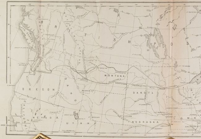
Auction 194, Lot 141
Subject: Northern United States
[Lot of 2] Plan of the Route of the Northern Pacific Railroad [in] Charter of the Northern Pacific Railroad Co... [and] Profile Shewing the General Features of the Route of the Proposed Railroad to the Pacific..., 1853-65
Size: See Description
Estimate: $240 - $300
Sold for: $170
Closed on 9/13/2023
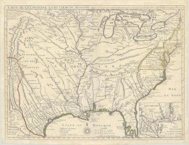
Auction 194, Lot 142
Subject: Colonial Eastern United States
Delisle, Guillaume
Carte de la Louisiane et du Cours du Mississipi Dressee sur un Grand Nombre de Memoires Entr'autres sur ceux de Mr. le Maire, 1718
Size: 25.6 x 19.2 inches (65 x 48.8 cm)
Estimate: $6,000 - $7,500
A Foundation Map for the Mississippi Valley and the First Appearance of Texas on a Printed Map - First Issue
Sold for: $8,000
Closed on 9/13/2023
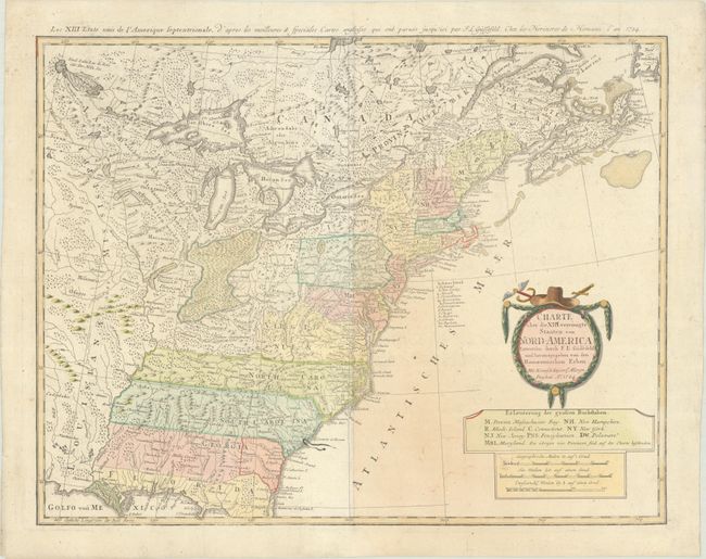
Auction 194, Lot 143
Subject: Eastern United States
Gussefeld/Homann Heirs
Charte uber die XIII Vereinigte Staaten von Nord-America..., 1784
Size: 22.6 x 17.6 inches (57.4 x 44.7 cm)
Estimate: $600 - $750
Sold for: $450
Closed on 9/13/2023
Auction 194, Lot 144
Subject: Eastern United States
Wilkes, J.
United States of America, 1797
Size: 9.5 x 7.3 inches (24.1 x 18.5 cm)
Estimate: $180 - $220
Sold for: $160
Closed on 9/13/2023
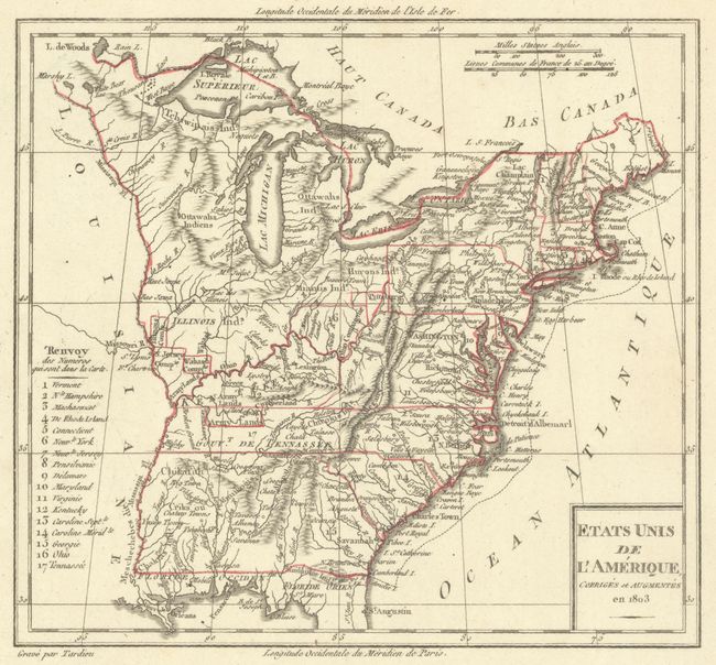
Auction 194, Lot 145
Subject: Eastern United States
Tardieu
Etats Unis de l'Amerique, Corriges et Augmentes en 1803, 1803
Size: 7.9 x 7.2 inches (20.1 x 18.3 cm)
Estimate: $100 - $130
Sold for: $55
Closed on 9/13/2023
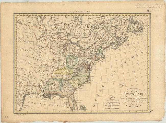
Auction 194, Lot 146
Subject: Eastern United States
Lapie, Alexander Emile & Pierre
Etats-Unis de l'Amerique Septentrionale, 1810
Size: 11.8 x 8.7 inches (30 x 22.1 cm)
Estimate: $110 - $140
Sold for: $170
Closed on 9/13/2023
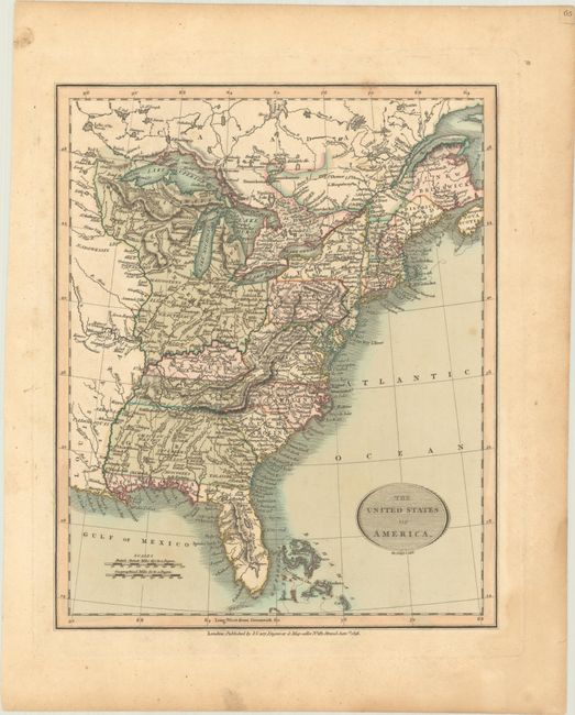
Auction 194, Lot 147
Subject: Eastern United States
Cary, John
The United States of America, 1816
Size: 9.2 x 11.2 inches (23.4 x 28.4 cm)
Estimate: $350 - $425
Sold for: $450
Closed on 9/13/2023
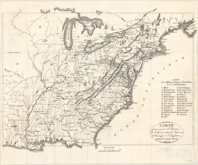
Auction 194, Lot 148
Subject: Eastern United States
Carte pour Servir a l'Histoire de la Guerre Entre les Etats-Unis d'Amerique et l'Angleterre, Pendant les Annees 1812, 13, 14 et 15, 1820
Size: 13.1 x 9.9 inches (33.3 x 25.1 cm)
Estimate: $160 - $190
Sold for: $120
Closed on 9/13/2023
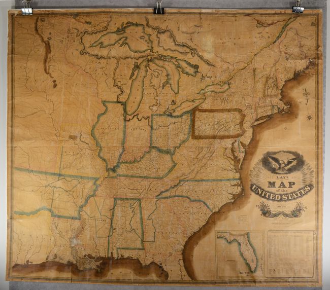
Auction 194, Lot 149
Subject: Eastern United States, Texas
Lay, Amos
Lay's Map of the United States. Compiled From the Latest and Best Authorities and Actual Surveys, 1827
Size: 60 x 51 inches (152.4 x 129.5 cm)
Estimate: $2,750 - $3,500
First Edition of Lay's Mammoth Map of the Young United States - Early Naming of Austin's Settlement
Sold for: $2,400
Closed on 9/13/2023
Auction 194, Lot 150
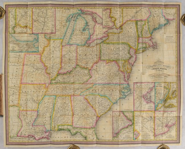
Subject: Eastern United States
Mitchell/Young
Mitchell's Travellers Guide Through the United States. A Map of the Roads, Distances, Steam Boat & Canal Routes &c., 1832
Size: 21.6 x 17.1 inches (54.9 x 43.4 cm)
Estimate: $600 - $750
Sold for: $550
Closed on 9/13/2023
Auction 194, Lot 151
Subject: Eastern United States
Marshall, John
Atlas to Marshall's Life of Washington, 1832
Size: 5.8 x 8.8 inches (14.7 x 22.4 cm)
Estimate: $275 - $350
Sold for: $240
Closed on 9/13/2023
220 lots
Page 1 of 5