Subject: United States
Period: 1950 (circa)
Publication:
Color: Printed Color
Size:
31.3 x 23.3 inches
79.5 x 59.2 cm
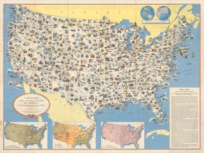
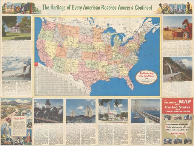
This is the first edition of this information-packed map created by the General Drafting Company. The main map features over 700 drawings in full color including points of interest, natural resources, and agricultural products. At bottom are inset maps showing railroad lines, air routes, and highways. The verso contains a road map of the United States with a mileage chart and points of interest surrounding it. This map was reissued several times with various sponsors including the New Jersey Bell Telephone Company and Department of State.
References: Rumsey #8140.
Condition: B+
Issued folding with several minor fold separations, including one measuring 2" at bottom that has been closed on verso with archival tape. There is faint staining in the left blank margin.