Subject: Colonial Northeastern United States & Canada
Period: 1756 (circa)
Publication:
Color: Hand Color
Size:
19.5 x 22.7 inches
49.5 x 57.7 cm
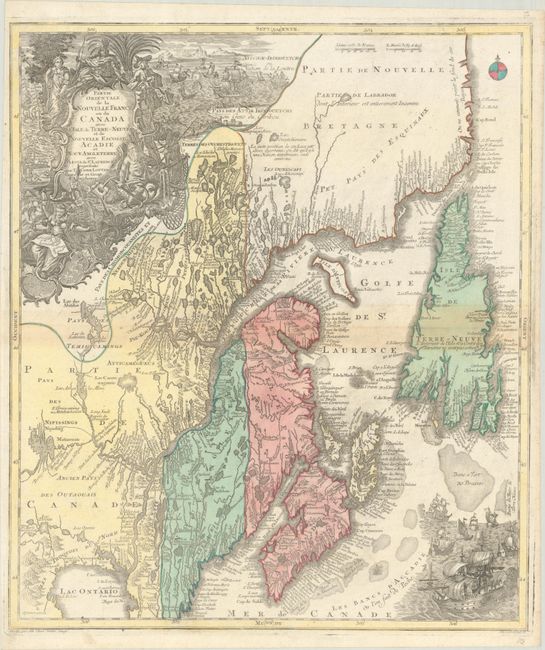
A beautiful map of Maine and northeastern Canada, including Nova Scotia, Labrador and Newfoundland. This is the second state of the map originally drawn by Seutter and engraved by Lotter, with Lotter's imprint in the title cartouche. The map's vertical format elongates the geography, which distorts Newfoundland and depicts the St. Lawrence River running nearly north-south. It is very detailed, especially along the coastlines and rivers with many place names noted, both European and Indian, including Casco Bay (Baye de Casco), the Penobscot River, Wells, and Cape Elizabeth. At bottom right is a scene with several sailing ships. At top left is a huge decorative title cartouche featuring allegorical figures, Indian chiefs, explorers, mapmakers, a fleet of ships, fishermen and wildlife.
References: Kershaw #344; Moreland and Bannister, p. 90; Sellers & Van Ee #278.
Condition: B+
A nice impression with full contemporary color on a bright sheet with some toning on centerfold and a minor crease at top left.