Filtered by Category:United States(Show All Categories)
Showing results for:Auction 144
Catalog Archive
53 lots
Page 1 of 2
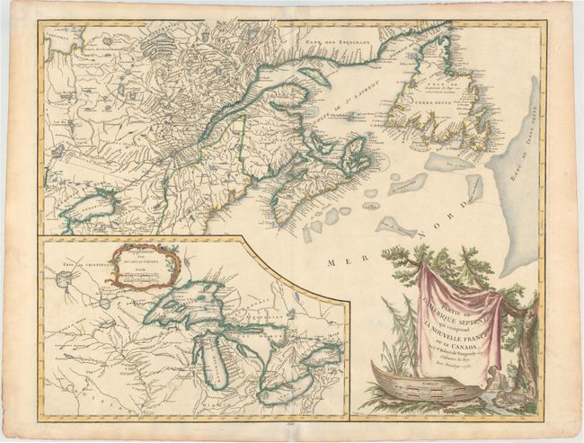
Auction 144, Lot 49
Subject: Colonial United States & Canada, Great Lakes
Robert de Vaugondy
Partie de l'Amerique Septent? qui Comprend la Nouvelle France ou le Canada, 1755
Size: 23.5 x 18.5 inches (59.7 x 47 cm)
Estimate: $800 - $950
Unsold
Closed on 4/3/2013
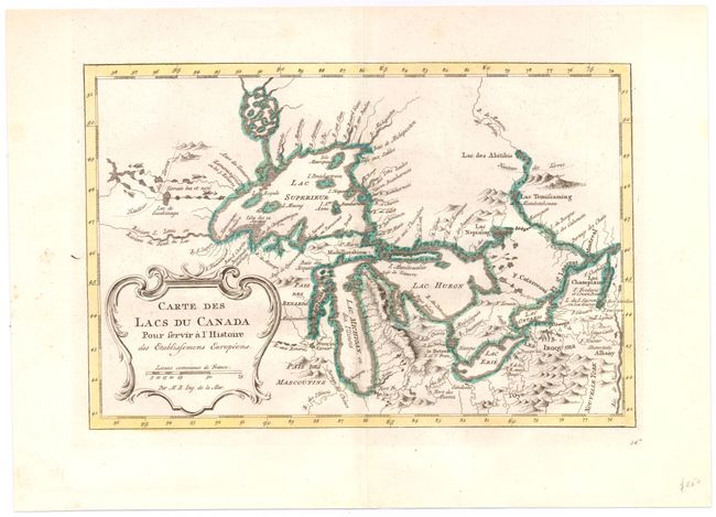
Auction 144, Lot 50
Subject: Colonial United States & Canada, Great Lakes
Bellin, Jacques Nicolas
Carte des Lacs du Canada pour Servir a l'Histoire des Etablissemens Europeens, 1773
Size: 11.2 x 7.4 inches (28.4 x 18.8 cm)
Estimate: $450 - $550
Sold for: $550
Closed on 4/3/2013
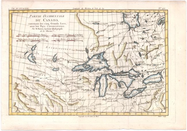
Auction 144, Lot 51
Subject: Colonial United States & Canada, Great Lakes
Bonne, Rigobert
Partie Occidentale du Canada, Contenant les Cinq Grands Lacs, avec les Pays Circonvoisins, 1780
Size: 12.3 x 8.3 inches (31.2 x 21.1 cm)
Estimate: $350 - $450
Sold for: $550
Closed on 4/3/2013
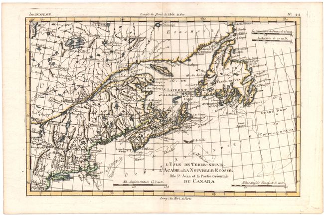
Auction 144, Lot 52
Subject: Colonial United States & Canada
Bonne, Rigobert
L'Isle de Terre-Neuve, l'Acadie, ou la Nouvelle Ecosse, l'Isle St Jean et la Partie Orientale du Canada, 1780
Size: 12.6 x 8.5 inches (32 x 21.6 cm)
Estimate: $200 - $250
Sold for: $150
Closed on 4/3/2013
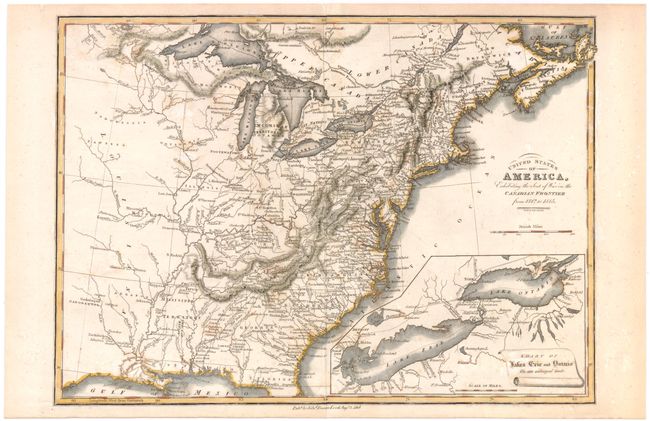
Auction 144, Lot 53
Subject: United States & Canada
Baines, Edward
United States of America, Exhibiting the Seat of War on the Canadian Frontier from 1812 to 1815, 1816
Size: 13.5 x 9.5 inches (34.3 x 24.1 cm)
Estimate: $275 - $350
Sold for: $500
Closed on 4/3/2013
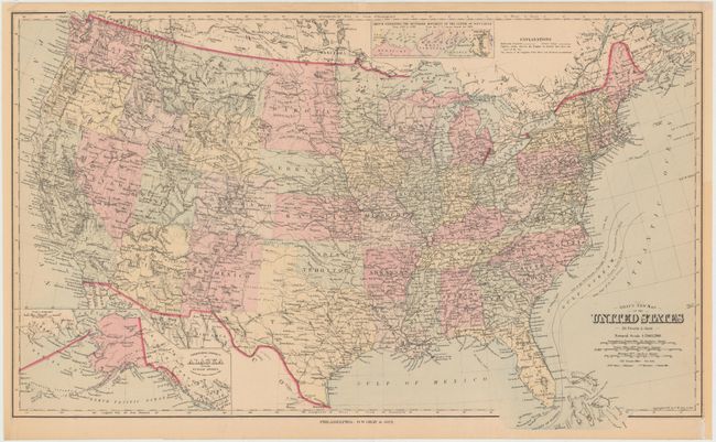
Auction 144, Lot 54
Subject: United States
Gray, Frank
Gray's New Map of the United States, 1879
Size: 26.8 x 16.2 inches (68.1 x 41.1 cm)
Estimate: $80 - $100
Sold for: $60
Closed on 4/3/2013
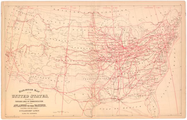
Auction 144, Lot 55
Subject: United States, Railroads
Mitchell/Bradley
Railroad Map of the United States, Showing the through Lines of Communication from the Atlantic to the Pacific. Together with the Various Steamship Lines along the Seaboard, 1884
Size: 22.6 x 14.2 inches (57.4 x 36.1 cm)
Estimate: $100 - $130
Sold for: $160
Closed on 4/3/2013
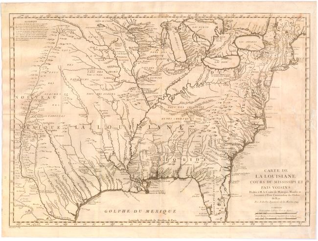
Auction 144, Lot 56
Subject: Colonial Eastern United States
Bellin, Jacques Nicolas
Carte de la Louisiane Cours du Mississipi et Pais Voisins…, 1744
Size: 22 x 15.5 inches (55.9 x 39.4 cm)
Estimate: $800 - $1,000
Sold for: $850
Closed on 4/3/2013
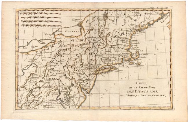
Auction 144, Lot 57
Subject: Colonial Eastern United States
Bonne/Raynal
Carte de la Partie Nord, des Etats Unis, de l'Amerique Septentrionale, 1780
Size: 12.5 x 8.2 inches (31.8 x 20.8 cm)
Estimate: $140 - $170
Sold for: $100
Closed on 4/3/2013
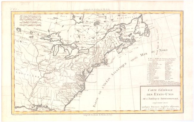
Auction 144, Lot 58
Subject: Eastern United States
Crevecoeur, Michel Guillaume De
Carte Generale des Etats-Unis de l'Amerique Septentrionale, Renfermant Aussi quelques Provinces Angloises adjacentes…, 1787
Size: 16.6 x 10 inches (42.2 x 25.4 cm)
Estimate: $300 - $375
First Printed Map to Name Franklinia
Sold for: $850
Closed on 4/3/2013
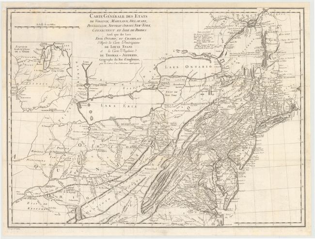
Auction 144, Lot 59
Subject: Eastern United States
Crevecoeur, Michel Guillaume De
Carte Generale des Etats de Virginie, Maryland, Delaware, Pensilvanie, Nouveau-Jersey, New-York, Connecticut et Isle de Rhodes Ainsi que des Lacs Erie, Ontario, et Champlain…, 1787
Size: 25.5 x 18.8 inches (64.8 x 47.8 cm)
Estimate: $1,000 - $1,300
Sold for: $850
Closed on 4/3/2013
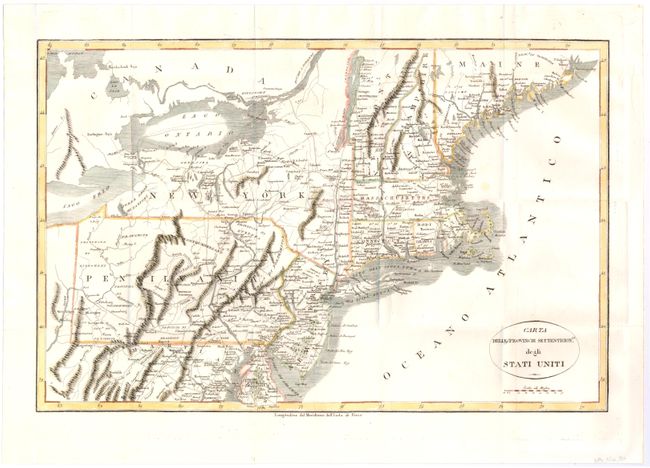
Auction 144, Lot 60
Subject: Eastern United States
Rochefoucald Liancourt, Francois Alexander
Carta delle Provincie Settentrionli degli Stati Uniti, 1800
Size: 19.2 x 12.5 inches (48.8 x 31.8 cm)
Estimate: $240 - $300
Sold for: $150
Closed on 4/3/2013
Auction 144, Lot 61
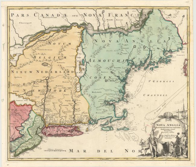
Subject: Colonial New England & Mid-Atlantic
Homann, Johann Baptist
Nova Anglia Septentrionali Americae Implantata Anglorumque Coloniis Florentissima, 1730
Size: 22.3 x 19 inches (56.6 x 48.3 cm)
Estimate: $1,500 - $1,700
Sold for: $850
Closed on 4/3/2013
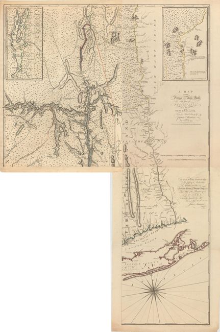
Auction 144, Lot 62
Subject: Colonial New England & Mid-Atlantic
Montresor, John
[On 3 Sheets of 4] A Map of the Province of New York, with Part of Pensilvania, and New England. From an Actual Survey by Captain Montresor, 1775
Size: 15.5 x 28.5 inches (39.4 x 72.4 cm)
Estimate: $4,000 - $5,000
An Important Revolutionary War Period Map
Unsold
Closed on 4/3/2013
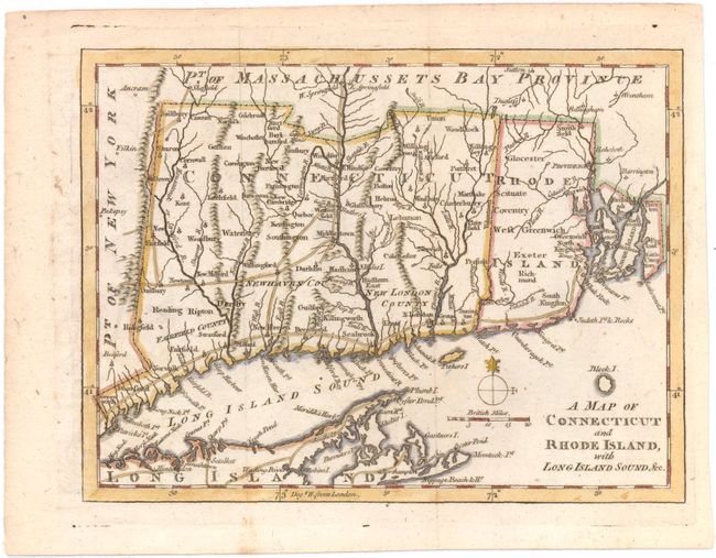
Auction 144, Lot 63
Subject: Colonial New England
Anon.
A Map of Connecticut and Rhode Island, with Long Island Sound, &c., 1776
Size: 9 x 6.8 inches (22.9 x 17.3 cm)
Estimate: $200 - $250
Sold for: $150
Closed on 4/3/2013
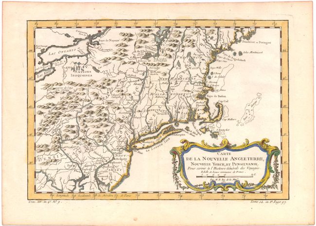
Auction 144, Lot 64
Subject: Colonial New England and Mid-Atlantic
Bellin, Jacques Nicolas
Carte de la Nouvelle Angleterre, Nouvelle Yorck, et Pensilvanie. Pour Servir a l'Histoire Generale des Voyages, 1780
Size: 11.5 x 8 inches (29.2 x 20.3 cm)
Estimate: $240 - $300
Sold for: $230
Closed on 4/3/2013
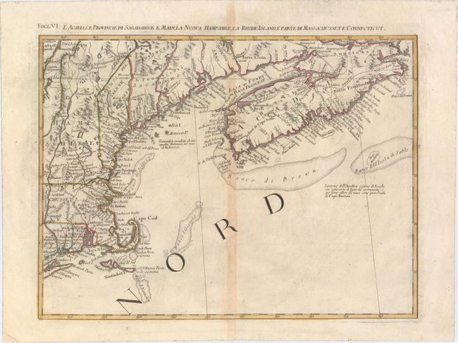
Auction 144, Lot 65
Subject: Eastern United States & Canada
Zatta, Antonio
L'Acadia, le Provincie di Sagadahook e Main, la Nuova Hampshire, la Rhode Island, e Parte di Massachusset e Connecticut, 1785
Size: 16.7 x 12.5 inches (42.4 x 31.8 cm)
Estimate: $300 - $375
Unsold
Closed on 4/3/2013
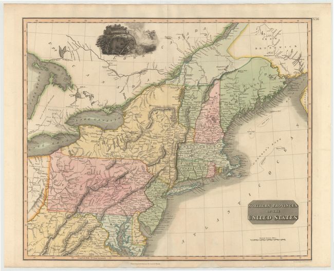
Auction 144, Lot 66
Subject: New England & Mid-Atlantic
Thomson, John
Northern Provinces of the United States, 1817
Size: 23.5 x 19.5 inches (59.7 x 49.5 cm)
Estimate: $400 - $500
Sold for: $300
Closed on 4/3/2013
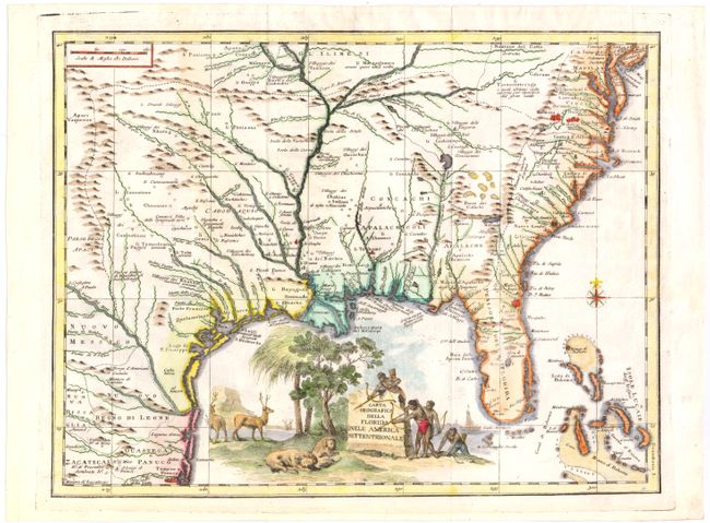
Auction 144, Lot 67
Subject: Colonial Southeast
Albrizzi, Girolamo
Carta Geografica della Florida nell' America Settentrionale, 1740
Size: 16.8 x 12.8 inches (42.7 x 32.5 cm)
Estimate: $1,300 - $1,600
Unsold
Closed on 4/3/2013
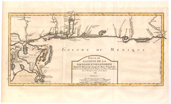
Auction 144, Lot 68
Subject: Colonial South
Bellin, Jacques Nicolas
Partie de la Coste de la Louisiane et de la Floride depuis le Missisippi jusqua St. Marc d'Apalache, 1744
Size: 16.8 x 8.3 inches (42.7 x 21.1 cm)
Estimate: $1,100 - $1,400
Sold for: $800
Closed on 4/3/2013
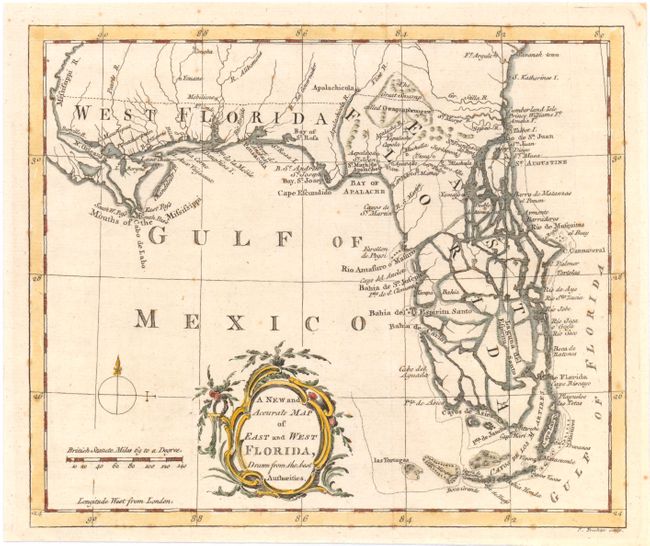
Auction 144, Lot 69
Subject: Colonial South, Florida
A New and Accurate Map of East and West Florida, Drawn from the Best Authorities, 1763
Size: 8.7 x 7.3 inches (22.1 x 18.5 cm)
Estimate: $400 - $500
Sold for: $375
Closed on 4/3/2013
Auction 144, Lot 70
Subject: Colonial Southern United States
Bonne, Rigobert
Carte de la Louisiane, et de la Floride, 1780
Size: 8.5 x 12.5 inches (21.6 x 31.8 cm)
Estimate: $150 - $200
Sold for: $110
Closed on 4/3/2013
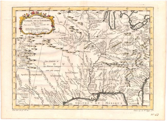
Auction 144, Lot 71
Subject: Colonial Central United States
Bellin, Jacques Nicolas
Carte de la Floride, de la Louisiane, et Pays Voisins…, 1757
Size: 12 x 8.8 inches (30.5 x 22.4 cm)
Estimate: $350 - $425
Sold for: $375
Closed on 4/3/2013
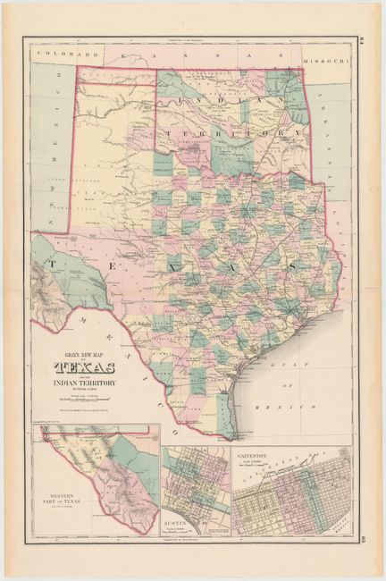
Auction 144, Lot 72
Subject: Texas, Oklahoma
Gray, Ormando Willis & Son
Gray's New Map of Texas and the Indian Territory, 1875
Size: 15 x 23 inches (38.1 x 58.4 cm)
Estimate: $250 - $325
Sold for: $325
Closed on 4/3/2013
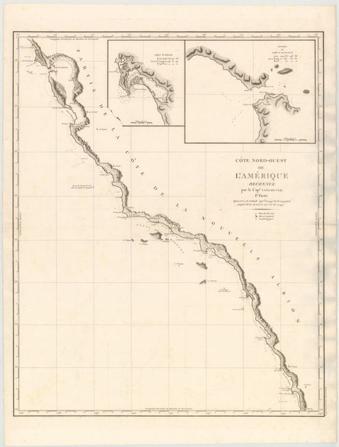
Auction 144, Lot 73
Subject: West Coast, United States
Vancouver, George (Capt)
Cote Nord-Ouest de l'Amerique Reconnue par le Cap.e. Vancouver. 1e Partie, 1799
Size: 24.2 x 30.2 inches (61.5 x 76.7 cm)
Estimate: $1,400 - $1,700
Sold for: $900
Closed on 4/3/2013
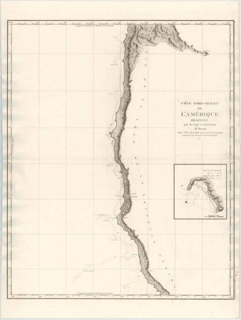
Auction 144, Lot 74
Subject: West Coast, United States
Vancouver, George (Capt)
Cote Nord-Ouest de l'Amerique Reconnue par la Cap.e Vancouver. 2e. Partie, 1799
Size: 24 x 29.7 inches (61 x 75.4 cm)
Estimate: $450 - $550
Sold for: $250
Closed on 4/3/2013
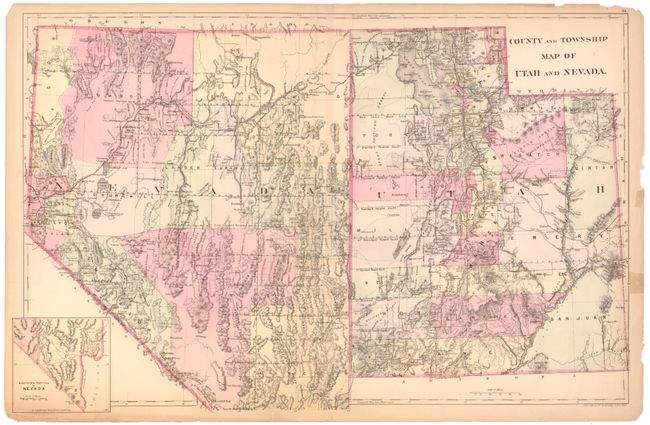
Auction 144, Lot 75
Subject: Southwestern United States - Utah and Nevada
Mitchell/Bradley
County and Township Map of Utah and Nevada, 1884
Size: 22 x 14.3 inches (55.9 x 36.3 cm)
Estimate: $70 - $90
Unsold
Closed on 4/3/2013
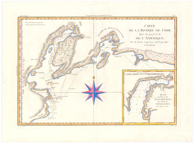
Auction 144, Lot 76
Subject: Southern Alaska
Bonne, Rigobert
Carte de la Riviere de Cook, dans la Partie N. O. de l'Amerique, 1787
Size: 13.6 x 9.3 inches (34.5 x 23.6 cm)
Estimate: $180 - $220
Sold for: $90
Closed on 4/3/2013
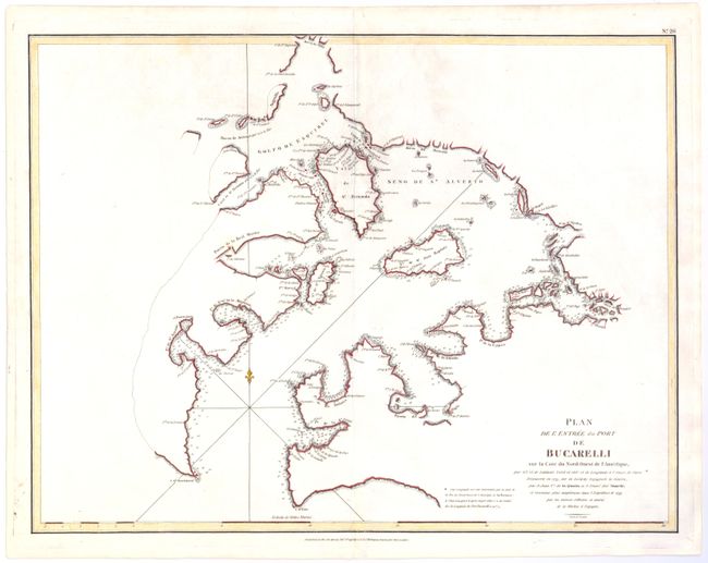
Auction 144, Lot 77
Subject: Southwestern Alaska
La Perouse, Comte Jean F. Galoup, de
Plan de l'Entree du Port de Bucarelli sur la Cote du Nord-Ouest de l'Amerique, par 55°15' de Latitude Nord et 136°15' de Longitude a l'Ouest de Paris. Decouverte en 1775…, 1797
Size: 27 x 19.8 inches (68.6 x 50.3 cm)
Estimate: $150 - $180
Sold for: $110
Closed on 4/3/2013
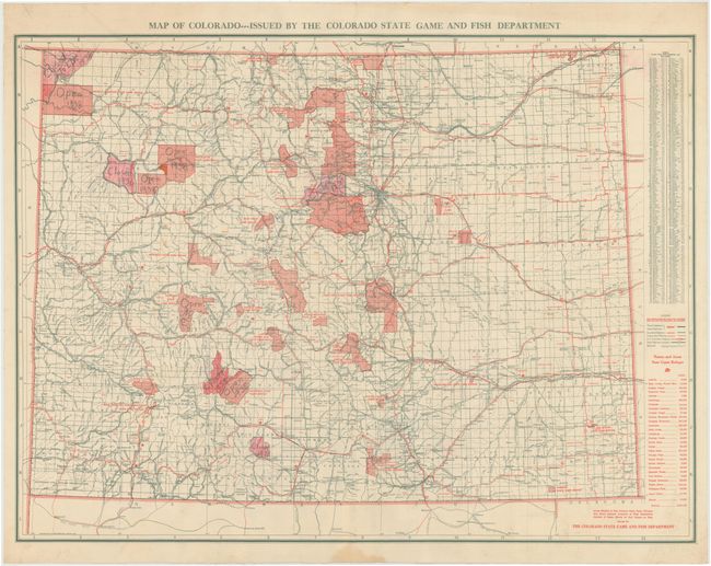
Auction 144, Lot 78
Subject: Colorado
Map of Colorado...Issued by the Colorado State Game and Fish Department, 1940
Size: 32.7 x 24.4 inches (83.1 x 62 cm)
Estimate: $150 - $200
Unsold
Closed on 4/3/2013
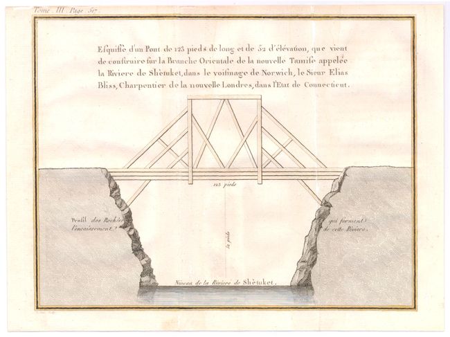
Auction 144, Lot 79
Subject: Norwich, Connecticut
Crevecoeur, Michel Guillaume De
[Untitled - Bridge Plate], 1787
Size: 9 x 7 inches (22.9 x 17.8 cm)
Estimate: $120 - $150
Unsold
Closed on 4/3/2013
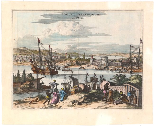
Auction 144, Lot 80
Subject: St. Augustine, Colonial Florida
Montanus/Ogilby
Pagus Hispanorum in Florida, 1671
Size: 14 x 10.5 inches (35.6 x 26.7 cm)
Estimate: $550 - $700
Sold for: $425
Closed on 4/3/2013
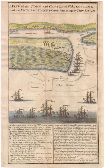
Auction 144, Lot 81
Subject: St. Augustine, Colonial Florida
Silver, Thomas
A View of the Town and Castle of St. Augustine, and the English Camp before it June 20, 1740, 1742
Size: 6.6 x 11.7 inches (16.8 x 29.7 cm)
Estimate: $200 - $250
Sold for: $230
Closed on 4/3/2013
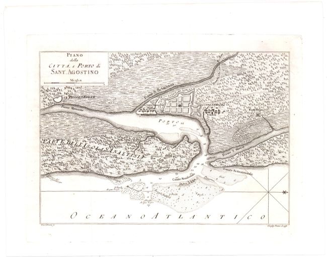
Auction 144, Lot 82
Subject: St. Augustine, Colonial Florida
Masi, Gio. Tommaso
Piano della Citta, e Porto di Sant. Agostino, 1763
Size: 11.3 x 8 inches (28.7 x 20.3 cm)
Estimate: $400 - $500
Unsold
Closed on 4/3/2013
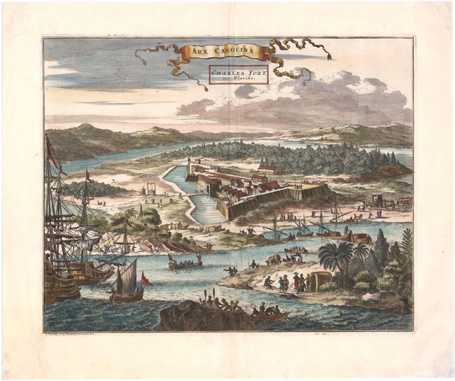
Auction 144, Lot 83
Subject: Jacksonville, Florida
Aa, Pieter van der
Arx Carolina. Charles Fort, sur Floride, 1729
Size: 13.8 x 11 inches (35.1 x 27.9 cm)
Estimate: $450 - $550
Sold for: $325
Closed on 4/3/2013
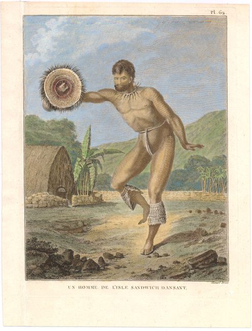
Auction 144, Lot 84
Subject: Hawaii
[Lot of 5 - Hawaiian Portraits], 1785-1855
Size: See Description
Estimate: $275 - $350
Sold for: $200
Closed on 4/3/2013
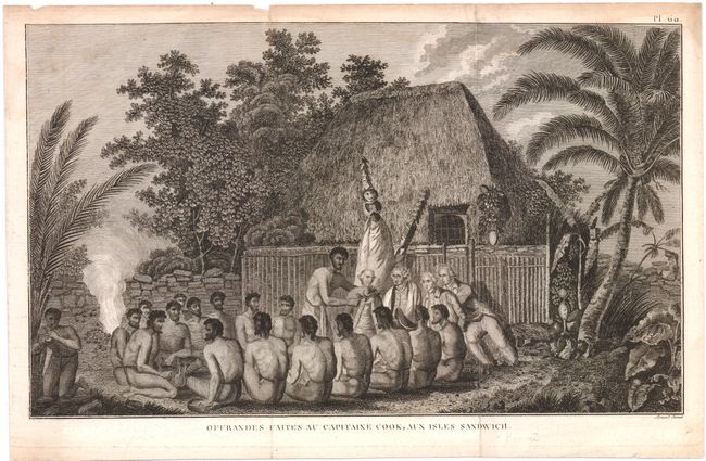
Auction 144, Lot 85
Subject: Hawaii
Cook, James (Capt.)
[Lot of 3] Offrandes Faites au Capitaine Cook, aux Isles Sandwich [and] The Death of Captain Cook at Owhyhee… [and] A Canoe of the Sandwich Islands, in the North Pacific Ocean with Rowers Maskes, 1785-1800
Size: See Description
Estimate: $300 - $400
Sold for: $220
Closed on 4/3/2013
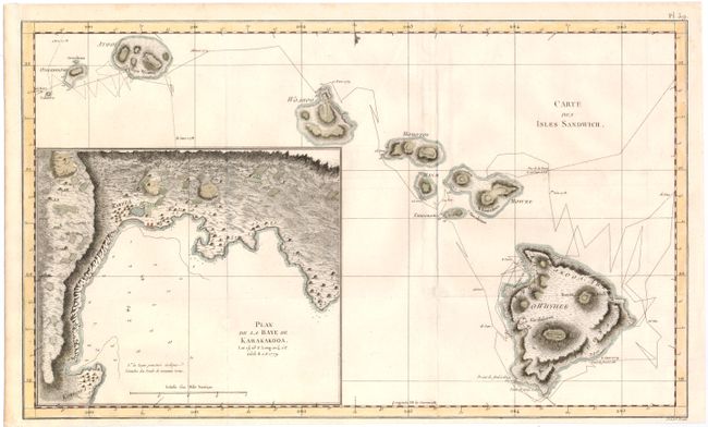
Auction 144, Lot 86
Subject: Hawaii
Cook, James (Capt.)
Carte des Isles Sandwich, 1784
Size: 18.3 x 11 inches (46.5 x 27.9 cm)
Estimate: $800 - $1,000
Important Map of the Hawaiian Islands
Sold for: $600
Closed on 4/3/2013
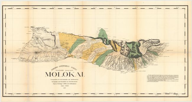
Auction 144, Lot 87
Subject: Molokai, Hawaii
Hawaii Territorial Surveys
Hawaiian Government Survey. Molokai, 1897
Size: 34 x 16.8 inches (86.4 x 42.7 cm)
Estimate: $180 - $220
Sold for: $130
Closed on 4/3/2013
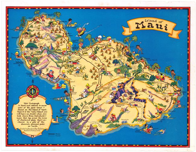
Auction 144, Lot 88
Subject: Maui, Hawaii
White, Ruth Taylor
Island of Maui , 1935
Size: 14.5 x 11.3 inches (36.8 x 28.7 cm)
Estimate: $150 - $180
Sold for: $190
Closed on 4/3/2013
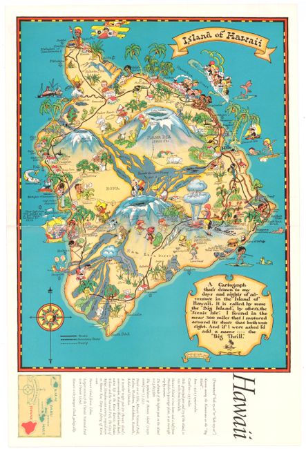
Auction 144, Lot 89
Subject: Big Island, Hawaii
White, Ruth Taylor
Island of Hawaii, 1935
Size: 11.3 x 17.5 inches (28.7 x 44.5 cm)
Estimate: $150 - $180
Sold for: $210
Closed on 4/3/2013
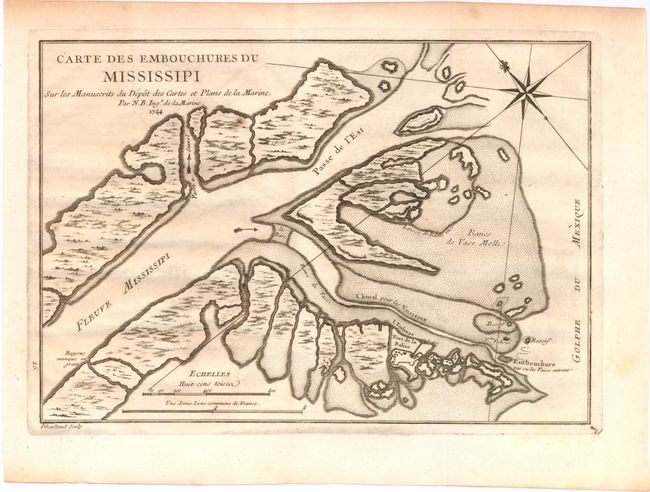
Auction 144, Lot 90
Subject: Colonial Louisiana, Mississippi River
Bellin, Jacques Nicolas
Carte des Embouchures du Mississipi…, 1744
Size: 11 x 7.8 inches (27.9 x 19.8 cm)
Estimate: $230 - $275
Sold for: $170
Closed on 4/3/2013
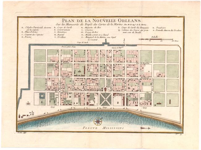
Auction 144, Lot 91
Subject: New Orleans, Louisiana
Bellin, Jacques Nicolas
Plan de la Nouvelle Orleans. Sur les Manuscrits du Depot des Cartes de la Marine, 1757
Size: 11 x 7.7 inches (27.9 x 19.6 cm)
Estimate: $400 - $500
Sold for: $375
Closed on 4/3/2013
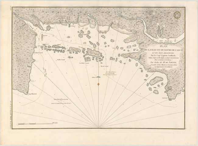
Auction 144, Lot 92
Subject: Casco Bay, Maine
Sartine
Plan de la Baie et du Havre de Casco et des Iles Adjacentes…, 1779
Size: 23 x 16 inches (58.4 x 40.6 cm)
Estimate: $1,000 - $1,200
Sold for: $650
Closed on 4/3/2013
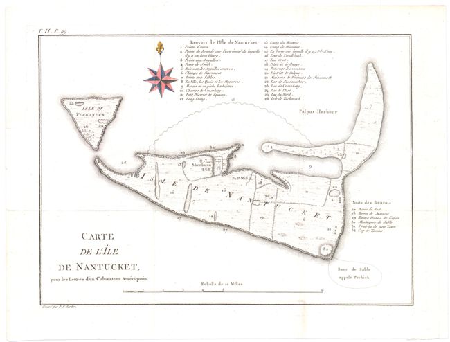
Auction 144, Lot 93
Subject: Nantucket, Massachusetts
Crevecoeur, Michel Guillaume De
Carte de l'Ile de Nantucket, pour les Lettres d’un Cultivateur Ameriquain, 1787
Size: 11 x 8 inches (27.9 x 20.3 cm)
Estimate: $1,400 - $1,700
Sold for: $1,000
Closed on 4/3/2013
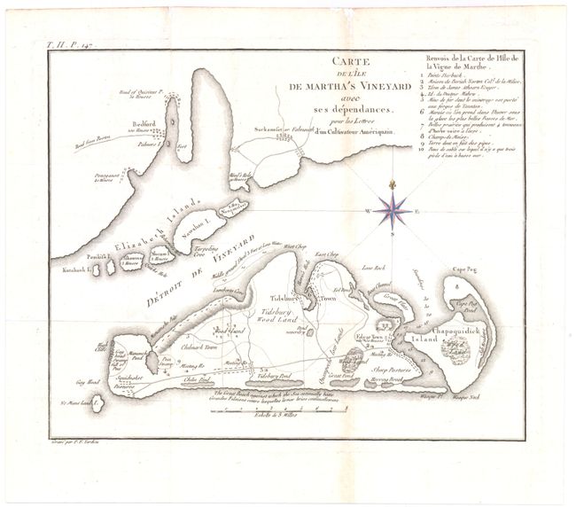
Auction 144, Lot 94
Subject: Martha's Vineyard, Massachusetts
Crevecoeur, Michel Guillaume De
Carte de l'Ile de Martha's Vineyard avec ses Dependances…, 1787
Size: 10.3 x 8.3 inches (26.2 x 21.1 cm)
Estimate: $1,400 - $1,700
Sold for: $1,000
Closed on 4/3/2013
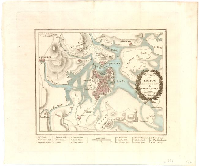
Auction 144, Lot 95
Subject: Boston, Massachusetts
Perrot, Aristide Michel
Environs de Boston dressée pour la Lecture de Lionel Lincoln…, 1825
Size: 7 x 6 inches (17.8 x 15.2 cm)
Estimate: $250 - $325
Sold for: $210
Closed on 4/3/2013
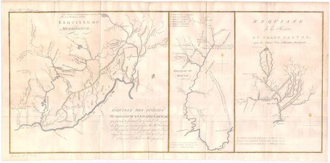
Auction 144, Lot 96
Subject: Ohio River
Crevecoeur, Michel Guillaume De
Esquisse du Muskinghum [on sheet with] Esquisse du Sioto [and] Esquisse de la Riviere du Grand Castor, 1787
Size: 20.5 x 9 inches (52.1 x 22.9 cm)
Estimate: $250 - $325
Sold for: $160
Closed on 4/3/2013
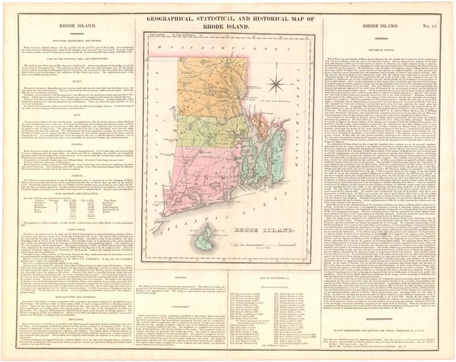
Auction 144, Lot 97
Subject: Rhode Island
Carey & Lea
Geographical, Statistical, and Historical Map of Rhode Island, 1822
Size: 8.5 x 11.3 inches (21.6 x 28.7 cm)
Estimate: $150 - $180
Sold for: $110
Closed on 4/3/2013
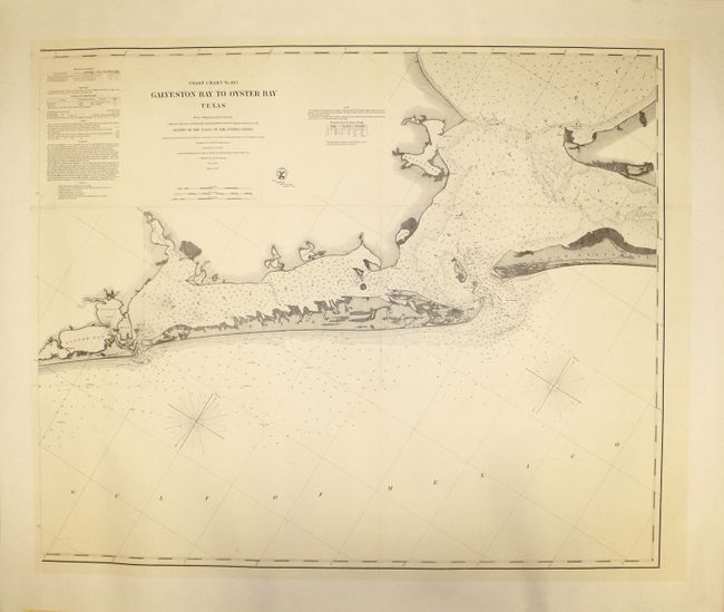
Auction 144, Lot 98
Subject: Galveston Bay, Texas
U.S. Coast Survey
No. 105. Galveston Bay to Oyster Bay Texas, 1870
Size: 39 x 32.5 inches (99.1 x 82.6 cm)
Estimate: $400 - $500
Unsold
Closed on 4/3/2013
53 lots
Page 1 of 2