Subject: Eastern United States & Canada
Period: 1785 (circa)
Publication: Atlante Novissimo
Color: Hand Color
Size:
16.7 x 12.5 inches
42.4 x 31.8 cm
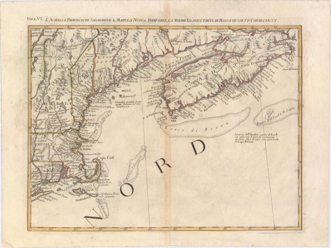
This great regional map covers New England and Nova Scotia and details the early settlements and roads with the adjacent fishing banks. It includes Cape Cod, Boston, Newport, New London, Portsmouth, and much more. Delineates the roads along the coast and westward from Concord. Provides excellent detail in Acadia and of the adjacent fishing banks. Towns, villages, roads, trails, and watershed topography were drawn from the earliest available English and indigenous surveys. This map is one sheet of the Italian version of Mitchell's seminal map of the British Dominions in North America that Zatta issued in 12 sections with the whole titled "Le Colonie Unite dell' America Settentrle." The map was also included in the Italian edition of Abbe Raynal's "Storia dell' America Settentrionale."
References: Kershaw #796; McCorkle #778.8; Portinaro & Knirsch #148; Sellers and Van Ee #163.
Condition: B+
On watermarked paper with wide, original margins and light centerfold toning.