Subject: Colonial New England
Period: 1776 (published)
Publication: Gentleman's Magazine
Color: Hand Color
Size:
9 x 6.8 inches
22.9 x 17.3 cm
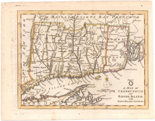
This Revolutionary War period map has good detail of early settlements including roads, villages and ports, and locates New London, Groton, Stanford, Norwalk, New Haven, and Seabrook. The counties of Fairfield, New Haven and New London are noted in Connecticut. There is a copper mine near Simsbury, CT. Includes a portion of eastern Long Island from Hog Neck to Montuck Point, noting villages and roads. This is the last of a series of four maps issued in the Gentleman’s Magazine during 1776 to illustrate the growing unrest in the colonies.
References: Jolly #GENT-249; Sellers & van Ee #819; Thompson #25.
Condition: A
issued folding, with a few minor spots and a hint of offsetting.