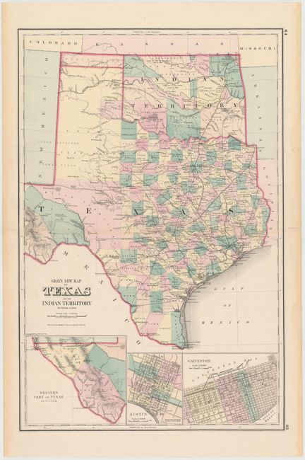
Subject: Texas, Oklahoma
Period: 1875 (dated)
Publication: Atlas of the United States
Color: Hand Color
Size:
15 x 23 inches
38.1 x 58.4 cm
This terrific double-page map is filled with detail. It is the vertically oriented edition not to be confused with the horizontal edition from Gray's National Atlas. The state's rapid development is evident with only Young, Bexar and Pecos Territories remaining unorganized. Wegefarth County, shown in Young Territory, was established in 1873 and abolished in 1876 by the legislature when they established the other Panhandle counties. Many railroads abruptly end between cities as the cartographer endeavored to show the exact progress to date. Details include numerous railroads, cities, towns, forts, and springs. A large inset depicts the Western Part of Texas, showing El Paso, Presidio, Pecos and part of Bexar Territory. In Indian Territory the Public Lands are limited to the western panhandle.
References:
Condition: B+
Clean and bright example with original color and centerfold separations at top and bottom closed on verso with archival tape, with the top separation just passing the neatline. Faint damp stains are confined to the blank margins.