Subject: Molokai, Hawaii
Period: 1897 (dated)
Publication:
Color: Printed Color
Size:
34 x 16.8 inches
86.4 x 42.7 cm
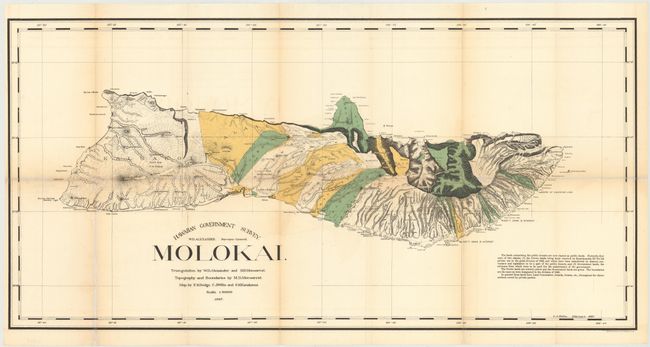
This first edition is the smaller version of the colorful lithographed map produced by W.D. Alexander, the Surveyor-General. The very detailed map delineates the topography, watershed, villages, land grants, coastal detail, lava flows and property owners. At the turn of the century numerous valleys supported cattle ranches. Triangulation, boundaries and topography by Alexander and M.D. Monsarrat. The map was drawn by F.S. Dodge, C.J. Willis, and S.M. Kanakanui. An early and fascinating map of this beautiful island.
References:
Condition: B
Issued folding with light toning along folds, numerous fold separations repaired on verso with archival material, and some light staining in the lower left corner of the image.