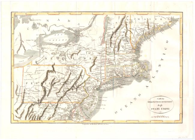
Subject: Eastern United States
Period: 1800 (circa)
Publication:
Color: Hand Color
Size:
19.2 x 12.5 inches
48.8 x 31.8 cm
An uncommon and crisply engraved map describing the northern part of the young United States. The map extends from the Passamaquoddy Bay in Maine down to Delaware and west to Lake Erie. It provides a nice view of early settlements and roads, as well as the mountains and forests. This map is from either an Italian edition of Francois la Rochefouchauld Liancourt's Travels through the United States of North America… or Carlo Botta's Storia della Guerra dell' Independenza Degli Stati Uniti d'America. Howes does not list an Italian edition of La Rochefouchauld Liancourt's book, but it is copied from his map.
References: cf Howes #L-106.
Condition: B+
Issued folding with one faint spot above Cape Cod. Remargined at left.