Filtered by Category:United States(Show All Categories)
Showing results for:Auction 101
Catalog Archive
111 lots
Page 1 of 3
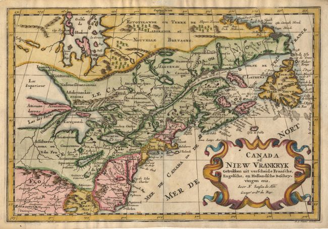
Auction 101, Lot 96
Subject: Colonial United States and Canada
Sanson, Nicolas
Canada of Niew Vrankryk Getrokken uit verscheide Fransche, Engelsche, en Hollandsche Beschryvingen enz, 1740
Size: 12 x 8.2 inches (30.5 x 20.8 cm)
Estimate: $500 - $600
Sold for: $500
Closed on 12/4/2002
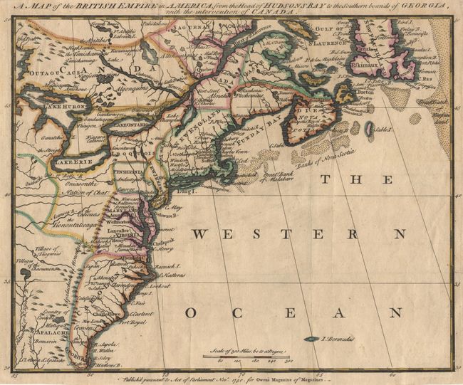
Auction 101, Lot 97
Subject: Colonial North America
Anon.
A Map of the British Empire in America, from the Head of Hudsons Bay to the Southern bounds of Georgia, with the intervention of Canada, 1750
Size: 11.8 x 9.5 inches (30 x 24.1 cm)
Estimate: $400 - $450
Sold for: $475
Closed on 12/4/2002
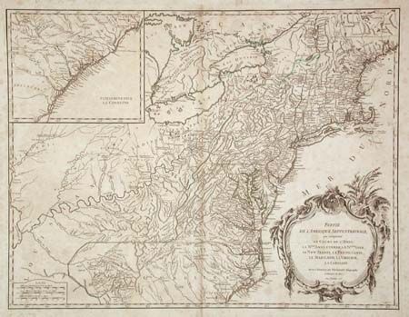
Auction 101, Lot 98
Subject: Colonial North America
Robert de Vaugondy
Partie de l'Amerique Septentrionale, qui Comprend le Cours de l'Ohio, la Nlle Angleterre, la Nlle York, le New Jersey, la Pensylvanie, la Maryland, la Virginie, la Caroline, 1755
Size: 24.5 x 18.8 inches (62.2 x 47.8 cm)
Estimate: $500 - $600
Sold for: $450
Closed on 12/4/2002
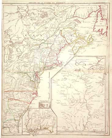
Auction 101, Lot 99
Subject: Colonial United States and Canada
Le Rouge, George Louis
Theatre de la Guerre en Amerique, 1777
Size: 19.5 x 24 inches (49.5 x 61 cm)
Estimate: $1,400 - $1,500
Unsold
Closed on 12/4/2002
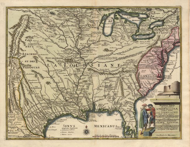
Auction 101, Lot 100
Subject: Colonial Louisiana
Weigel, Christopher
Novissima Tabula Regionis Ludovicianae Gallice dicta la Louisiane…, 1734
Size: 16.5 x 12.5 inches (41.9 x 31.8 cm)
Estimate: $1,800 - $1,900
Sold for: $1,300
Closed on 12/4/2002
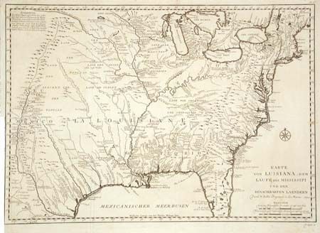
Auction 101, Lot 101
Subject: Colonial Louisiana
Bellin, Jacques Nicolas
Karte von Luisiana, dem Laufe des Mississipi und den Benachbarten Laendern…, 1744
Size: 22 x 15.5 inches (55.9 x 39.4 cm)
Estimate: $1,100 - $1,200
Sold for: $800
Closed on 12/4/2002
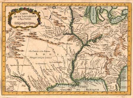
Auction 101, Lot 102
Subject: Colonial Central United States
Bellin, Jacques Nicolas
Carte de la Louisiane et Pays Voisins…, 1757
Size: 11.8 x 8.3 inches (30 x 21.1 cm)
Estimate: $350 - $400
Sold for: $425
Closed on 12/4/2002
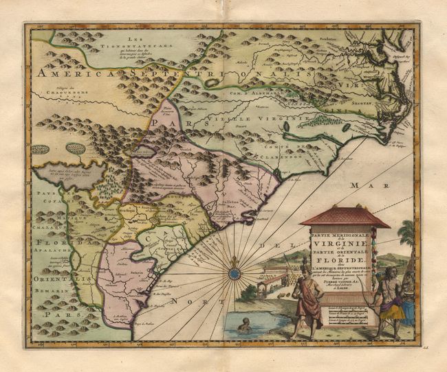
Auction 101, Lot 103
Subject: Colonial Southeast
Aa, Pieter van der
Partie Meridionale de la Virginie, et la Partie Orientale de la Floride dans l'Amerique Septentrionale, 1729
Size: 14 x 11.2 inches (35.6 x 28.4 cm)
Estimate: $1,600 - $1,800
Sold for: $1,200
Closed on 12/4/2002
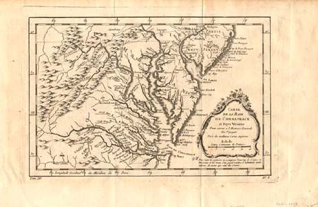
Auction 101, Lot 104
Subject: Colonial Chesapeake Bay
Bellin, Jacques Nicolas
Carte de la Baye de Chesapeack, 1757
Size: 11.3 x 7.5 inches (28.7 x 19.1 cm)
Estimate: $300 - $350
Sold for: $850
Closed on 12/4/2002
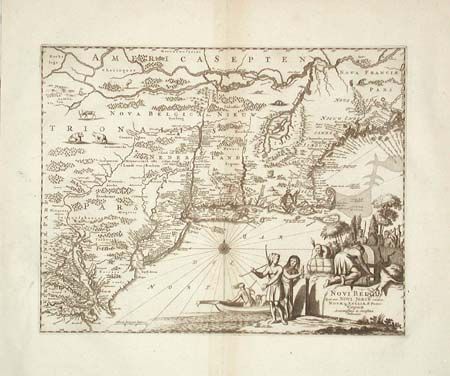
Auction 101, Lot 105
Subject: Colonial New England
Montanus/Ogilby
Novi Belgii, quod nunc Novi Jorck Vocatur, Novae qz. Angliae & Partis Virginiae Accuratissima et Novissima Delineatio, 1671
Size: 14.5 x 11.5 inches (36.8 x 29.2 cm)
Estimate: $1,800 - $2,000
Unsold
Closed on 12/4/2002
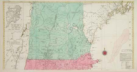
Auction 101, Lot 106
Subject: Colonial New England
Lotter, Tobias Conrad
A Map of the most Inhabited part of New England, containing the Provinces of Massachusetts Bay and New Hampshire, with the Colonies of Connecticut and Rhode Island…, 1776
Size: See Description
Estimate: $3,500 - $4,000
Sold for: $3,500
Closed on 12/4/2002
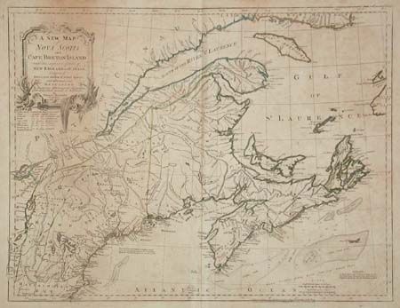
Auction 101, Lot 107
Subject: Colonial New England and Canada
Jefferys, Thomas
A New Map of Nova Scotia, and Cape Breton Island with the adjacent parts of New England and Canada…, 1775
Size: 24.1 x 18.5 inches (61.2 x 47 cm)
Estimate: $300 - $350
Sold for: $275
Closed on 12/4/2002
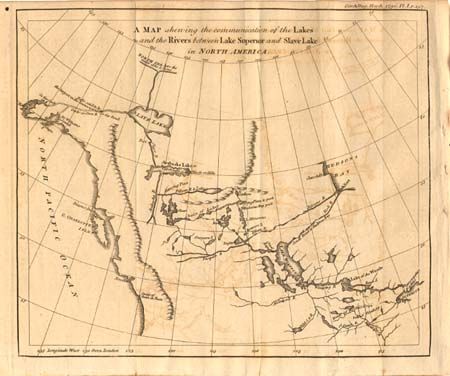
Auction 101, Lot 116
Subject: Canada and Alaska
Anon.
A Map Shewing the Communication of the Lakes and the Rivers between Lake Superior and Slave Lake in North America, 1790
Size: 9.3 x 7.8 inches (23.6 x 19.8 cm)
Estimate: $275 - $325
Sold for: $140
Closed on 12/4/2002
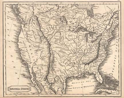
Auction 101, Lot 117
Subject: United States
Findlay, Alexander
United States, 1825
Size: 9.4 x 7.5 inches (23.9 x 19.1 cm)
Estimate: $100 - $130
Sold for: $120
Closed on 12/4/2002
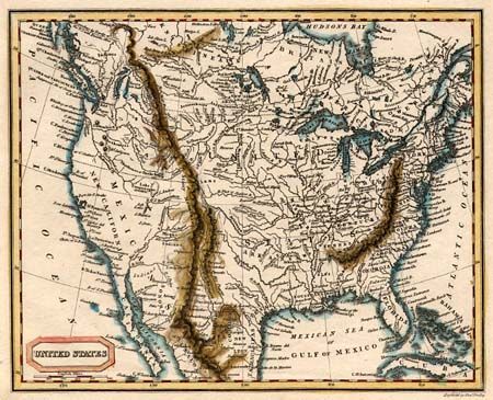
Auction 101, Lot 118
Subject: United States
Kelly, Thomas
United States, 1825
Size: 9.1 x 7.4 inches (23.1 x 18.8 cm)
Estimate: $120 - $150
Sold for: $130
Closed on 12/4/2002
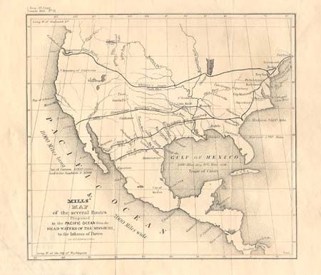
Auction 101, Lot 119
Subject: United States
U.S. Government
Mills' Map of the several Routes Proposed to the Pacific Ocean from the Head Waters of the Missouri, to the Isthmus of Darien, 1848
Size: 9 x 8.2 inches (22.9 x 20.8 cm)
Estimate: $275 - $325
Sold for: $200
Closed on 12/4/2002
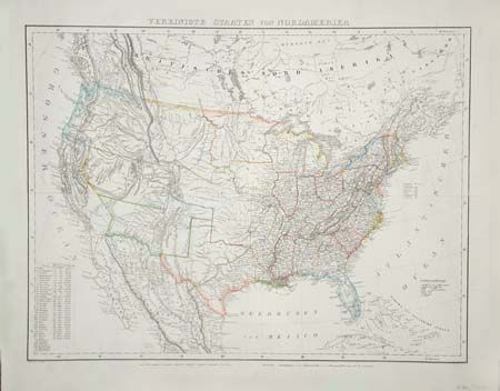
Auction 101, Lot 120
Subject: United States
Handtke, Friedrich H.
Die Vereinigten Staaten von Nordamerika, 1849
Size: 26.8 x 20.3 inches (68.1 x 51.6 cm)
Estimate: $325 - $375
Sold for: $240
Closed on 12/4/2002
Auction 101, Lot 121
Subject: United States
Gilman, E.
[United States], 1849
Size: 33.2 x 13.8 inches (84.3 x 35.1 cm)
Estimate: $400 - $500
Sold for: $325
Closed on 12/4/2002
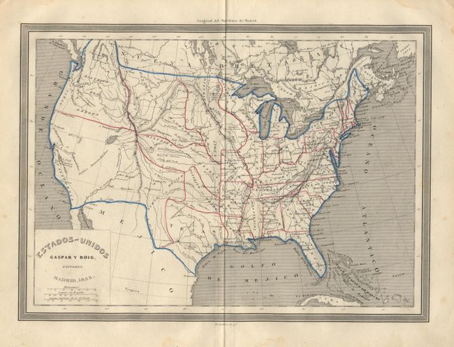
Auction 101, Lot 122
Subject: United States
Alabern, Ramon
Estados-Unidos, 1855
Size: 11.5 x 8.3 inches (29.2 x 21.1 cm)
Estimate: $300 - $400
Sold for: $200
Closed on 12/4/2002
Auction 101, Lot 123
Subject: United States
Burr, David H.
Map of the United States Exhibiting the Several Collection Districts, 1856
Size: 49 x 31 inches (124.5 x 78.7 cm)
Estimate: $300 - $400
Sold for: $220
Closed on 12/4/2002
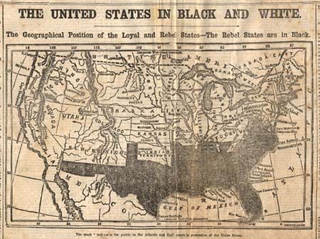
Auction 101, Lot 124
Subject: United States - Civil War
Anon.
The United States in Black and White, 1861
Size: 9.3 x 5.6 inches (23.6 x 14.2 cm)
Estimate: $120 - $180
Sold for: $130
Closed on 12/4/2002
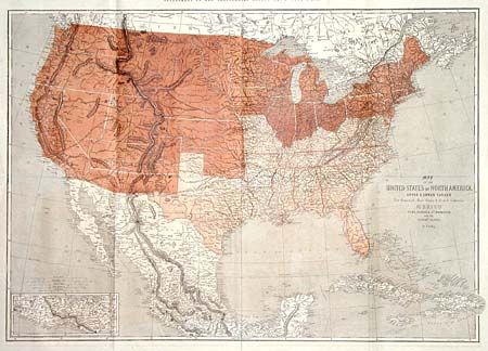
Auction 101, Lot 125
Subject: United States - Civil War
Ettling, Theodor
Map of the United States of North America, Upper & Lower Canada New Brunswick, Nova Scotia & British Columbia. Mexico Cuba, Jamaica, St. Domingo and the Bahama Islands, 1861
Size: 36.5 x 25.8 inches (92.7 x 65.5 cm)
Estimate: $240 - $275
Sold for: $180
Closed on 12/4/2002
Auction 101, Lot 126
Subject: United States
General Land Office
Map of the United States and Territories, 1866
Size: 55 x 28 inches (139.7 x 71.1 cm)
Estimate: $350 - $450
Sold for: $375
Closed on 12/4/2002
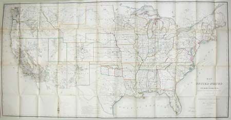
Auction 101, Lot 127
Subject: United States - Eastern
Robinson, G. G.
United States of America, 1799
Size: 15.5 x 13.7 inches (39.4 x 34.8 cm)
Estimate: $400 - $450
Sold for: $300
Closed on 12/4/2002
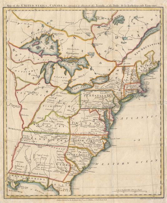
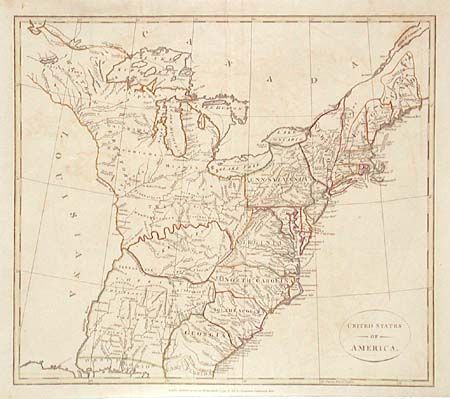
Auction 101, Lot 128
Subject: United States - Eastern
Rochefoucald Liancourt, Francois Alexander
Map of the United States, Canada &c, intended to illustrate the Travels of the Duke de la Rochefoucault Liancourt, 1799
Size: 13.3 x 16 inches (33.8 x 40.6 cm)
Estimate: $600 - $700
Sold for: $750
Closed on 12/4/2002
Auction 101, Lot 129
Subject: United States - Eastern
Giraldon
Etats Unis et Grandes Antilles, 1811
Size: 8.8 x 11.8 inches (22.4 x 30 cm)
Estimate: $110 - $140
Sold for: $140
Closed on 12/4/2002
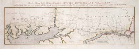
Auction 101, Lot 130
Subject: United States - Eastern
U.S. Corps of Engineers
Map of a Reconnaissance Between Baltimore and Philadelphia exhibiting the several routes of the Mail Road contemplated by the resolution of Congress approved on the 4th of May 1826, 1827
Size: 31 x 9 inches (78.7 x 22.9 cm)
Estimate: $325 - $375
Sold for: $240
Closed on 12/4/2002
Auction 101, Lot 131
Subject: United States - Eastern
Wyld, James
The United States of North America, with the British Territories, 1841
Size: 25 x 21 inches (63.5 x 53.3 cm)
Estimate: $475 - $550
Sold for: $350
Closed on 12/4/2002
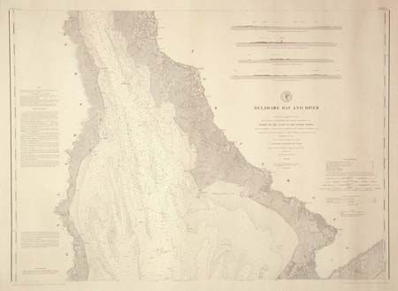
Auction 101, Lot 132
Subject: United States - Eastern
U.S. Coast & Geodetic Survey
Delaware Bay and River [together with] Delaware River, 1881
Size: 35.5 x 25 inches (90.2 x 63.5 cm)
Estimate: $80 - $100
Unsold
Closed on 12/4/2002
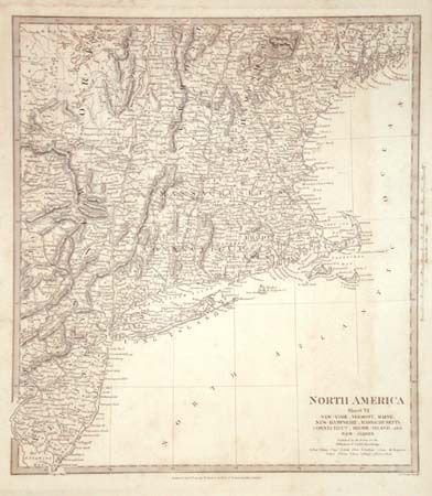
Auction 101, Lot 133
Subject: United States - Northeast
SDUK Society for the Diffusion of Useful Knowledge
North America Sheet VI New-York, Vermont, Maine, New-Hampshire, Massachusetts, Connecticut, Rhode-Island, and New-Jersey, 1832
Size: 12.5 x 13.8 inches (31.8 x 35.1 cm)
Estimate: $75 - $100
Sold for: $85
Closed on 12/4/2002
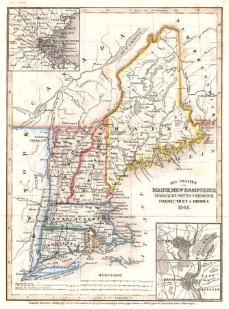
Auction 101, Lot 134
Subject: United States - Northeast
Hildburghausen Biblio Institut
Die Staaten von Maine, New Hampshire, Massachusetts, Vermont, Connecticut & Rhode I., 1846
Size: 7.8 x 10.5 inches (19.8 x 26.7 cm)
Estimate: $80 - $100
Sold for: $55
Closed on 12/4/2002
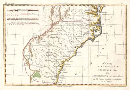
Auction 101, Lot 135
Subject: United States -Southeastern
Bonne, Rigobert
Carte de la Partie Sud des Etats Unis de l'Amerique Septentrionale, 1780
Size: 12.5 x 8.3 inches (31.8 x 21.1 cm)
Estimate: $120 - $150
Sold for: $90
Closed on 12/4/2002
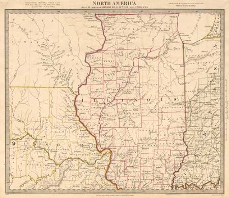
Auction 101, Lot 136
Subject: United States - Central Midwest
SDUK Society for the Diffusion of Useful Knowledge
North America Sheet IX Parts of Missouri, Illinois and Indiana, 1833
Size: 14.5 x 12 inches (36.8 x 30.5 cm)
Estimate: $120 - $150
Sold for: $40
Closed on 12/4/2002
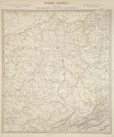
Auction 101, Lot 137
Subject: United States - Central Midwest
SDUK Society for the Diffusion of Useful Knowledge
North America Sheet VIII Ohio, with Parts of Kentucky and Virginia, 1833
Size: 12.5 x 13.7 inches (31.8 x 34.8 cm)
Estimate: $100 - $130
Sold for: $75
Closed on 12/4/2002
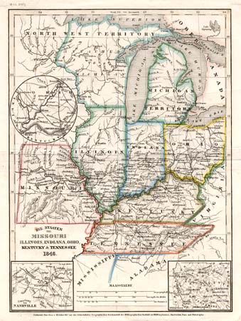
Auction 101, Lot 138
Subject: United States - Central Midwest
Hildburghausen Biblio Institut
Die Staaten von Missouri, Illinois, Indiana, Ohio, Kentucky & Tennessee, 1846
Size: 7.8 x 10.5 inches (19.8 x 26.7 cm)
Estimate: $80 - $100
Sold for: $60
Closed on 12/4/2002
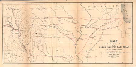
Auction 101, Lot 139
Subject: United States - Central Midwest
U.S. Government
Map showing the Eastern Portion of the Union Pacific Rail Road and its Connections…, 1866
Size: 22 x 10.4 inches (55.9 x 26.4 cm)
Estimate: $100 - $120
Sold for: $60
Closed on 12/4/2002
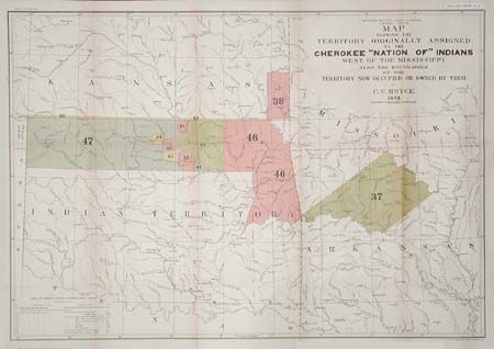
Auction 101, Lot 140
Subject: Central United States and Oklahoma
Royce, C. C.
Map of the Former Territorial Limits of the Cherokee Nation of Indians… [together with] Map Showing the Territory Originally Assigned to the Cherokee Nation of Indians West of the Mississippi…, 1884
Size: See Description
Estimate: $350 - $450
Sold for: $250
Closed on 12/4/2002
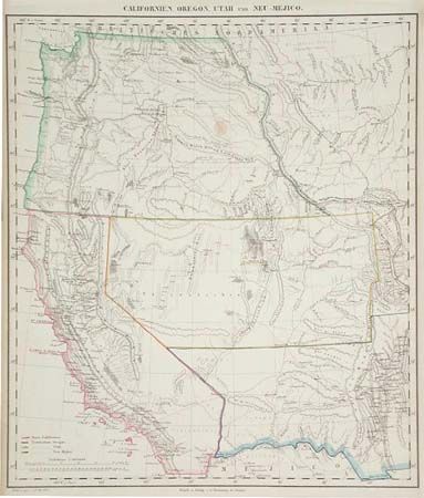
Auction 101, Lot 141
Subject: United States - Western
Flemming, Carl
Californien, Oregon, Utah und Neu-Mejico, 1855
Size: 13.7 x 15.7 inches (34.8 x 39.9 cm)
Estimate: $250 - $300
Sold for: $180
Closed on 12/4/2002
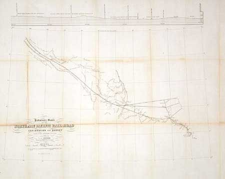
Auction 101, Lot 142
Subject: Western United States
Stevens, Isaac Ingalls
Preliminary Sketch of the Northern Pacific Rail Road Exploration and Survey from St. Paul to Riviere des Lacs [together with] …from Riviere des Lacs to the Rocky Mountains made in 1853 by I.I. Stevens Governor of Washington Territory, 1855
Size: See Description
Estimate: $200 - $250
Sold for: $275
Closed on 12/4/2002
Auction 101, Lot 143
Subject: United States - Northwestern
U.S. War Department
Map of Military Road From Fort Walla Walla on the Columbia to Fort Benton on the Missouri, 1863
Size: 33.8 x 17.5 inches (85.9 x 44.5 cm)
Estimate: $250 - $300
Sold for: $275
Closed on 12/4/2002
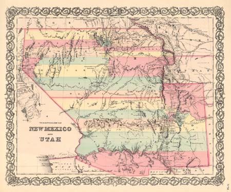
Auction 101, Lot 144
Subject: United States - Southwest
Colton, Joseph Hutchins
Territories of New Mexico and Utah, 1856
Size: 15.5 x 12.7 inches (39.4 x 32.3 cm)
Estimate: $300 - $400
Sold for: $250
Closed on 12/4/2002
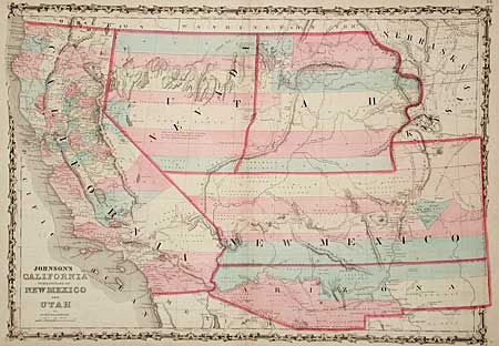
Auction 101, Lot 145
Subject: United States - Southwest
Johnson & Browning
Johnson's California Territories of New Mexico and Utah, 1861
Size: 24 x 16.8 inches (61 x 42.7 cm)
Estimate: $600 - $700
Sold for: $800
Closed on 12/4/2002
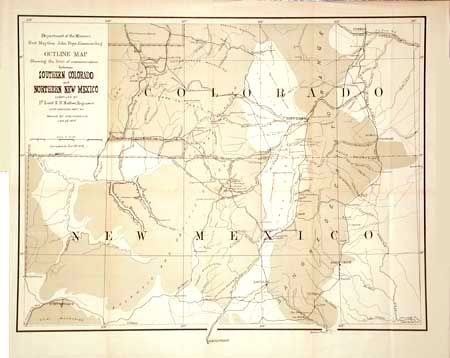
Auction 101, Lot 146
Subject: Southwestern United States
Ruffner, Lt. E.H.
Outline Map Showing the lines of communication between Southern Colorado and Northern New Mexico, 1878
Size: 18.3 x 14 inches (46.5 x 35.6 cm)
Estimate: $120 - $175
Sold for: $110
Closed on 12/4/2002
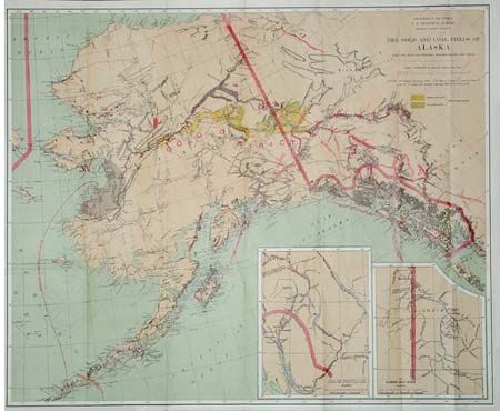
Auction 101, Lot 147
Subject: Alaska
U.S. Geological Survey (USGS)
The Gold and Coal Fields of Alaska Together with the Principal Steamer Routes and Trails, 1898
Size: 28.5 x 23.5 inches (72.4 x 59.7 cm)
Estimate: $200 - $300
Sold for: $210
Closed on 12/4/2002
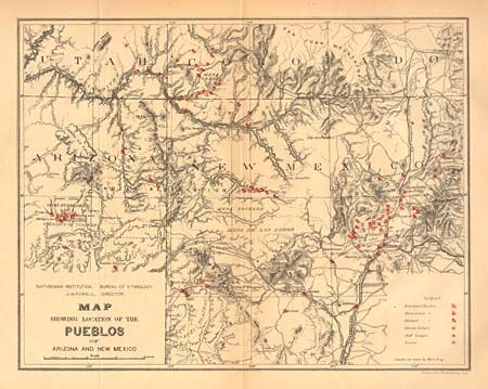
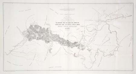
Auction 101, Lot 148
Subject: Arizona
U.S. Bureau of Ethnology
Map of the Province of Tusayan, Arizona Surveyed by A.L. Webster, 1881 [together with] Map Showing the Location of the Pueblos of Arizona and New Mexico, 1881
Size: See Description
Estimate: $120 - $150
Sold for: $65
Closed on 12/4/2002
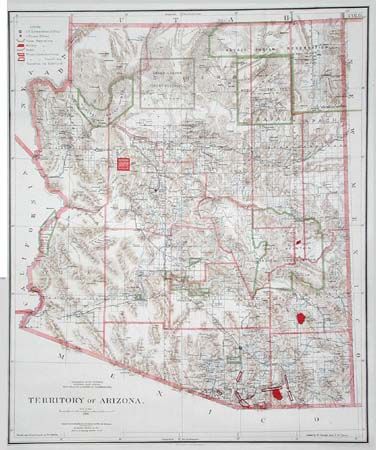
Auction 101, Lot 149
Subject: Arizona
General Land Office
Territory of Arizona, 1896
Size: 16.9 x 20.3 inches (42.9 x 51.6 cm)
Estimate: $150 - $200
Sold for: $170
Closed on 12/4/2002
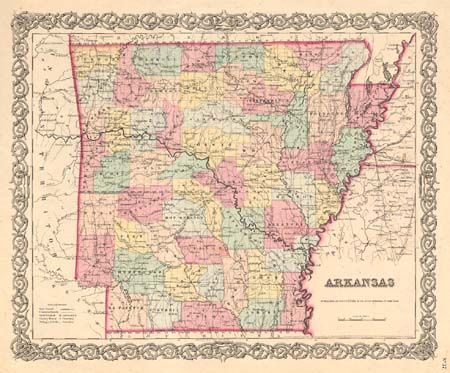
Auction 101, Lot 150
Subject: Arkansas
Colton, Joseph Hutchins
Arkansas, 1855
Size: 15.5 x 12.6 inches (39.4 x 32 cm)
Estimate: $80 - $100
Sold for: $75
Closed on 12/4/2002
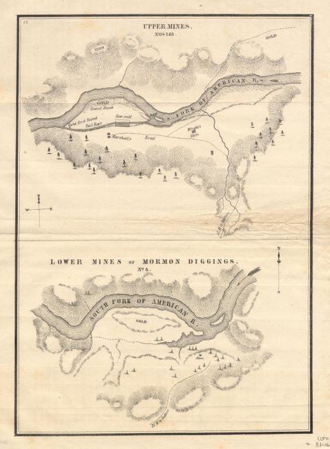
Auction 101, Lot 151
Subject: California
U.S. Government
[Lot of 2 - California Gold Rush], 1848
Size: 18.4 x 9.3 inches (46.7 x 23.6 cm)
Estimate: $350 - $400
Sold for: $400
Closed on 12/4/2002
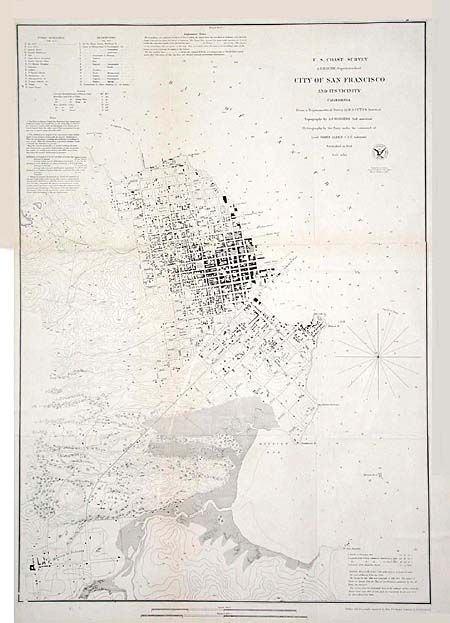
Auction 101, Lot 152
Subject: San Francisco, California
U.S. Coast Survey
City of San Francisco and its Vicinity California, 1853
Size: 17.8 x 25.1 inches (45.2 x 63.8 cm)
Estimate: $150 - $250
Sold for: $210
Closed on 12/4/2002
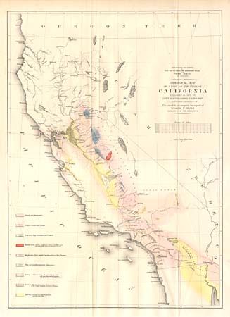
Auction 101, Lot 153
Subject: California
Williamson, R. S. (Lt.)
Geological Map of a Part of the State of California Explored in 1853 by Lieut. R.S. Williamson U.S. Top. Engr., 1855
Size: 16 x 22.2 inches (40.6 x 56.4 cm)
Estimate: $200 - $300
Sold for: $150
Closed on 12/4/2002
111 lots
Page 1 of 3