Catalog Archive
Auction 101, Lot 130
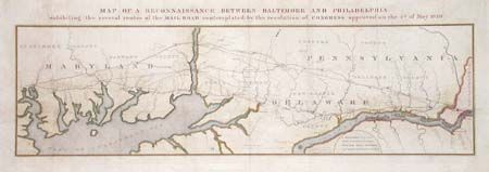
"Map of a Reconnaissance Between Baltimore and Philadelphia exhibiting the several routes of the Mail Road contemplated by the resolution of Congress approved on the 4th of May 1826", U.S. Corps of Engineers

Subject: United States - Eastern
Period: 1827 (published)
Publication: HR Doc #94, 19th Cong., 2nd Session
Color: Hand Color
Size:
31 x 9 inches
78.7 x 22.9 cm
Download High Resolution Image
(or just click on image to launch the Zoom viewer)
(or just click on image to launch the Zoom viewer)

