Catalog Archive
Auction 101, Lot 146

"Outline Map Showing the lines of communication between Southern Colorado and Northern New Mexico", Ruffner, Lt. E.H.

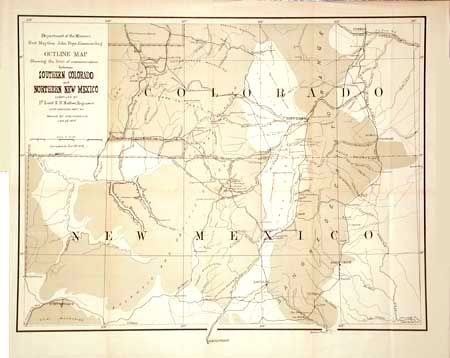
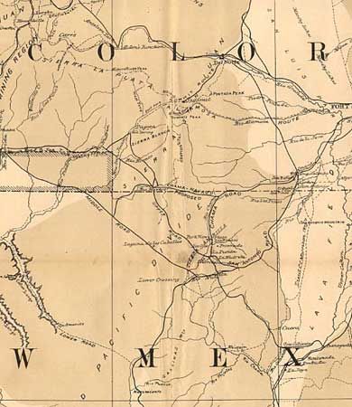
Subject: Southwestern United States

Period: 1878 (dated)

Publication: HR Doc. #66 Map #2, 45th Cong., 2nd Session

Color: Printed Color

Size:
18.3 x 14 inches
46.5 x 35.6 cm
Download High Resolution Image
(or just click on image to launch the Zoom viewer)

Depicts the region from Pueblo to Albuquerque and Fort Defiance to just east of Trinidad. Great topographical details as well as roads, towns, watering holes, pueblos and much more. The map was issued at the conclusion of Ruffner's 1873 expedition into Ute Country, to quell the unrest between the Ute Indians and the prospectors in the newly discovered San Juan Mining Region. A scarce map when issued in 1876, but this is the 1878 corrected edition we've not seen before. Includes revised information in a block of territory south of Animas and west of Pagosa. Completely re-engraved without the hachure lines.

References:

Condition: A

Issued folding, now backed with archival tissue and pressed.

Estimate: $120 - $175

Sold for: $110

Closed on 12/4/2002

Archived